Download
1 / 5
0 likes | 47 Views
Global Remote Sensing Software Market Size, Share, Trends, Growth, Industry Analysis, Key Players, Revenue, Future Development & Forecast

E N D
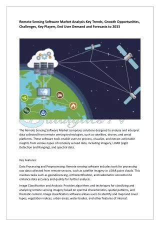
Remote Sensing Software Market Analysis Key Trends, Growth Opportunities, Challenges, Key Players, End User Demand and Forecasts to 2033 The Remote Sensing Software Market comprises solutions designed to analyze and interpret data collected from remote sensing technologies, such as satellites, drones, and aerial platforms. These software tools enable users to process, visualize, and extract actionable insights from various types of remotely sensed data, including imagery, LiDAR (Light Detection and Ranging), and spectral data. Key Features: Data Processing and Preprocessing: Remote sensing software includes tools for processing raw data collected from remote sensors, such as satellite imagery or LiDAR point clouds. This involves tasks such as georeferencing, orthorectification, and radiometric correction to enhance data accuracy and quality for further analysis. Image Classification and Analysis: Provides algorithms and techniques for classifying and analyzing remote sensing imagery based on spectral characteristics, spatial patterns, and thematic content. Image classification software allows users to identify and map land cover types, vegetation indices, urban areas, water bodies, and other features of interest.
Change Detection and Time-Series Analysis: Enables users to detect and quantify changes in the Earth's surface over time by comparing multiple images acquired at different points in time. Change detection software identifies areas of land cover change, deforestation, urban expansion, and environmental disturbances, facilitating monitoring and assessment of dynamic processes. Geospatial Data Visualization: Offers visualization tools for displaying and interpreting remote sensing data in 2D, 3D, and interactive formats. Geospatial visualization software allows users to create maps, overlays, and thematic layers to visualize spatial relationships, trends, and patterns in the data. Geospatial Analysis and Modeling: Provides spatial analysis tools for deriving meaningful insights from remote sensing data through spatial statistics, spatial interpolation, and geostatistical modeling techniques. Geospatial analysis software supports tasks such as terrain analysis, habitat modeling, suitability mapping, and risk assessment. Market Trends: Integration with Artificial Intelligence and Machine Learning: The integration of remote sensing software with AI and machine learning algorithms is enhancing the automation and efficiency of data analysis tasks. AI-powered features enable automatic feature extraction, object detection, and predictive modeling from large volumes of remote sensing data, accelerating insights generation and decision-making. Cloud-Based Solutions: The adoption of cloud-based remote sensing software is increasing, driven by advantages such as scalability, accessibility, and collaboration. Cloud-based platforms offer on-demand access to processing resources, storage, and analytical tools, enabling users to analyze large datasets and collaborate remotely without the need for expensive hardware or software licenses. High-Resolution Satellite Imagery: The availability of high-resolution satellite imagery from commercial satellite providers is expanding the applications of remote sensing software across industries such as agriculture, forestry, urban planning, and disaster management. High-resolution imagery enables detailed mapping, monitoring, and analysis of land cover, land use, and environmental changes at local and regional scales. Open-Source and Free Software: The proliferation of open-source and free remote sensing software tools is democratizing access to geospatial data analysis and interpretation capabilities. Open-source software platforms such as QGIS, GRASS GIS, and R provide powerful alternatives to proprietary solutions, offering flexibility, customization, and community-driven development for users worldwide. Challenges:
Data Integration and Interoperability: Integrating and interoperating diverse datasets from different sensors, platforms, and sources can be challenging due to variations in data formats, resolutions, and metadata standards. Data integration software tools are needed to harmonize and consolidate heterogeneous datasets for seamless analysis and interpretation. Computational Complexity and Scalability: Processing and analyzing large volumes of remote sensing data require significant computational resources and specialized algorithms. Scalability challenges may arise when handling big data sets, requiring efficient parallel processing, distributed computing, and cloud-based solutions to overcome computational bottlenecks. Data Privacy and Security: Protecting sensitive remote sensing data, such as high-resolution imagery or LiDAR scans, from unauthorized access, manipulation, or exploitation is critical for ensuring data privacy and security. Data encryption, access controls, and secure data transmission protocols are essential for safeguarding remote sensing data throughout its lifecycle. Algorithm Validation and Accuracy Assessment: Validating the accuracy and reliability of algorithms and models used in remote sensing software is essential for producing trustworthy results. Accuracy assessment techniques, such as ground truth data collection, validation sampling, and error propagation analysis, are necessary to evaluate the performance of remote sensing algorithms and quantify uncertainties. Get Free Exclusive PDF Sample Copy of This Research Report https://stringentdatalytics.com/sample-request/remote-sensing-software-market/8941/ Market Segmentations: Global Remote Sensing Software Market: By Company • PCI Geomatics USA • Hexagon AB • BAE Systems • Clark Labs • Earth Observing Systems • Esri • L3Harris Technologies • Textron Systems • Trimble Inc. • PIESAT Information Technology Co., Ltd
• Rapid Imaging • ReSe Applications LLC • Merrick & Company Global Remote Sensing Software Market: By Type • On-premise • Cloud Global Remote Sensing Software Market: By Application • Environment • Agriculture • Defence • Security Intelligence • Oil and gas industry Click Here, To Buy Premium Report https://stringentdatalytics.com/purchase/remote- sensing-software-market/8941/?license=single Market Outlook: The Remote Sensing Software Market is poised for significant growth driven by increasing demand for geospatial intelligence, environmental monitoring, and resource management solutions across various industries. Advances in remote sensing technologies, coupled with innovations in software algorithms and analytics, are expanding the applications and capabilities of remote sensing software for addressing complex challenges in a rapidly changing world. Regional Analysis: The market for remote sensing software is segmented into regions such as North America, Europe, Asia-Pacific, Latin America, and the Middle East and Africa. Each region presents unique opportunities and challenges based on factors such as technological infrastructure, regulatory landscape, and market maturity.
Key Questions Answered in This Report: What are the key features and functionalities of remote sensing software solutions? What are the emerging trends driving the adoption of remote sensing software in the market? What challenges do organizations face in implementing and leveraging remote sensing software effectively? How is the market segmented based on deployment model, application, and end-user industry? What is the outlook for the global remote sensing software market in terms of growth and adoption? About Stringent Datalytics Stringent Datalytics offers both custom and syndicated market research reports. Custom market research reports are tailored to a specific client's needs and requirements. These reports provide unique insights into a particular industry or market segment and can help businesses make informed decisions about their strategies and operations. Syndicated market research reports, on the other hand, are pre-existing reports that are available for purchase by multiple clients. These reports are often produced on a regular basis, such as annually or quarterly, and cover a broad range of industries and market segments. Syndicated reports provide clients with insights into industry trends, market sizes, and competitive landscapes. By offering both custom and syndicated reports, Stringent Datalytics can provide clients with a range of market research solutions that can be customized to their specific needs. Contact Us Stringent Datalytics Contact No- +1 346 666 6655 Email Id- sales@stringentdatalytics.com