Download
1 / 2
20 likes | 32 Views
M.Sc Geoinformatics colleges in India help the students to learn advanced tools & techniques that facilitate the analysis of geographic data.

E N D
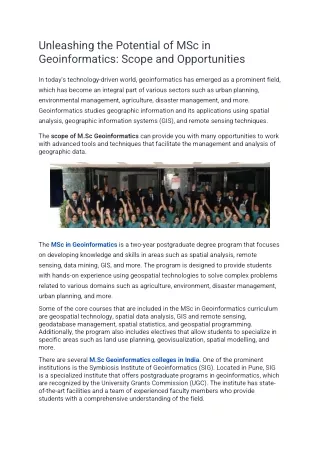
Unleashing the Potential of MSc in Geoinformatics: Scope and Opportunities In today's technology-driven world, geoinformatics has emerged as a prominent field, which has become an integral part of various sectors such as urban planning, environmental management, agriculture, disaster management, and more. Geoinformatics studies geographic information and its applications using spatial analysis, geographic information systems (GIS), and remote sensing techniques. The scope of M.Sc Geoinformatics can provide you with many opportunities to work with advanced tools and techniques that facilitate the management and analysis of geographic data. The MSc in Geoinformatics is a two-year postgraduate degree program that focuses on developing knowledge and skills in areas such as spatial analysis, remote sensing, data mining, GIS, and more. The program is designed to provide students with hands-on experience using geospatial technologies to solve complex problems related to various domains such as agriculture, environment, disaster management, urban planning, and more. Some of the core courses that are included in the MSc in Geoinformatics curriculum are geospatial technology, spatial data analysis, GIS and remote sensing, geodatabase management, spatial statistics, and geospatial programming. Additionally, the program also includes electives that allow students to specialize in specific areas such as land use planning, geovisualization, spatial modelling, and more. There are several M.Sc Geoinformatics colleges in India. One of the prominent institutions is the Symbiosis Institute of Geoinformatics (SIG). Located in Pune, SIG is a specialized institute that offers postgraduate programs in geoinformatics, which are recognized by the University Grants Commission (UGC). The institute has state- of-the-art facilities and a team of experienced faculty members who provide students with a comprehensive understanding of the field.
The Symbiosis Geoinformatics program covers various topics such as GIS, remote sensing, spatial modelling, data management, and more. The program is designed to provide students with a strong theoretical foundation, along with practical experience through project work, internships, and field visits. The curriculum is regularly updated to keep up with the latest trends and developments in the field. One of the key advantages of pursuing an MSc in Geoinformatics is the wide range of career opportunities available. Graduates can work in various sectors, such as government agencies, private companies, research organizations, and more. Some of the job roles that are available include GIS analyst, remote sensing specialist, spatial data analyst, geospatial programmer, land surveyor, and more. Additionally, there is also the option to pursue higher studies, such as a PhD in Geoinformatics. Apart from SIG, other prominent M.Sc geoinformatics colleges in India include Pune University, Osmania University, Gujarat University and more. In conclusion, the MSc in Geoinformatics is a promising postgraduate program that provides students with a comprehensive understanding of geospatial technologies and their applications.