Download
1 / 4
0 likes | 3 Views
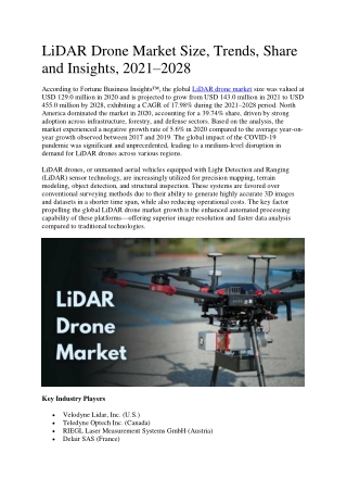
According to Fortune Business Insightsu2122, the global LiDAR drone market size was valued at USD 129.0 million in 2020 and is projected to grow from USD 143.0 million in 2021 to USD 455.0 million by 2028, exhibiting a CAGR of 17.98% during the 2021u20132028 period.

E N D
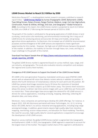
LiDAR Drone Market Size, Trends, Share and Insights, 2021–2028 According to Fortune Business Insights™, the global LiDAR drone market size was valued at USD 129.0 million in 2020 and is projected to grow from USD 143.0 million in 2021 to USD 455.0 million by 2028, exhibiting a CAGR of 17.98% during the 2021–2028 period. North America dominated the market in 2020, accounting for a 39.74% share, driven by strong adoption across infrastructure, forestry, and defense sectors. Based on the analysis, the market experienced a negative growth rate of 5.6% in 2020 compared to the average year-on- year growth observed between 2017 and 2019. The global impact of the COVID-19 pandemic was significant and unprecedented, leading to a medium-level disruption in demand for LiDAR drones across various regions. LiDAR drones, or unmanned aerial vehicles equipped with Light Detection and Ranging (LiDAR) sensor technology, are increasingly utilized for precision mapping, terrain modeling, object detection, and structural inspection. These systems are favored over conventional surveying methods due to their ability to generate highly accurate 3D images and datasets in a shorter time span, while also reducing operational costs. The key factor propelling the global LiDAR drone market growth is the enhanced automated processing capability of these platforms—offering superior image resolution and faster data analysis compared to traditional technologies. Key Industry Players Velodyne Lidar, Inc. (U.S.) Teledyne Optech Inc. (Canada) RIEGL Laser Measurement Systems GmbH (Austria) Delair SAS (France)
Phoenix LiDAR Systems (U.S.) Leica Geosystems AG (Switzerland) Yellow Scan (France) LiDARUSA (U.S.) SZ DJI Technology Co., Ltd (China) Benewake (China) RoboSense (China) Sick AG (Germany) Microdrones (Germany) These companies focus on technological innovation, strategic partnerships, and R&D investment to maintain competitiveness and enhance their product offerings. Source: https://www.fortunebusinessinsights.com/lidar-drone-market-102602 Market Drivers Improved Processing and Imaging Capabilities: UAV LiDAR systems are increasingly preferred over traditional methods for mapping and object detection due to their efficiency in generating precise 3D data, faster processing, and lower operational costs. Growing Demand for 3D Imaging and Exploration: Increased usage of drones for collecting historical, environmental, and structural data fuels demand. These systems are vital in multiple applications, from archaeology to construction and precision farming. Advancements in Sensor Technology: Next-generation UAV LiDAR sensors with optical altimeters, dynamic sensor arrays, and MEMS-based laser scanners are enhancing efficiency and data quality while enabling compact, lightweight designs. Restraining Factors High Costs and Regulatory Challenges: The integration of laser scanners, high-resolution 3D cameras, and navigation systems adds significant costs. Furthermore, regulatory restrictions related to drone altitude, flight timing, and safety increase operational complexity. Market Trends Development of Next-Gen Sensors: The evolution of lightweight, solid-state LiDAR sensors based on micro-lidar array architecture (MLA) enables high-resolution imaging at a lower cost, broadening the appeal for government and commercial uses.
Increased Corridor Mapping Applications: UAV LiDAR is emerging as a key solution for infrastructure monitoring including roads, bridges, railways, and buildings, especially in remote and rugged terrains. Segmentation Analysis By Product: The rotary wing segment dominated the LiDAR drone market in 2020, owing to its extensive application in 3D mapping and corridor mapping tasks. Multi-rotor drones are particularly favored for their ease of control and excellent flight stability, making them ideal for complex and close-range missions. In contrast, the fixed wing segment is expected to witness significant growth in the coming years due to its advantages in long-range operations and Beyond Line of Sight (BLOS) capabilities, especially in topographic and infrastructure mapping over large areas. By LiDAR Type: Mechanical LiDAR held the largest market share in 2020, primarily due to its effectiveness in providing 360-degree area coverage, which is crucial for high-precision mapping and scanning applications. However, the solid-state LiDAR segment is projected to grow at the fastest rate during the forecast period. Its compact size, affordability, and suitability for high- resolution imaging make it increasingly popular across commercial and defense applications. By Range: Short-range LiDAR drones led the market in 2020, driven by their effectiveness in low- altitude operations such as terrain mapping, asset inspection, and structural analysis. Meanwhile, the long-range segment is anticipated to expand rapidly as technological advancements enable better detection accuracy and greater coverage distances, which are essential for infrastructure, mining, and environmental monitoring. By Application: In terms of application, mapping and cartography emerged as the leading segment in 2020. The growing use of LiDAR drones in infrastructure development, power line inspections, and precision farming has fueled demand in this area. Other applications—such as surveillance, environmental monitoring, exploration, and precision agriculture—also contribute notably to market expansion, supported by the increasing deployment of UAVs in both commercial and defense sectors. Regional Insights North America: Held a market size of USD 51.27 million in 2020, leading globally due to mature drone regulations, major market players (e.g., Velodyne, LiDARUSA), and widespread use in government and industrial applications. Europe: Secured the second-largest share. Key manufacturers like Leica and Delair, along with strong environmental and infrastructure development initiatives, drive regional demand.
Asia Pacific: Witnesses rapid growth due to expanding commercial drone production and usage in countries like China and India. Agriculture and geospatial mapping are key growth drivers. Middle East & Africa: Expected to experience moderate growth due to infrastructure investments and emerging drone adoption. Rest of the World: Includes emerging markets like Turkey and South Africa with growing demand for affordable surveying technologies. Key Industry Developments July 2021: A high-precision survey across three dams in Brazil was conducted using Microdrones technology, covering 10 sq km in a week. June 2021: Velodyne unveiled the next-gen Velabit™ sensor using micro-lidar array architecture, offering wider FoV and improved resolution.