Download

1 / 11
0 likes | 1 Views
The combination of BIM services and LiDAR scanning - how the technology scans natural and manmade environments delivering accurate point cloud data.

E N D
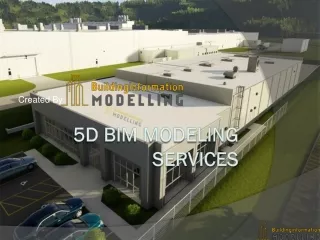
LiDAR Systems for Building Information Modeling Services Explore how Light Detection and Ranging (LiDAR) technology is transforming the Architecture, Engineering, and Construction (AEC) industry. This presentation will cover the fundamentals of LiDAR scanning for BIM Services, its seamless integration with Building Information Modeling (BIM), and the profound benefits it brings to modern construction projects.
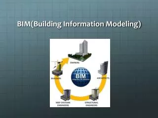
Introduction to LiDAR What is LiDAR? LiDAR, or Light Detection and Ranging, is a cutting-edge remote sensing method that utilizes pulsed laser light to measure distances and create precise three-dimensional representations of objects and environments. This technology is rapidly becoming indispensable in the AEC industry for visualizing and managing built facilities with unprecedented accuracy. At its core, a LiDAR system emits laser beams that strike a target surface and reflect back to a sensor. By precisely measuring the time it takes for each light pulse to return, the system calculates the distance to the target with centimeter-level accuracy. This process generates massive datasets known as "point clouds."
LiDAR's Role in BIM Seamless Integration The true power of LiDAR in the AEC sector emerges when seamlessly integrated with Building Information Modeling (BIM). This synergy enables the creation of rich, high-fidelity digital models directly from real-world scans, providing an elaborate and accurate representation of existing structures and landscapes. Enhanced Digital Models Accurate Elevation Models LiDAR data enables highly detailed digital terrain models and precise 3D modeling drawings of various building elements, including pipes, walls, and HVAC systems, far beyond what traditional methods can offer. Generate precise digital elevation models crucial for early design stages, allowing architects and engineers to make informed decisions from the outset of a project. Streamlined Verification Reliable Clash Detection Facilitates streamlined as-built verification, ensuring that constructed elements align perfectly with design specifications and preventing costly discrepancies. Enables reliable clash detection and design validation by identifying inconsistencies and potential conflicts early in the process, significantly reducing rework and associated costs.
Key Benefits Advantages of LiDAR-BIM Integration Accurate Data Analysis Easy Data Access 3D scanning technology provides data in a format easily understood by all stakeholders, surpassing the accuracy of manual measurements and point clouds. Project stakeholders can access data from any location via BIM, enabling accurate analysis and cost-effective amendments, with cloud access for clash detection. Precise Measurements 3D Model Visualization The integration eliminates over 90% of human and measurement errors, ensuring superior precision in project execution. Digital 3D representations offer in-depth analysis, allowing contractors to verify designs meet safety and building codes before construction begins.
Addressing Challenges Limitations of LiDAR-BIM Integration Visible Challenges Surface-Level Issues Technical Difficulties Operational & Cost Concerns Quality & Expertise Factors While LiDAR-BIM integration offers undeniable benefits, it's not without limitations. Challenges can arise in environments with highly reflective surfaces or complex geometries, where light interference may lead to inaccurate data.
LiDAR Systems and Classification Types of LiDAR Systems Topographic LiDAR Utilizes infrared lasers primarily for surveying land and man-made infrastructure. It's ideal for mapping elevated terrain, buildings, and urban environments.Both airborne and mobile LiDAR systems offer unparalleled accuracy, providing comprehensive data for diverse applications. Bathymetric LiDAR Employs water-penetrating green light to study submerged ecosystems and underwater topography. It is essential for shoreline mapping, hydrodynamic modeling, and navigation charting.
LiDAR Sensor Types & Applications Variants of LiDAR Sensors Full Waveform LiDAR Records the entire returned laser signal, providing high accuracy even with complex targets like dense vegetation, and minimizing noise for detailed analysis. LiDAR Altimeters Used by scientists in planetary missions to gauge distances between spacecraft and targets, ensuring safe operations and facilitating scientific data collection. Flash LiDAR Sensor Captures an entire scene in a single flash, ideal for autonomous vehicles and robotics due to its rapid data acquisition. Though costly, it's suited for specialized, high-demand applications. Each LiDAR sensor setup is unique, with variations in laser wavelength and resolution tailored to specific environmental and application requirements.
LiDAR Data Acquisition The Workflow Explained 01 02 03 Pre-survey Planning Sensor Selection Field Data Collection Define the precise area to be measured and establish the desired accuracy levels for the project, setting the foundation for data collection. Choose the most suitable LiDAR scanners (e.g., airborne or mobile systems) based on project scope, environmental conditions, and required data resolution. Mount laser scanners on appropriate platforms, such as drones or helicopters, to systematically collect topographical data from the target area. 04 05 Post-Processing Model Integration Transform raw LiDAR data into structured point cloud datasets through specialized software, cleaning and organizing the information for further use. Import the processed point cloud into BIM software to generate accurate digital terrain models, surfaces, and detailed geometry for design and analysis. This meticulous workflow ensures that LiDAR data is collated and prepared for critical applications in urban planning, natural resource management, and emergency response operations, among others.
Ensuring Precision Enhancing LiDAR Accuracy While LiDAR instruments offer remarkable precision with horizontal accuracy deviations of 1-2 cm and vertical accuracy oscillations of 2 cm several factors can influence their performance. Factors Affecting Accuracy: • Laser Beam Divergence: The spread of the laser beam as it travels, which can affect the precision of the measured point. • Scanner Resolution & Angle: The density of data points collected and the angle at which the laser hits the surface. • Environmental Conditions: Atmospheric conditions like fog, rain, or dust can scatter laser pulses and reduce accuracy. • GPS Synchronization: Errors in GPS data can lead to inaccuracies in the georeferencing of point clouds. To ensure consistent data quality and reliability, modern LiDAR systems undergo regular calibration and rigorous testing. This commitment to precision makes LiDAR an indispensable tool for applications demanding the highest levels of measurement accuracy, from large-scale surveying to autonomous navigation.
The Future of AEC: LiDAR & BIM LiDAR, a high-precision remote sensing technique, measures distances using laser pulses. When paired with BIM, it represents a modern trend in digital construction and design, offering unparalleled accuracy. From detailed mapping to digital terrain models, this technology empowers AEC stakeholders to incorporate precision into every stage of design and construction, marking a bright and clear future. Whether scanning complex man-made environments or contributing to emergency response operations, LiDAR is more than a tool—it's a strategic asset. Looking to enhance your project with precision-driven BIM Services?Connect with Pinnacle Infotech — your trusted BIM partner worldwide.
Thank You Website :https://pinnacleinfotech.com/services/ Email id : info@pinnacleinfotech.com