Download

1 / 12
120 likes | 528 Views
Using Google Earth as a GIS tom.rc@field-studies-council.org. Adding places of interest to Google Maps & creating your own maps To access the maps you will need to log in to Google and the login: Email: northwestfieldwork@gmail.com Password: fieldwork1234.

E N D
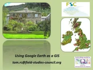
Using Google Earth as a GIS tom.rc@field-studies-council.org
Adding places of interest to Google Maps & creating your own maps To access the maps you will need to log in to Google and the login: Email: northwestfieldwork@gmail.com Password: fieldwork1234 Maps Available at: NorthWest:http://www.geographyteachingtoday.org.uk/fieldwork/info/fieldwork-cpd/north-west-network/
Adding places of interest to Google Maps & creating your own maps • Think of your favourite place to do local fieldwork (it could be somewhere you • currently use or have thought about using) • 2. Share your location with your partner and why you picked it • 3. Log in to Google, click on maps (left side of the page) then go to my maps • Go to edit in my maps then find the fieldwork location place on the Google Map • Click on the Pin in the left corner of the Map and place it in the right location • Add a title to the pin and some information about the location (if you want to be a bit fancy you can link to a picture and websites) • To access the maps you will need to log in to Google and the login: • Email: northwestfieldwork@gmail.com Password: fieldwork1234 Maps Available at: NorthWest:http://www.geographyteachingtoday.org.uk/fieldwork/info/fieldwork-cpd/north-west-network/
Creating a pin in Google Earth • Find a place on Google Earth where you could do, or do, some local fieldwork. Place a pin there. • Add some info about the site in the description box. • See if you can add a picture.
Useful html code <b> your text </b> Bold text <i> your text </i> italics text <p> your paragraph </p> separate paragraph <br> line break <font face=“comic sans MS”> changes font type <font style=“font-size:44pt”> changes font size <font color=“#ff0000> font colour <a href=“mailto:email address”> creates an e-mail link <a href=“http://www.website”> creates a website hyperlink <center> your text </center> centres text
Creating a layer • There are picture files of local maps in the shared area, or you can download your own maps to add as layers from the web
‘Lovely Layers’ in Google Earth • Street View: 3600 pictures • Weather (you need to zoom out to see these layers) • Roads (very useful when adding your own layers) • Panoramio photos: Geo located pictures • National Geographic: places of interest in Gallery
Creating graphs • Have a go - there are pins at a local river and urban area in the shared network.
Video function • Video tours are a useful and very quick way to record students thoughts about places
Sketch up • You can use Sketch up (free download) and the 3D warehouse, of buildings and objects, to find things you want to download into Google Earth. Useful when investigating proposed local developments like wind farms.
Plenary Hopefully something has been of use/new today. Think of the most useful idea you have developed today. Share this with your partner and explain how you are going to use it in the future. Please fill in an evaluation form. Using Google Earth as a GIS tom.rc@field-studies-council.org
Websites with easy to use GIS resources • Natural England www.natureonthemap.org.uk • Environment Agency www.environment-agency.gov.uk • British Geological Survey www.bgs.ac.uk/britainbeneath • National Statistics http://neighbourhood.statistics.gov.uk • Meteorological Office www.meto.gov.uk/climate/uk