The Mercantile City
240 likes | 555 Views
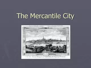
The Mercantile City. Waterfront Site. Image source: http://www.postaprint.co.uk/. LONDON. Waterfront Site. Image source: http://www.postaprint.co.uk/. VIENNA. Changes in values. nobility and clergy slowly lose ground to traders and craft guilds

The Mercantile City
E N D
Presentation Transcript
Waterfront Site Image source: http://www.postaprint.co.uk/ LONDON
Waterfront Site Image source: http://www.postaprint.co.uk/ VIENNA
Changes in values • nobility and clergy slowly lose ground to traders and craft guilds • guilds provided education, insurance, identity and entertainment • speculation on land and shipping led to a more adventurous and entrepreneurial spirit • work initially improves quality of life, then moves towards industrial era’s ideal: “work for the sake of work” • people no longer shy away from change, slowly move toward industrial era’s “change for the sake of change”
Agricultural Roots of Urban Growth • Organic fertilizer comes into use (manure) • Technique of crop rotation is developed • Fallow period is shortened • New-world crops introduced from 1500s • Enclosure (1750-1850) • Clearing of woods, drainage of marshland
Strong ties to rural hinterland Picture source: http://www.postaprint.co.uk/
Big European cities by 1500? • “big” at this time was over 100,000 • Some already benefited from long-distance trade • Rome • Milan • Venice • Paris
Rome, Milan, Venice, Paris still had over 100,000 Now joined by: London Dublin Amsterdam Lyons Berlin Madrid Lisbon Naples Palermo (Sicily) Vienna Moscow Big European cities by 1750?
Changes in the urban system • Activity was now greater in NW. Europe than in S. Europe • Cities in this area were now protected by the states that contained them, so walls were no longer necessary • The biggest cities depended increasingly on their relations to other European cities rather than focusing on their hinterlands • Colonies in the Americas & elsewhere drove European development by the 1700s
The U.S. urban system,1800(pre-railway) Don Meinig Atlantic America, 1492-1800
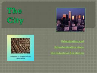
The Walking City • pedestrian scale (r < 2mi.) • layering of activities in vertical space • roads narrow and muddy • waterfront dominated by mills, warehouses, docks • dense population • land uses not very sorted out (but low-lying flood-prone areas were “reserved” for industries & the poor)
Transportation & Communication Technology • steamboat from early 1810s • major canals (e.g. Erie Canal) from 1820s • steam locomotive from 1830s • telegraph from 1840s • new infrastructure accelerated urban growth and ushered in the industrial era • how?
Planning took a back seat to money-making • grid layout was quick and easy to plan • grid also promoted buying and selling of lots and properties • solar exposure, though understood by Neolithic people and was now forgotten • not until 19th c. was the need for parks and playgrounds recognized • attention to the appearance and the safety of the built environment decreased (until 20th c.)
Application of a simple system 1764 1807 http://freepages.genealogy.rootsweb.com/~blkyn/Map/NY.1807.html http://www.carto.com/chighlights/us_east.html
Growing Pains • Mercantile cities were beset by various problems due to the unprecedented concentration of people • Fire • Epidemic disease (cholera, tuberculosis, etc.) • Crime • Traffic accidents (yes, horse-drawn vehicles could kill people!)
Sanitation Problems • Wastewater was not adequately isolated from drinking water sources • Pigs were allowed to roam the streets to clean up food scraps • Horses contributed to the mess in the roads • Human wastes were thrown into the streets from windows at the 2nd story and above • Human wastes were dumped directly into canals and rivers that ran through the city
John Snow’s Cholera map • Mortality map drawn in 1849 cholera epidemic • First application of geographical information for the purpose of epidemiology • Debunked theory of “miasmatic” transmission • Resulted in the removal of the handle from the water pump on Broad Street in 1854 • Various schemes for isolating fresh water and treating sewage followed from this discovery Source: http://www.csiss.org/classics/content/8
Summary • Capitalist urban systems developed for several hundred years before industrialization • This period was characterized by • Waterfront sites • Pedestrian scale • Poor sanitation • Growing trade • Changes in values • Simplification of land use patterns • Dawning of the application of science to areas such as urban health and transportation