Download
1 / 16
160 likes | 931 Views
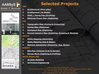
Selected Projects CAD Architectural (Floor plan) Architectural (3D Model) HVAC / Piping Plan (Drafting) Electrical Power Plan (Digitizing) GIS Topographic Map (Zoning & Contouring) Zoning Map (Digitizing) Geological Map (Digitizing) Ground Cadastre Map (Digitizing, Grouping & Merging)

E N D
Selected Projects • CAD • Architectural (Floor plan) • Architectural (3D Model) • HVAC / Piping Plan (Drafting) • Electrical Power Plan (Digitizing) • GIS • Topographic Map (Zoning & Contouring) • Zoning Map (Digitizing) • Geological Map (Digitizing) • Ground Cadastre Map (Digitizing, Grouping & Merging) • AM/FM • Utility Mapping (Electricity) • Utility Mapping (Gas & Water) • Network Adjustment (Electricity, Gas, Water) • SURVEY • Site Plan (Telecom & ALTA Survey) • Survey Work (Digitizing & Drafting) • SOLID MODELING • 3d Solid Modeling • 3d Product Engineering AABSyS Information Technology Pvt. Ltd. Plot No. E/54 and E/54 /1, Infocity, Chandaka Industrial Estate, Patia, Bhubaneswar-751024, INDIA Tel. +(91) 674 3269130, Fax +(91) 674 274-0129 Email: info@aabsys.com, Web: http://www.aabsys.com
Requirement of client: • Preparation of digital floor plans for multi-storey buildings as per raster and incorporating the modifications indicated. • Data received from client : • Raster images of floor plans with hand-drawn modifications in TIF format & specifications of the work. • Job of AABSyS: • The raster images were fit into the proper scale of the floor plans and taken as a reference. • Extra care was taken to exactly overlap the drawings of different floors of respective multi-storey buildings. • Floor plans were constructed as per the dimension on the raster images and wherever the dimension was not provided, it was measured from the raster images. • Room Polygoning, identification and layer assignment for respective rooms were implemented. • Plots of the digital floor plans were matched against the plots of the raster image to ensure quality. • Delivery to client in DWG format. CAD GIS AM/FM SURVEY SOLID 1 2 3 4 1 2 3 4 1 2 3 1 2 1 2 ARCHITECTURAL Floor Plan Industry: Architecture and construction Source: Raster images of the plans
Requirement of client: • Preparation of 3D Models, adding right textures, light, camera and creating pictures of perspective views from different angles of the Bathroom • Data received from client : • Floor plans, Elevations, different side views in 2D digital format (AutoCAD DWG). • Job of AABSyS: • 3D Model was prepared by using 3D Studio Max software from the provided 2D floor plan by referring the elevations and side views. • Right textures were added to finished surfaces. • Objects such as Wash Basin, Toilet, Shower Cabin, etc were added • Perspective views created by fixing the camera and light at different positions of the model. • Pictures of perspective views were sent to customer for feedback. • Customers remarks were received and the model was revised. • Delivery was done in *.3DS for model and *.JPG for pictures CAD GIS AM/FM SURVEY SOLID 1 2 3 4 1 2 3 4 1 2 3 1 2 1 2 ARCHITECTURAL 3D Model Industry: Architecture Source: Floor plans, Elevation, Side views
Requirement of client: • Conversion of HVAC / Piping plans as per the dimensions shown on the scanned image. • Data received from client : • Scanned images showing HVAC and Piping plans and Floor plans • Job of AABSyS: • Plots of the scanned image were taken for easy reference. • Customized linetypes were created and automated program was developed to draft/annotate the linetypes as per customer’s requirement. • The HVAC / Piping plan was drawn as per the dimensions given on scanned image. • Plots of the drawings were taken and matched against the source plans to ensure the quality. • Newly created HVAC plan was fit on the Floor plan provided by the client. • AABSyS’s Query Management System was used to track the queries/answers. • The file was delivered to the client in DWG format. CAD GIS AM/FM SURVEY SOLID 1 2 3 4 1 2 3 4 1 2 3 1 2 1 2 HVAC/Piping PLAN Drafting Industry: Facility Management Source: Scanned images & Floor plans
Requirement of client: • Digitization of Electric power plan • Data received from client : • Scanned images • Job of AABSyS: • The scanned images containing the Electrical power plan were scaled to fit the pre-digitized floor plan. • Blocks were created for the electrical symbols to maintain the uniformity in all over the drawings. • Raster to vector conversion was performed using AutoCAD software. • Manual quality check was done by matching the plots of vector files against the plots of the raster files. • The file was delivered to the client in DWG format. CAD GIS AM/FM SURVEY SOLID 1 2 3 4 1 2 3 4 1 2 3 1 2 1 2 ELECTRIC POWER PLAN Digitizing Industry: Facility Management Source: Scanned images
Requirement of client: • Digital geographic information of the region which allows 3D modeling and analysis of effects of earthquakes and other influences on the region. • Data received from client : • Hard copies and scanned color images of earthquake-prone zones of Romania. • Job of AABSyS: • Scanned images of earthquake-prone zones were digitized. • The topological information such as contour lines, streets, rivers, lakes and geographic information such as vegetation lines, state and district boundaries were digitized in specified layer. • The contour lines were drawn as per the elevation information provided on the scanned image. • Digitized maps were rubber-sheeted and merged to obtain a single map. • Plot of vectorized map was matched against the source hard copy on a lighted glass table. • The file was delivered to the client in DGN format. CAD GIS AM/FM SURVEY SOLID 1 2 3 4 1 2 3 4 1 2 3 1 2 1 2 TOPOGRAPHIC MAP Zoning & Contouring Industry: Information Management (GIS) Source: Scanned Color images
Requirement of client: • Digitization of specific zones on the raster images. • Data received from client : • Scanned color images • Job of AABSyS: • Scanned images were taken as a reference and digitized using AutoCAD software as per the client’s specification. • Polygons were created for different zones. • Filling work was done as shown on the scanned image. • Quality check was done and data delivered to the client in DWG format. CAD GIS AM/FM SURVEY SOLID 1 2 3 4 1 2 3 4 1 2 3 1 2 1 2 ZONING MAP Digitizing Industry: Information Management (GIS) Source: Scanned Color images
Requirement of client: • Capturing of points with it’s altitude and depth of minerals as attribute data. • Data received from client : • Scanned maps and map registration information. • Job of AABSyS: • Scanned images were registered as per the supplied geo-coordinates using Mapinfo software. • Points were captured • Attributes such as altitude of point, depth of different type of material viz. Pb, Cu and Ba at the point location were captured • Thorough quality check was done for attribute data correctness • Delivery was done as Mapinfo Tab files. CAD GIS AM/FM SURVEY SOLID 1 2 3 4 1 2 3 4 1 2 3 1 2 1 2 Geological MAP Digitizing Industry: Geological & Mining Source: Scanned map & map registration info
Requirement of client: • Digitization of ground cadastre maps of different German cities for efficient town planning and administration • Data received from client : • Scanned images and overview maps of the cities • Job of AABSyS: • Digitization of maps was performed by heads-up digitization. • Entities such as plots, houses, streets and their respective numbers were captured on different layers. • The digitized data was cleaned up to ensure the topology correctness and polygons for plots and house were made. • The plot numbers with plots and house numbers with houses were grouped. • Individual digitized maps were georeferenced using geodetic coordinates and merged into a single map using affine method of transformation with reference to overview maps. • Data delivered to client in DWG format. CAD GIS AM/FM SURVEY SOLID 1 2 3 4 1 2 3 4 1 2 3 1 2 1 2 GROUND CADASTRE MAP Digitization, Grouping & Merging Industry: Town Planning Source: Scanned images & Overview maps
Requirement of client: • Vectorization of electrical cables and devices on the pre-vectorized ground cadastre map and linking all electrical entities with the MS Access database containing their respective properties. • Data received from client : • Scanned images of plans, detail sheets of stations & transformers and details of house connections • Job of AABSyS: • Plots of scanned images were taken for easy reference. • Electrical network information containing cables, substations, transformers, street lights, etc. were drawn as per dimensions on the digital ground cadastre map using customized tools provided in GEBIS software. • All digitized electrical entities were linked to a MS Access database containing their respective properties through the GEBIS software. • The vectorized map in DGN format along with the MS Access database were delivered to the client. CAD GIS AM/FM SURVEY SOLID 1 2 3 4 1 2 3 4 1 2 3 1 2 1 2 UTILITY MAPPING Electricity Industry: Utility Solutions & Network Management Source: Scanned images & vectorized Ground cadastre maps
Requirement of client: • Vectorization of Gas and Water pipes on the pre-digitized ground cadastre map as per the dimension. • Data received from client : • Scanned images having both Gas & Water information & vectorized ground cadastre map. • Job of AABSyS: • Plots of Scanned images were taken for easy reference. • Gas and Water lines were digitized in separate files as per the dimension with reference to the ground cadastre map. • A tailored routine programme developed in Auto LISP was used for automated execution of the dimensioning and transformation of entities to their specified layers. • All the utility information were captured from the image as per client’s specification. • The relevant objects were grouped. • The drawing files were merged. • Finally two merged files of both gas and water were delivered to the client after a thorough quality check. CAD GIS AM/FM SURVEY SOLID 1 2 3 4 1 2 3 4 1 2 3 1 2 1 2 UTILITY MAPPING Gas & Water Industry: Utility Solutions & Network Management Source: Scanned images & vectorized Ground cadastre maps
Requirement of client: • Adjust of network with reference to New/updated Land base • Adjustment Process: • Login through CITRIX to access customer data • Project area creation • Identification of shifting nodes on old land base and corresponding node on new land base • Shifting accuracy checking through constraint detector • Adjustment of network • QA / QC • Delivery CAD GIS AM/FM SURVEY SOLID 1 2 3 4 1 2 3 4 1 2 3 1 2 1 2 Network Adjustment Electricity/Gas/Water in association with Industry: Utility, Town Planning, Revenue and Taxation Identify Shift Required Resulting Adjustment Utility Network System on CITRIX
Requirement of client: • Preparation of Site plans with reference to survey points provided by the survey crew of client • Data received from client : • Survey points (field book *.fbk), site photographs and field sketches. • Job of AABSyS: • Points/coordinates were imported from Field book file to AutoCAD using Softdesk Civil survey facility. • Site information such as houses, streets, curb, parking spaces, fences and pavements etc. were drawn with reference to the GPS information with help of field notes. • Property information were drawn with reference to record plan. • The site plan was shown in Paper space with title information and legal description notes etc. • The time difference between USA and India allows for a fast turn around time for drafting, where the survey data of the site is provided to AABSyS at the end of the day, and the custormer obtains the digital survey maps on the next morning. CAD GIS AM/FM SURVEY SOLID 1 2 3 4 1 2 3 4 1 2 3 1 2 1 2 SITE PLAN Telecom & ALTA Survey Industry: Survey Source: Survey points, field notes, site photographs, record plans
Requirement of client: • Detail information of optical fibre cable on ground cadastre map in DWG format. • Data received from client : • Scanned images of ground cadastre maps, DWG file containing survey points and drilling information of the optical fibre cables. • Job of AABSyS: • The ground cadastre maps were digitized, georeferenced and merged into a single map. • Optical fibre cables were drawn separately as per the survey points provided by the client. • Digital cable maps were merged on the ground cadastre map and cleaned as per client’s specification. • Frames (in model space) were used to show various section of the merged map in paper space. • Each frame contained information on the geo-position and under ground details of the cables, type of drills and title information. • Data was delivered to the client in DWG format. CAD GIS AM/FM SURVEY SOLID 1 2 3 4 1 2 3 4 1 2 3 1 2 1 2 SURVEY WORK Digitizing & Drafting Industry: Survey Source: Scanned images of ground cadastre, survey points and drilling information of the Optical fibre cables
Requirement of client: • Preparation solid models of machine parts. • Data received from client : • 2D plans and the perspective views • Job of AABSyS: • The models were prepared with reference to the dimensions. • The job was executed using PROE software. • Data delivered to the customer with a proper quality check. CAD GIS AM/FM SURVEY SOLID 1 2 3 4 1 2 3 4 1 2 3 1 2 1 2 SOLID MODELING 3d Engineering Design and drawing Industry: Heavy Engineering Source: 3d model of images
Requirement of client: • Preparation solid models for the production of Gems • Data received from client : • 2D pictures of the Gems • Job of AABSyS: • The models were prepared with reference to the dimensions. • The job was executed using 3ds max software. • Data delivered to the customer with a proper quality check. • Data delivered in IGS format. CAD GIS AM/FM SURVEY SOLID 1 2 3 4 1 2 3 4 1 2 3 1 2 1 2 SOLID MODELING 3d Product Engineering Industry: Gems Cutting Source: Exported Image from actual model