Download
1 / 42
430 likes | 1.06k Views
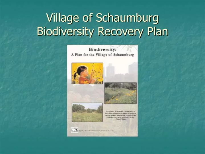
Village of Schaumburg Biodiversity Recovery Plan. Schaumburg is located approximately 26 miles northwest of Chicago. The village was incorporated on March 7, 1956 and consisted of 130 residents and a land area of 2 square miles.

E N D
Schaumburg is located approximately 26 miles northwest of Chicago. • The village was incorporated on March 7, 1956 and consisted of 130 residents and a land area of 2 square miles. • Schaumburg is home to 75,936 residents occupying 19 square miles and is now almost completely developed.
Getting Started on a Biodiversity Recovery Plan • Elected Officials became involved • NIPC, resolution in support of CW BRP • Planning Dept. staff assigned to lead this project • Consultant was hired
Applied Ecological Services worked closely with the village to identify our goals and to refine the scope of work. AES worked with village staff to incorporate comments made by the village and conducted presentations to elected officials at public meetings
Scope of Work • The village developed four goals in order to fulfill the mission of the CW BRP • Create a Biodiversity Plan • Address Residential and Corporate Applications of Biodiversity • Target High Priority Sites • Ordinance Development
Project Approach • Ecological Assessment • Natural Area Restoration • High Priority Sites • Conservation Development Planning • Greenway Opportunities • Funding Mechanisms • Ordinance Review • Educational Information
Ecological Assessment • Identifies representative natural communities within the village. • The assessment documents the flora and fauna of both terrestrial and aquatic habitats on open lands and includes a discussion of the potential presence of rare species.
Natural Area Restoration • This section provides an introduction to the philosophy behind ecological restoration and management. • Common restoration techniques as well as methods of maintaining and monitoring natural areas are described. • Suggested performance standards, specifications, and cost estimates are included.
High Priority Sites • Using the ecological assessment, high priority sites were identified. • There are 12 high priority sites that comprise 937 acres • The sites range in size from 7.8 acres to 350 acres • This section provides a closer look at the current condition of each site, assesses the impact of surrounding land use, and suggests a restoration and management plan.
How has the village used this information? • The BRP plan recommended that the village guide development of the Loeber Farm Property to be sensitive to the environmental resources on site
Design Guidelines for environmentally significant parcels • Loeber Farm Guidelines • Created by staff and approved by the Village Board • Development plans for this project are currently under review
Conservation Development Planning • This section includes an overview of the basic principles behind conservation development and discusses the use of native landscaping and alternative stormwater management in new developments. • Retrofitting commercial and residential areas.
Greenway Opportunities • Connectivity of open space within the village and with adjacent municipalities. • Opportunities to create larger habitats.
Funding Mechanisms • Great resource for the village and private organizations. • Information on funding sources for land acquisition, restoration, and education.
Ordinance Review • Complete renovation of some codes: • Zoning Ordinance • Landscaping and Screening • Tree Preservation • Wetland Protection Overlay District • Weeds Declared Nuisance • Definitions
Ordinance Review • Subdivision and Land Development Ordinance • Storm Sewer and Drainage Systems • Protection of Existing Trees, Landscaping, Parkway Grading and Sedimentation
Commercial Sites • The village worked closely with Motorola to reduce erosion along lengthy stretches of drainage swales using native plantings.
This encouraged Motorola to expand their improvements to include the enhancement of an existing wetland • 7% of the campus is devoted to natural plantings
Motorola has formed a stewardship group of employees that assist with the removal of invasive species
School District • The village assisted School District 54 in preparing a bid for selective clearing of invasive species at their nature center
Residential Sites • Townhomes of Brookhill Homeowners Assoc. completed a “retro-fit” of their detention pond using native plants, and was able to take advantage of a $100,000.00 interest free loan from the village
Results • Village initiated projects • Renaissance Schaumburg Hotel and Convention Center site combines vegetated swales in the parking lot with native landscaping in the detention areas. • Expansion of Engineering and Public Works Facility and Fire Station #5 combines vegetated swales in the parking lot with native landscaping in the detention areas. • Public pocket park planted with native plantings. • Active in Salt Creek and Poplar Creek Watershed Planning projects. • Issued 4 residential natural landscaping permits. • Quarterly Biodiversity Reports are compiled to keep our elected officials up to date on our biodiversity progress. • Yeargin Creek; final phase has been submitted for funding.
Results • Private projects • Motorola has converted 7% of their turf to native plantings and were recognized by the US EPA and CW for their efforts. • Tallgrass Restoration relocated to Schaumburg and installed native landscaping on their site. • Six detention ponds in PUD’s have been retrofitted with natural landscaping; 2 additional projects are under review. Two new residential developments have been built with naturalized landscaping around the detention/retention facilities. • Twelve commercial developments have been built with naturalized landscaping.
Small Projects Make a Big Difference. • 2008 Rain Barrel Initiative
Yeargin Creek Improvements • Tributary No. 5 to the West Branch of Salt Creek • Channelized stream with mud and silt bottom • Landscape treatment along the stream bank consisted of bluegrass lawn • Extreme fluctuations during storm events
In 1999 the Village Board approved a proposal to restore the natural alignment and enhance the area with native plantings • The project included replacing culverts with bridges, bank stabilization, tree preservation, and the installation of riffles in the creek bed
Construction began in September, 2000 and the project was completed in May, 2001
The stream portion is 1,070 linear feet with native plantings comprising approximately 1 ½ acres
Riffles were added to slow the flow of the water and to create habitat • Lannon stone retaining walls were installed to aid tree preservation
Approximately 6,400 prairie forb plugs were interplanted in the seeded areas to provide color • Annuals were also mixed with the prairie grass seed for seasonal color
Education • Tell people how great your community is! • Interpretive signage can be beneficial in explaining why natural landscaping is used and how it is maintained
Get involved in regional planning efforts • Poplar Creek Watershed • Salt Creek Watershed • CMAP Environment and Natural Resources Working Committee • Illinois Climate Change Advisory Group • Chicago Wilderness 2008 Congress Planning Committee
www.villageofschaumburg.comMartha DooleySenior Landscape Planner847-923-3855