Download

1 / 24
240 likes | 528 Views
Conference Overview Topics. ESRI’s Top 10 9.3 Desktop Timesavers AIMS list of Additional 9.3 Desktop Enhancements Editing Enhancements CAD and GIS, Interoperability and Extensions 9.3 Compatibility ArcGIS Server The Road Ahead including 9.4. ESRI’s Top 10 9.3 Desktop Timesavers.

E N D
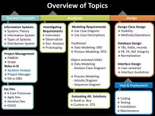
Conference Overview Topics • ESRI’s Top 10 9.3 Desktop Timesavers • AIMS list of Additional 9.3 Desktop Enhancements • Editing Enhancements • CAD and GIS, Interoperability and Extensions • 9.3 Compatibility • ArcGIS Server • The Road Ahead including 9.4
ESRI’s Top 10 9.3 Desktop Timesavers • 10 – Bookmarks • 9 – Pause Labeling • 8 – Alt-Click to turn off all layers • 7 – Clip Raster to Graphic • 6 – Transparent Legends • 5 – Table Enhancements (Sort, Alias, Joins) • 4 – Reverse Geocoding • 3 – Convert Graphics to Features • 2 – ID Shortcuts and HTML Popups • 1 – Error Reporting (and Decrease of random crashes)
AIMS List of Additional 9.3 Desktop Enhancements • ArcGIS Online • Layer Files • Zoom to Layer • Improved Viewer Windows • PDF Export • New Options • Layer2KML and Map2KML • Better Geoprocessing Tool Errors • Enhanced Geocoding Interface
Editing Enhancements • Version Changes Viewer • Merge Geometry • Cut Polygons • Keyboard Shortcuts
CAD and GIS, Interoperability and Extensions • Data Interoperability Extension • Use in Arc Map, Arc Catalog, Arc Server • Safe Software capabilities built to work in Arc GIS platform • Improved and more capabilities at 9.3 • Free support for .gml and .wfm formats • Quick import or Quick Export (Easy way to transform data) • Full access to FME Workbench to manipulate data created within toolbox as a Spatial ETL Tool • Read/Write many formats and manipulate data though FME transformers • Automation done by export to python scripting • Cost is same as other ESRI extension and is much less expensive than full version of Safe Software FME • http://www.esri.com/software/arcgis/extensions/datainteroperability/index.html
CAD and GIS, Interoperability and Extensions • ArcGIS for AutoCAD Plug-In • New release by end of 2008 • Same capabilities to read Arc GIS Server Services but with better enhancements and performance • Security • Better rendering of Service • Additions to Plug-In • Improvement to Import and Export to CAD tools • New tool to allow you see attributes from GIS in CAD through MSD tool • Creation of “Feature Classes” with in AutoCAD and assign what layers to assign to feature class • Creation of attributes for each feature class • These two allow you to import a new feature type when reading CAD files and attributes will be assigned to each feature • CAD users will be creating GIS data with out even knowing it • By importing Server services, will allow the user to create data in correct real world location • Going back and forth between GIS and CAD users will be simpler
9.3 Upgrade and Compatibility • 9.3 Requires you to upgrade the “floating” license manager • 9.3 is Vista supported • 9.2 SP 3 introduced 64bit support • ArcGIS 9.2 SP 5 compatible with ArcGIS 9.3 GeoDatabase (Application Connection)
9.3 Upgrade and Compatibility • GeoDatabase access not limited to specific version at 9.3 for SDE Direct Connect • GDBDirectConnect (Located on DVD)
AIMS Upgrade Schedule • ArcIMS – Done (CAMA/Orion) • ArcGIS Desktop testing complete – upgrade anytime • ArcGIS Server - early September • ArcSDE - mid to late September? • More dependent on SQL2008 upgrade • ArcSDE 9.3 now has a native 64bit version for Windows
AIMS Infrastructure Upgrade • Late 4th Quarter 2008 • Replace existing AIMS data server hardware (in place since May 2004) • Upgrade existing Operating System Windows 2000 to ? • Upgrade existing Database Software SQL2000 to SQL2008
ArcGIS Server • OMG The Boss Needs It NOW! • Your glorious boss has asked for a map today or you’re fired. What do you do?
Go check AIMS of course • The IMS? Sorry, can’t add your data • DDR? The jerk didn’t buy you any storage space, remember??? • ArcServer and the REST API? • Ding ding ding ding • Do a generic find • Do a specific query
Some other interesting things…. • Flex API • A cool example • New ADF Template • Caching Improvements • 1 Load preset schemas • 2 Only cache some areas • 3 Don’t allow local
The Road Ahead9.3 Support for Geometry & Geography data types in SQL Server 2008 SQL Server 2008 - RTM Instead of storing coordinates in the Points field in the f table (image data type), store coordinates in the business table using a field with either a Geometry (planar/flat earth) or Geography (ellipsoid/round earth) data type
The Road Ahead9.3 Support for Geometry & Geography data types in SQL Server 2008 (cont) Why is this so exciting? ~80 Spatial Functions (SQL Spatial Operators) “Select by location” and gp can be done in SQL e.g., Definition Query: All states that intersect I-70 STIntersects, STTouches, STCrosses, STWithin, STBuffer, STUnion, … Our SDE Views can now be true spatial views!
Currently, using only SQL (without GP), this is as close to a “Spatial View” as one can get …
In the future … WHERE clause using STIntersects
The Road Ahead9.3 Support for Geometry & Geography data types in SQL Server 2008 (cont) Editing simple features with SQL Editing non-versioned FCs straightforward Must use multi-versioned views to edit Versioned FCs
The Road Ahead9.3 Service Packs Quarterly 9.3 SP1 – Q4 2008 9.3 SP2 – Q1 2001 Cumulative (e.g., SP2 includes SP1) SPs will linclude Bug Fixes & New Functionality Improved performance of WebADF at 9.3 Dynamic panning of cached services Faster blending of cached and dynamic services Was there more coming at SP2?
The Road Ahead9.4 – No Promises & No Timetable Key Themes: Simplify & Streamline Workflows, Share Knowledge “Iterative and Innovative” make existing things better, maintain compatibility, better user experience new workflow, new science, expansive across the Web Offload complex analysis to background Make TOC “shy away” Warnings when publishing a map service with errors Remove unnecessary redraws Common 3D navigation tools across all products Editing simplification Overhaul metadata editing Personal GDB updated to Access 2007 Improved SQL query functionality in file GDB Ability to “borrow” a license No longer supported: Windows 2000, VB 6, perhaps VS 2005, CAD Client, VBA is slowly dying
The Road AheadWhat is wagging the ESRI dog? Consumer Mapping Response: ArcExplorer, Caching, … Mashups Response: Javascript API, Flex API DBMS Vendors Response: Support for spatial data types Much less prominent are …. Large utility companies Hardcopy cartography Research: Models & Geoprocessing