Download
1 / 21
210 likes | 386 Views
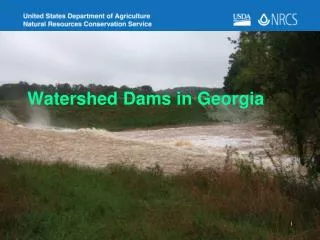
Dams in the Omaruru catchment. Hydrology presentation Omaruru Basin meeting Omaruru, 27 November 2012. Dams in the Omaruru catchment. Dams in the Omaruru catchment. 2001/2002 investigation: Purpose: Inventory of farm dams in catchment Position Size Legal status

E N D
Dams in the Omaruru catchment Hydrology presentation Omaruru Basin meeting Omaruru, 27 November 2012
Dams in the Omaruru catchment 2001/2002 investigation: Purpose: • Inventory of farm dams in catchment • Position • Size • Legal status • Assessment of alleged detrimental affect of dam on flow in the main Omaruru River
Dams in the Omaruru catchment 2001/2002 investigation: • Hydrology ground team • Summer Desertification programme (SDP) students project (Sida/DRFN) • Areal photos and satellite images • Helicopter inspections • Information from farm owners/managers • Ground surveys • Information on DWA Law Administration records
Dams in the Omaruru catchment 2001/2002 investigation – findings • About 140 “farm dams” in Omaruru catchment • Total estimated storage capacity is 2 Mm3 (million cubic meters) = < (less than) 10 % of normal flow in main Omaruru River) • Intercepted catchment area of all farm dams < 3 % of total Omaruru River catchment area • Hydrologcial model shows that theoretical maximum water use + (plus) evaporation is only 5 % in overall water balance
Dams in the Omaruru catchment 2001/2002 investigation • water balance for Omaruru catchment
Dams in the Omaruru catchment 2001/2002 investigation • Suggested explanation for reduced riverflows: lower rainfalls • Legal status of dams • Distributed and very poor record • Waiting for new Water Resources Management Act for re-registration 2004 2005 2006 2007 2008 2009 2010 2011 2012 2013?
Dams in the Omaruru catchment 2008 investigation • Northwest of Omaruru • Complaints about “large” dams • Helicopter inspection • no large dams identified
Dams in the Omaruru catchment 2006-2011 NamWater re-assessment of hydrology of Omaruru catchment • Permit conditions for Omdel Scheme • To be presented by NamWater New concerns • Persistent low inflows in Omdel Dam • Very high rainfalls over past years 2010/2011: Otjimue-Sud 741 mm / Kalkfeld 947 mm (NMS)
Dams in the Omaruru catchment 2012 new investigation • Satellite images • Helicopter inspection (August 2012) • Google Earth • Still continuing
Dams in the Omaruru catchment 2012 investigation • No new large dams • Most dams are still towards northeast (Mount Etjo area) Planned activities • Further work on satellite images • Ground surveys • Registration campaign 2013
Dams in the Omaruru catchment THANK YOU