Download

1 / 20
200 likes | 326 Views
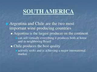
Eye on South America. Purpose/Overview:. Students will use geographic clues and mental mapping to locate South American countries and relative location clues to locate major landforms and bodies of water. Objectives:. Students will use geographic clues and mental mapping to locate the

E N D
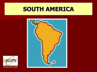
Eye on South America
Purpose/Overview: Students will use geographic clues and mental mapping to locate South American countries and relative location clues to locate major landforms and bodies of water. Objectives: Students will use geographic clues and mental mapping to locate the countries of South America on a blank outline map. Students will use relative location clues to locate South American landforms and bodies of water on a blank outline map. Students will obtain a visual image of South American landforms and bodies of water by viewing PowerPoint photographs of each feature.
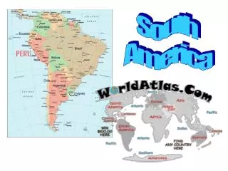
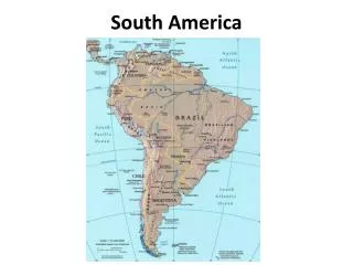
Procedures: Students will label all the countries of South America on a blank outline map without looking at a map or globe. Help students label the Caribbean Sea, Atlantic Ocean, and Pacific Ocean before they begin locating the countries. Students will use the South American Puzzle sheet of geographic clues to locate the countries on a blank outline map of South America. When all students have finished, show the answers on PowerPoint and have them check their answers. Show the remaining PowerPoint slides depicting South American landforms and bodies of water. Ask students to use a physical map of South America to help them locate the landforms and bodies of water on their outline maps as they see them depicted in the photographs.
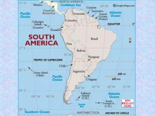
CARIBBEAN SEA VENZUELA GUYANA SURINAME FR. GUIANA COLOMBIA ECUADOR PERU BRAZIL BOLIVIA PARAGUAY PACIFIC OCEAN CHILE ATLANTIC OCEAN ARGENTINA URUGUAY National Geographic Society
Procedures: Students will label all the countries of South America on a blank outline map without looking at a map or globe. Help students label the Caribbean Sea, Atlantic Ocean, and Pacific Ocean before they begin locating the countries. Students will use the South American Puzzle sheet of geographic clues to locate the countries on a blank outline map of South America. When all students have finished, show the answers on PowerPoint and have them check their answers. Show the remaining PowerPoint slides depicting South American landforms and bodies of water. Ask students to use a physical map of South America to help them locate the landforms and bodies of water on their outline maps as they see them depicted in the photographs.
What mountain range stretches from Ecuador through Chile seen here surrounding Chacabuco, Chile? Andes Mountains All photos without URLs are by Glenda Sullivan
What are the table-like mountains located in southeast Venezuela, Guyana, Suriname, French Guiana and northern Brazil? Guiana Highlands http://www.summitpost.org/images/medium/181689.JPG
Brazilian Highlands What is the low mountain range in the eastern, southern and central portion of Brazil? http://www.braziltravelnews.com/photos/chapada2.jpg
Galapagos Islands Isabela Island seen in this satellite image is the largest island of what archipelago that is a province of Ecuador? Latitude/longitude is 0⁰, 91⁰ W. http://en.wikipedia.org/wiki/Galapagos_Islands
What is one of the driest deserts in the world located in Chile? Atacama Desert www.gonomad.com/.../Atacama_desert.jpg
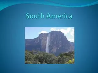
Angel Falls What is the world’s highest waterfalls located in Venezuela? www.islamargarita.com/images/AngelFalls2.jpg
Consisting of 275 cascades what falls forms the border between Brazil and Argentina? Iguazu Falls http://en.wikipedia.org/wiki/Iguazu_Falls
What is the largest river in the world by volume? Amazon River http://vaughanwylie.com/images/amazon-river.jpg
Lake Maracaibo What is the largest lake in South America located in Venezuela? http://en.wikipedia.org/wiki/Lake_Maracaibo
What is the highest navigable lake in the world located on the border between Peru and Bolivia? Lake Titicaca http://media-2.web.britannica.com/eb-media/88/3888-004-486D18C6.jpg
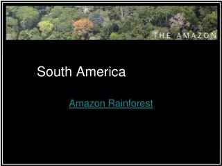
What rain forest is located in nine South American countries? Amazon Rain Forest http://en.wikipedia.org/wiki/Image:River_in_the_Amazon_rainforest.jpg
What is the widest estuary in the world located between Montevideo, Uruguay and Buenos Aires, Argentina? Rio de la Plata
What archipelago is separated from Argentina by the Strait of Magellan? Tierra del Fuego
What is the southernmost island in the Tierra del Fuego archipelago of southern Chile? Cape Horn
What navigable sea route separates Argentina from Tierra del Fuego and cuts through southern Chile? Strait of Magellan