Download
1 / 14
140 likes | 323 Views
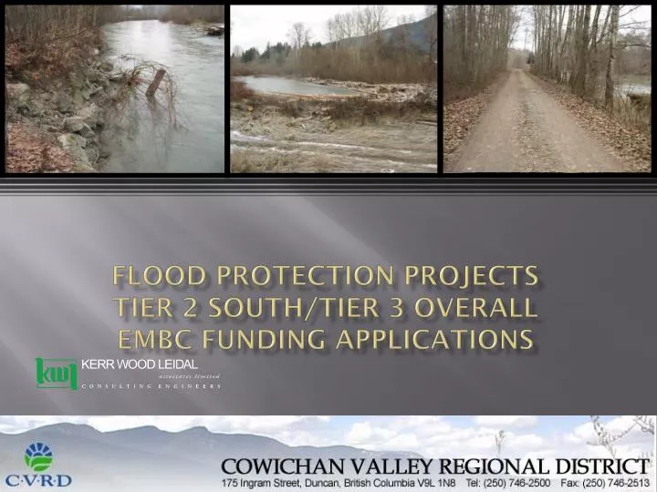
Flood Protection Projects Tier 2 South/Tier 3 overall EMBC funding applications. Strategies. Based on the information developed in the IFM process we recognize that the floodplain acts as a unit. Works on the floodplain have the potential to increase flooding elsewhere

E N D
Flood Protection ProjectsTier 2 South/Tier 3 overallEMBC funding applications
Strategies • Based on the information developed in the IFM process we recognize that the floodplain acts as a unit. • Works on the floodplain have the potential to increase flooding elsewhere • The Tier 2 south strategies protect the developed areas between the two rivers • Tier 3 strategies reduce the overall potential flood hazard over the whole of the floodplain
Tier 2 South and 3 proposals • Tier 2 South three project areas • Tier 3 benefits all areas
OVERVIEW of Applications • Projects are conceptual at this point pending funding approvals • Need to provide sufficient information for screening level funding application (ie: rough concept and high level costs) • More detailed assessment of each project to be completed after screening
Project 1 – South Side Dikes Involves upgrading and linking of: • South Side Dike • South Spur Dike • Mission Road Dike And construction of new connecting Dike Is considered one project with components rather than separate projects
Project 1 – South Side Dikes Key flood protection structures City of Duncan Cowichan River South Side Dike South Spur Dike Mission Road Dike
Project 1 – South Side Dikes Project Benefits • Protects Cowichan Tribes Community from overland flooding • Protects regional water supply wells operated by North Cowichan • Upgrades existing dykes to current standards including erosion protection • Fills the “gap” between South Spur Dyke and Mission Road dyke
Project 2 – Koksilah Area • Improve flood protection of Koksilah Village • Improve drainage from Sh-shelyu (Busy Place) Creek to protect Koksilah Industrial Park • Protect Highway 1 and Miller Road from overtopping • Protect rail line from damage • Protect industrial area south of Highway 1
Project 2 – Koksilah Area A single “solution” has not yet been developed, options include: • Raise Koksilah Village Dyke and Protect from Erosion • Flood proof (Raise) Koksilah Village houses and remove dyke • Raise Miller Road and improve Busy Place Drainage • Re-direct Busy Place Creek high flow All options require further detailed investigation that would be completed at next stage
Project 3 – Cowichan Bay • Protect safety, homes, and property at Clem Clem Village • Protect homes and industrial development in area Challenges: • Flooding from all sides (Koksliah River, Cowichan River, Cowichan Bay) • To meet 200-year design criteria would require ring dyke • Proposal –to protect from erosion and increase hazard warning and emergency access
Tier 3 Programs GRAVEL AND LOGJAM REMOVAL
Gravel and Logjam Removal Purpose: Protect upgraded dykes from erosion from accumulation of gravel and logjams Protect existing infrastructure (bridges, homes, etc) from potential release of logjams 2. Potential improvement of flood conveyance in channels
Gravel and Logjam Removal Potential Locations: • Black Bridge (upstream of E & N railway Bridge) • Cowichan River North Arm • Opposite JUB Outfall
Gravel and Logjam Removal Considerations: • Habitat Impacts and DFO requirements • Assessment of flood impacts from logjam removal and gravel removal • Need for comprehensive on-going maintenance plan