Download
1 / 15
150 likes | 279 Views
Workshop Organization. Dave Wells. Tuesday Morning 16 March 2004 Applications and Requirements 0800 – 0830 MORNING COFFEE 0830 – 0845 Welcome Don Roman The University of Southern Mississippi

E N D
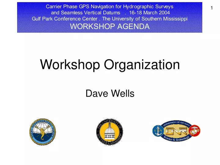
Workshop Organization Dave Wells
Tuesday Morning 16 March 2004 Applications and Requirements • 0800 – 0830 MORNING COFFEE • 0830 – 0845 Welcome Don Roman The University of Southern Mississippi • 0845 – 0900 Workshop Organization Dave Wells The University of Southern Mississippi • 0900 – 0930 Fleet Survey Team GPS ActivitiesChris Esposito Fleet Survey Team, Naval Oceanographic Office • 0930 – 1000 PHOTO OPPORTUNITY • 1000 – 1020 COFFEE BREAK • 1020 – 1100 Joint Airborne Lidar Bathymetry Technical Center of Expertise (JALBTCX) KGPS Challenges Jeff Lillycrop, Eddie Culpepper, and Eddie Wiggins U.S. Army Corp of Engineers / Naval Oceanographic Office • 1100 – 1130 Hydrographic Applications of Precise Geodesy John Brozena Naval Research Laboratory • 1130 – 1200 NAVOCEANO Hydrography Department Upgrades to its Positioning Systems and Hopes to Operationally Reduce its Bathymetric Measurements to a Seamless Vertical DatumElliot N. Arroyo-Suarez Naval Oceanographic Office
Tuesday Afternoon 16 March 2004 Seamless Vertical Datum • 1200 – 1300 LUNCH • 1300 – 1330 A Comparison of Error Budgets for Vertical Positioning Using Traditional and GPS Carrier-Phase Approaches Rob Hare Canadian Hydrographic Service • 1330 – 1400 GPS Tide Detection: Implementation of a Fully Integrated Solution for Hydrographic Surveys on the St. Lawrence River from Data Collection to Data ProcessingLouis Maltais Canadian Hydrographic Service • 1400 – 1430 The NOS National Program for Tidal Datum Field Modeling for Vdatum Kurt Hess National Oceanic and Atmospheric Administration • 1430 – 1450 COFFEE BREAK • 1450 – 1520 An Easily Deployed and Recovered GPS-Tracked Water Level Buoy Marshall Earle, Mike Brown, and Jeffrey Gallagher Neptune Sciences, Inc. • 1520 – 1620 BREAKOUT SESSIONS • 1620 – 1700 DISCUSSION PERIOD • 1800 – 1900 COCKTAIL HOUR Steve’s Marina Restaurant Sponsored by Applanix Corp. • 1900 – 2100 DINNER Steve’s Marina Restaurant Sponsored by The University of Southern Mississippi
Wednesday Morning 17 March 2004 Single Baseline Processing • 0800 – 0830 MORNING COFFEE • 0830 – 0900 University of New Hampshire GPS Research ActivitiesLloyd Huff University of New Hampshire • 0900 – 0920 The Princess of Acadia GPS Ferry Project Marcelo Santos University of New Brunswick • 0900 – 1000 Initial Results and Future Goals of the Princess of Acadia GPS Ferry Project Karen Cove University of New Brunswick • 0900 – 1000 Preliminary Performance Analysis of the Enhanced UNB RTK Software for Long Baselines Don Kim University of New Brunswick • 1000 – 1020 COFFEE BREAK • 1020 – 1100 Sensitivity of Surface Meteorological Errors on Tropospheric delay / Comparison of Three GPS Constellations for Height Determination Ben Remondi The XYZs of GPS, Inc. • 1100 – 1130 USM GPS Research ActivitiesSunil Bisnath, Dave Wells, Stephan Howden, and Dave Dodd The University of Southern Mississippi • 1130 – 1200 POS MV Vertical PositioningSteven Woolven, Peter Canter, and Louis Lalumiere Applanix Corp.
Wednesday Afternoon 17 March 2004 Multi-Baseline Processing • 1200 – 1300 LUNCH • 1300 – 1330 Multiple Reference Station DGPS RTK for Sub-Decimeter Level 3D Positioning Paul Alves University of Calgary • 1330 – 1400 Long Baseline Buoy and Vessel PositioningOscar Colombo Goddard Space Flight Center • 1400 – 1430 Enhanced DGPS Mike Parsons U.S. Coast Guard • 1430 – 1450 COFFEE BREAK • 1450 – 1600 BREAKOUT SESSIONS • 1600 – 1630 DISCUSSION PERIOD • 1830 – 1930 COCKTAIL HOUR Vrazel’s RestaurantSponsored by Fugro Chance Inc. • 1930 – 2200 BANQUET Vrazel’s Restaurant Sponsored by C&C Technologies, Inc.
Thursday Morning 18 March 2004 Precise Point Positioning • 0800 – 0830 MORNING COFFEE • 0830 – 0850 C-Nav: Introduction and Accuracy Jimmy Chance C&C Technologies, Inc. • 0850 – 0910 C-Nav: Application to Hydrography Pete Alleman C&C Technologies, Inc. • 0910 – 0930 C-Nav: New DevelopmentsJohn Roscoe-Hudson C&C Technologies, Inc. • 0930 – 1010 Comparison of Network and State Space DGPS Services / Impact of High Solar Activity of DGPS / Real Time Tidal Monitoring for Seismic Data Collection Applications Richard Barker Fugro Chance, Inc. • 1010 – 1030 COFFEE BREAK • 1030 – 1100 The International Association of Geodesy and Precise Point PositioningSunil Bisnath The University of Southern Mississippi • 1100 – 1200 BREAKOUT SESSIONS
Thursday Afternoon 18 March 2004 Wrap-up • 1200 – 1300 LUNCH • 1300 – 1445 WRAP UP SESSION / Discussion of Opportunities • 1445 – 1500 CLOSING REMARKSDave Wells The University of Southern Mississippi
Charge to breakout groups • Five topics for break-out group discussion are identified below. • Please mark your first and second choices on the sign-up sheet being circulated. • The topics chosen for the actual breakout groups will depend on the interest y’all show. • The following issues / questions are NOT breakout group “do-lists”. They are only suggested starting points, from which each group will select the few issues of most concern to group members.
1 - Modeling of temporal and spatial water level variations / seamless vertical datum • What are the prospects for future enhancements in spatial tidal modeling performance? • What are the main limitations to this performance? • What are the needs and requirements for a seamless vertical reference frame? • What are the ingredients required to realize the concept of a seamless vertical reference frame? • What enhancements are possible / required in geoid – ellipsoid separation models to realize the goal of a seamless datum? • What enhancements are possible / required in tidal datum – ellipsoid separation models to realize the goal of a seamless datum? • How do the two approaches to datum transfer field generation used by NOAA compare (i.e. the hydrodynamical model generated field, and the data-generated field also known as TCARI = Tidal Constituent and residual Interpolation)? • What other approaches may be possible / feasible? • Is the Princeton Ocean Model the best basis for tidal datum field hydrodynamical modeling? • What are the opportunities for collaboration among government agencies in addressing these questions?
2 – Convergence of GPS processing approaches • What are the advantages, disadvantages and performance differences among PPK processing based on the (a) single baseline (b) network, and (c) point positioning approaches? Are these approaches fundamentally different? • What are the opportunities for convergence of these three methods? • What challenges must be overcome for such convergence? • What improved accuracy and reliability of results can be demonstrated by PPK in comparison with RTK? • What are the advantages and disadvantages of PPK vs RTK? • What are the prospects / needs for increased communication system bandwidth to support reliable RTK? • What differences in performance have been experienced with different PPK software packages? • What are the prospects for future enhancements in this performance? • What are the main limitations to this performance? • What are the opportunities for collaboration among PPK users and suppliers in addressing these questions?
3 – What should a GPS PPK “height” be? • What variety of PPK solution antenna height is most useful for marine PPK users (e.g. ellipsoid heights, heights above Chart Datum at a defined water level gauge location, height above a modeled Chart Datum at the user’s location)? • What should be reported in the NMEA GGA string altitude field? • How important is an accurate geoid-ellipsoid separation in the GGA geoid height field? How should this be computed? • What are the impacts of earth tides and ocean tidal loading on heights reported to users? Should the ellisoid - geoid separation in the GGA string vary with earth tide and/or tide loading? Should an earth tide corrector be supplied, or an algorithm supplied to users?
4 – Future prospects for long range PPK • What are the projected capabilities (range, ambiguity-resolution reliability, etc.) today and in the near future to be provided by proposed commercial and public CPDGPS services? • What are the prospects for future enhancements in this performance? What are the main limitations to this performance? • What are the prospects / needs / benefits for raw data (not corrections) from dozens or hundreds of reference stations to “rain down” on users? • What are the prospects for higher accuracy broadcast ephemeris and satellite clock models? • What are the prospects for greatly reduced GPS multipath contamination? • What will be the impact of the changes due to GPS modernization on PPK performance? • What will be the impact of Galileo signals on combined GPS / Galileo PPK performance? • What increased performance could result from a re-designed satellite constellation? • What are the opportunities for collaboration among PPK users and suppliers to address these questions?
5 – Towards better atmospheric modeling • How important is the issue of ionospheric errors now (using expensive dual frequency receivers), and in the future (using C2 and inexpensive dual frequency receivers)? • What improved PPK performance might be expected were the troposphere (differential tropospheric delays) to be perfectly modeled? • How close can we aspire to achieve this goal, through the use of numerical weather models? • What specific differential tropospheric delay procedures are presently available, and how can they be improved in the future? • How applicable are existing numerical weather models (generally collected over land) to estimating tropospheric delays over the ocean? • What is the best method of testing and evaluating the impact of new approaches to atmospheric modeling on marine PPK performance?
Logistics items • Coffee breaks are here in the room. • Lunches at in the dining room at the west end of the entrance corridor. • The photo session in 30 minutes is under the Friendship Oak just outside. • There is an Email facility available here in the room. • Each speaker should have received a complementary Portable Flash Drive (USB memory stick). Please put your presentation on these drives ASAP, and ask Robyn Montgomery to add it to our collection. • With your cooperation, we intend to distribute Workshop CDs containing all presentations before we wrap-up on Thursday. • We need the meal and breakout sign-up sheets returned by first coffee break.
Carrier Phase GPS Navigation for Hydrographic Surveys and Seamless Vertical Datums . 16-18 March 2004Gulf Park Conference Center . The University of Southern MississippiWORKSHOP AGENDA