Download
1 / 27
270 likes | 376 Views
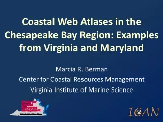
Coastal Web Atlases in the Chesapeake Bay Region: Examples from Virginia and Maryland. Marcia R. Berman Center for Coastal Resources Management Virginia Institute of Marine Science. Virginia Coastal Geospatial Education Mapping System Maryland Shorelines Onlines.

E N D
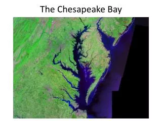
Coastal Web Atlases in the Chesapeake Bay Region: Examples from Virginia and Maryland Marcia R. Berman Center for Coastal Resources Management Virginia Institute of Marine Science
VirginiaCoastal Geospatial Education Mapping SystemMaryland Shorelines Onlines
Chesapeake Bay Coastal Atlases in Review VA Coastal GEMS MD Shorelines Online NOAA funded Developed and served offsite ArcIms Data partners Baseline and modeled data Web portal with map interface • NOAA funded • Developed and served offsite • ArcIms • Data partners • Baseline and modeled data • Interactive map interface
With respect to • What works well • Common problems • Do they meet the definition of a coastal atlas? • Are they interoperable?
VIRGINIA Coastal Geospatial and Education Mapping System GEMS
Data Categories • Water Features • Shoreline Features • Land Features • Wildlife • Recreational Features • Conservation Planning Tools • Conservation Planning Examples • Reference Layers
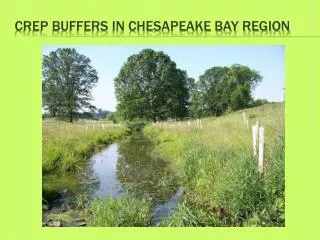
Data Layers Water Features • Commercial Shellfish Aquaculture Sites • Oyster Gardening Sites • State Constructed Oyster Reefs • Baylor Grounds (Public Oyster Grounds) • Private Oyster Leases • Seaside SAV Planting Sites • Submerged Aquatic Vegetation (SAV) • Anadromous Fish Use Areas • Fisheries Management Areas • Threatened & Endangered Species Waters • Healthy Streams Shoreline Features • Beaches Above High Water • Chesapeake Bay Dunes • Wetlands (Tidal & Non-Tidal) • Restored Riparian Buffer Sites Land Features • Conservation Lands • Forest Cover • Barrier Island Ownership Wildlife • Essential Wildlife Habitat • Important Bird Areas • Migratory Songbird Stopover Habitat Recreational Features • VDGIF Boat Ramps • Scenic Rivers • Birding & Wildlife Trail Sites and Loops • Seaside Eastern Shore Water Trail • Public Access Sites Conservation Planning Tools • Oyster Aquaculture Vulnerability Model • Clam Aquaculture Vulnerability Model • Biotic Stream Assessment (INSTAR) Sites • Benthic Index of Biotic Integrity • Historic & Cultural Value Model • Predicted Growth Model • Forest Economics Model • Ecological Cores • Landscape Corridors • Agricultural Model • Recreation Model • Watershed Integrity Model • Tidal Flushing Rates • Condemned Shellfish Areas • Accomack County Bayside Buffer Classification • Clam Aquaculture Suitability Model • Oyster Aquaculture Suitability Model • Invasive Reed (Phragmites) • Marina Siting Suitability • Impediments to Fish Movement • Impaired Waters Conservation Planning Examples • Dragon Run Program Boundary • Seaside Heritage Program Boundary • Southern Watersheds Program Boundary • Hampton Roads Conservation Corridors Reference Layers • County Boundaries • Watershed Boundaries • Detailed Streams • Roads
Maryland Shoreline Changes Online • Blue Infrastructure • Coastal Bays • Rates of Change • Historical Shorelines • Shoreline Inventory • Littoral Drift Maps • Transportation • Hydrology • Storm Surge Areas • Watersheds • Municipal Boundaries • Sea Level Rise Vulnerability • Imagery • Boundaries
Maryland Shoreline Changes Online • Blue Infrastructure • Coastal Bays • Rates of Change • Historical Shorelines • Shoreline Inventory • Littoral Drift Maps • Transportation • Hydrology • Storm Surge Areas • Watersheds • Municipal Boundaries • Sea Level Rise Vulnerability • Imagery • Boundaries
Shoreline Changes Online Blue Infrastructure
With respect to • What works well • data partners • simple /familiar layout • comprehensive • Common problems • Offsite management • Cartographic challenges • Loading speeds • Metadata completeness • Are they interoperable?