Download
1 / 18
180 likes | 298 Views
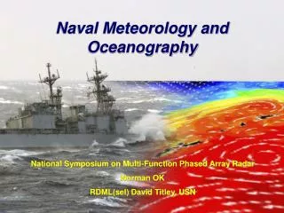
Navy Meteorology and Oceanography Support for Homeland Security. Thomas J. Cuff Deputy Technical Director Oceanographer of the Navy 28 November 2001. How do we do it?. Partner with other entities: NOAA/NWS; NESDIS; NOS DOD/U.S. Air Force Weather; Army Corps of Engineers

E N D
Navy Meteorology and Oceanography Support for Homeland Security Thomas J. Cuff Deputy Technical Director Oceanographer of the Navy 28 November 2001
How do we do it? • Partner with other entities: • NOAA/NWS; NESDIS; NOS • DOD/U.S. Air Force Weather; Army Corps of Engineers • Office of the Federal Coordinator for Meteorology • Industry (e.g. The Weather Channel) • Develop organic capabilities: • Office of Naval Research: funds academia • Navy Research Laboratory: Navy’s “Corporate Lab” • Space and Naval Warfare Systems Command: demonstrate, test, and field new capabilities • Industry
Navy METOC Support for Homeland Security (HLS) • Functional lead roles identified for Navy METOC centers*: • Mesoscale Modeling: Fleet Numerical METOC Center, Monterey, CA. • Ocean Modeling/Mine Warfare Support: Naval Oceanographic Office, Stennis Space Center, MS. • WMD consequence management & liaison with Defense Threat Reduction Agency: Naval Atlantic METOC Center, Norfolk,VA. * Commander, Naval METOC Command message, 18 Sep 2001
What needs to be done? • Enhance awareness of available METOC support and its application to Homeland Security. • Inventory available products and the national capacity for meeting known and anticipated requirements. • Identify and prioritize operational weather and ocean support requirements. • Balance CONUS and overseas METOC requirements against available interagency DoC and DoD resources. • Determine and fund most urgent R&D needs.
Context for METOC Support • DoD operational METOC responsibilities for Operations Noble Eagle and Enduring Freedom are identified: • NORAD and JFCOM Staff METOC Officers • Anticipation that as planning for homeland security accelerates, requirements will grow. • Other than NOAA, most Federal agency roles are focused on incident response, not routine support. * NORAD: North American Aerospace Defense Command; bi-national United States and Canadian organization* JFCOM: U.S. Joint Forces Command
Navy METOC Support to HLS • Baseline data collection in priority ports and strategic waterways. • NOAA responsibility. • Increased Fleet priority resulting in NOAA/Navy/Army Corps cooperative effort. • Support for atmospheric WMD dispersion models. • Navy responsibility to support JFCOM, National Weather Service for civil agencies. We both need to give same answer. • Modeling waterborne contaminant dispersion. • NOAA responsibility in U.S. waters; Navy already running operational ocean models.
Key Navy HLS Capabilities • Observations • Oceans: Oceanographic survey fleet, single and multi-beam depth measurements, digital side-scan imagery, tidal stations, bottom-mounted current profilers, etc. • Atmosphere: potential for extracting weather data/chem-bio information from Navy AEGIS radar when operating in U.S. waters.
Key Navy HLS Capabilities • Predictions • Atmosphere/Weather: • Global Model (NOGAPS): 81 km/28 levels, soon 50 km/50 levels. • Coupled Ocean-Atmosphere Mesoscale Prediction System (COAMPS): Triple-nested, 27/9/3 km, 30-50 vertical levels. • Atmosphere/Chemistry: • WMD dispersion predictions (HPAC) to support Joint Forces Command
Key Navy HLS Capabilities • Predictions • Ocean: • Global ocean model, 5 km resolution/6 vertical layers. • Mesoscale models, 200-6000 m resolution/20 vertical levels; mix of 2-D and 3-D models, run over 17 locations worldwide. • Wave models (global – 1º/mesoscale – 12´ to 1´) • Various satellite-derived and other products, tailored to meet Navy mission needs.
Interagency Relationships • Naval Deputy to NOAA • Navy’s global model in NCEP ensemble. • National Hurricane Center provides hurricane forecasts for Navy’s 2nd and 3rd Fleet activities. • WAVEWATCH III model. • WMO data (via NWS Telecommunications Gateway). • Navy buoy deployments support Navy and NOAA models. • NPOESS: Navy currently chairs Senior Users Advisory Group for national converged polar-orbiting satellite program.
Interservice Relationships • Air Force Weather: • Space Weather products and real-time cloud depiction analyses and forecasts. • Joint Typhoon Warning Center (Navy/USAF) provides forecasts for U.S. interests in western Pacific and Indian Oceans. • Defense Meteorological Satellite Program (DMSP). • Global numerical weather model data (NOGAPS). • Exchange of mesoscale model databases.
Interagency Relationships • NAVOCEANO/NOS/USACE agreement (15-16 Oct): • Conduct cooperative surveys in U.S. waters to meet Navy’s requirements for harbor surveys. • Explore ocean modeling cooperation to support waterborne hazard predictions. • Investigate associated data networking, processing, and storage issues.
Support and Backup • Fleet Numerical METOC Center back-up site for NCEP global models. • Navy use of NCEP, AFWA model data as back-up. • NAVOCEANO/NODC data exchange. • National Ice Center: backed-up by Canada. • Navy METOC centers have established back-up capabilities.
Near-term Challenges • On the fidelity of high-resolution mesoscale atmospheric models to feed WMD models: • What’s good enough? • Weather model validation – how good are they? • WMD VV&A • Ensure DoD and NOAA weather model fields are fully “exchangeable” • Near-shore estuarine models need lots of R&D.