Download
1 / 88
880 likes | 1.01k Views
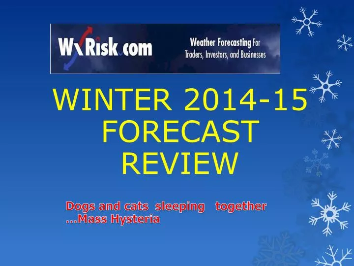
WINTER 2014-15 FORECAST REVIEW. Dogs and cats sleeping together …Mass Hysteria. HYPE… IS GOING TO BE A BIG ISSUE FOR THIS WINTER. **It started back in JULY with a few HYPSTER meteorologists issuing forecasts in JULY !! **

E N D
WINTER 2014-15 FORECAST REVIEW Dogs and cats sleeping together …Mass Hysteria
HYPE… IS GOING TO BE A BIG ISSUE FOR THIS WINTER **It started back in JULY with a few HYPSTER meteorologists issuing forecasts in JULY !! ** Once those forecasts/ hype were issued… Social Media was flooded with “weenies” issuing similar such forecasts. Everyone of these “ forecasts” all features severe cold and huge amount of snow for Midwest/ East coast WEENIE… term used to describe high school students and adults who think they are the next Jim Cantore – (but actually work 3rd shift at WalMart)
I do NOT post winter weather/ storm info/ updates on THIS Twitter Page. The Info here is MAINLY for traders etc
THIS is the Twitter Page I post updates on during winter season– and all seasons tyat are about “operational “ (Regular) weather forecasts
BRIEF REVIEW OF LAST WINTER • VAST MAJORITY OF FORECASTS (govt & private) CALLED FOR A MILD or very MILD WINTER • ESPECIALLY FORECASTS ISSUED IN SEPT and OCT 2013 • OCT & NOV 2013 WERE NOT COLD AT ALL • MANY INDICATORS WERE UNFAVORABLE FOR COLD/ SNOWY PATTERN IN CENTRAL/ EAST US • -PDO +AO +NAO BELOW NORMAL SNOW IN SIBERIA
BRIEF REVIEW OF LAST WINTER part 2 • SO WHAT HAPPENED? • In NOV 2013 A LARGE POOL OF VERY WARM SSTA (Sea surface temperature Anomalies ) DEVELOPED IN NE PACIFIC / GULF OF ALASKA • THAT POOL OF WARM SSTAs • ‘FLIPPED” the -PDO to +PDO • SET UP –EPO ….SET UP –WPO • SET UP A +TNH PATTERN • ALLOWED THE AO TO DROP SOUTH …ARCTIC OUTBREAKS
This shows the “ surprise” pool of warm SSTAs that developed in mid NOVEMBER 2013. Most forecasts were already issued by Mid NOV so they missed this
POLAR VORTEX DEVELOPS IN OCT/NOV and LASTS UNTIL JUNE. IT’S SIZE … INTENSITY ….POSITION IS ** CRITICAL ** IN DETERMING THE WINTER PATTERNS OVER ALL OF THE NORTH HEMISPHERE -AO +AO
WHEN THE POLAR VORTEX IS WEAK IT IS USUALLY BROKEN UP INTO 2 or 2 PIECES and IS NOT FOUND OVER THE NORTH POLE. This leads to the ARCTIC OSCILLATION (AO) being “ negative” -AO WINTER PATTERNS = BIG EAST COAST SNOWSTORMS… COLD PATTERNS LOCKED IN PLACE WINTERS 2009-10 2010-11 -AO
WHEN THE POLAR VORTEX IS VERY STRONG IT IS USUALLY OVER THE ARCTIC REGION / NORTH POLE. This leads to the ARCTIC OSCILLATION (AO) being “ positive” +AO WINTER PATTERNS = NO BIG EAST COAST SNOWSTORMS… MILD PATTERNS LOCKED IN PLACE WINTERS 2011-12 And 2013-14 +AO
This map at 500mb shows the MASSIVE Polar Vortex (PV) over eastern Canada / Greenland. 6 times in Winter of 2013-14 the PV would drop way SOUTH bringing Arctic air out breaks to the US + (AO)
As you can see the large pool of very warm SSTAs did NOT weaken or move.In fact it increased during the winter
RIDGE PV PV RIDGE ACTUAL JAN 2014 500 MB PATTERN
This is the TEXT book map of what a “+TNH” pattern in FEB is suppose to look like. DARK purple = Polar vortex
PV RIDGE RIDGE PV This is what the actual 500 mb pattern looked like in FEB 2014
This shows mean temps of the USA from 12/1/13 to 3/1/14 and impact of the 6 Arctic air mass out breaks 1 3 6 4 1 2 5
This shows AO phases and Intensity from 12/12/13 to 4/1/14. EVERY TIME the AP dropped into “ negative” territory there was an Arctic air mass out break 5 2 6 4 3
WXRISK WINTER 2014-15FORECAST SUMMARY • NOV looks to be a MILD month and 1st half of DEC east of the Mississippi river generally mild • NOT AS COLD AS LAST YEAR… (this is obvious) • NOT as many snow events (many places on East coast had 15-20 ”middle size “ events) BUT bigger winter storms • Increased Risk of ICE STORMS over Ohio valley Middle Atlantic New England
THE DETAILSUNDERSTANDING THE FORECAST • 30 DAY & SEASONAL FORECASTING IS HALF SCIENCE / HALF ART. You have to do it all the time to be good at it. PROBLEMS: • Media play of useless Farmers Almanac. Then e when they bust folks think its a ‘real’ forecast • Issuing Winter forecast in July. 100% CHAOS theory/ rules says its BS. • TV Mets who are pressured by news managerbut have no clue what they are doing
SEASONAL FORECASTING is based on: • The CURRENT atmosphere • Current and future Seas Surface temp anomalies/ pattern • Figuring out which factors are going to the DRIVERS or dominating force • SOIL MOISTURE • “WHAT COULD GO WRONG ?”
There is some “ skepticism” about a El NINO is REALLY coming this time. Back in March & April it LOOKED like a Moderate El Nino was developing but by JULY the El Nino collapsed
Actual DATA – NOT Models/ forecast - clearly shows el Nino round 2 IS coming and it will be a WEAK El Nino
this easy to read SUMMARY of El NINO Forecasts clearly show a “ WEAK” event for this Winter
mid OCT IRI summary of El Nino model “plumes” …of 25 various models 3 show El Nino BARELY reaching clearly show a “ WEAK” event for this Winter and 5 show NO El Nino
All WEAK El Nino temperature anomalies DJF ( DEC- JAN – FEB) since 1900 based on 1951-2010 Based on 1981-2010 climate record climate record
WE MEASURE EL NINO BY USING “MEI” VALUES OCT MEI = 0.500
ASSUMING weak El Nino does develop this late Autumn/ Winter .. The current OCTOBER 2014 M.EI. Value will increase to around 1.000 by DEC 1 Gives us **ANALOGS ** … Possible similar winters `1977-78 1979-80 2002-03 2006-07 2009-10
500 MB PATTERN – NOTE the Strong –AO… Strong –NAO and the Mean trough on East Coast
NOT ALL EL NINO EVENTS ARE THE SAME as shown by Recent discovery by Japan’s wx folks
Modoki El Nino events have a HIGH Probability of bringing Colder & Snowier then Normal Winters for central / eastern US
The severely snowy winter of 2009-10 was a MODOKI El Nino- notice how the warm El Nino waters shifted WEST from late OCT to DEC
SUPPOSE THE EL NINO DOES ** NOT ** DEVELOPS and STAYS FLAT Neutral NAO ( North Atlantic Thumb Ridge) trough is just off the east coast= se US- New England storm track