Download
1 / 15
150 likes | 245 Views
OCONUS Activities. Science Advisory Committee Meeting 26 – 28 August, 2014. National Space Science and Technology Center, Huntsville, AL. SPoRT OCONUS Background. 2009 SAC recommended “careful expansion” beyond Southern Region. Later, PG asked for more OCONUS applications.

E N D
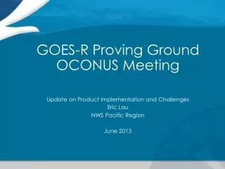
OCONUS Activities Science Advisory Committee Meeting 26 – 28 August, 2014 National Space Science and Technology Center, Huntsville, AL
SPoRT OCONUS Background • 2009 SAC recommended “careful expansion” beyond Southern Region. Later, PG asked for more OCONUS applications. • Alaska & Pacific Regions, Puerto Rico involved in QPE, Hybrid and some RGBs • Early work in AK involved transition of SPoRT SST Composite • “Ice Desk” decreased prep time of their own product by ~60% • Lead in to ABI-type products (Hybrid, QPE, RGB) and JPSS/S-NPP products (DNB) • Visits to AK/HI • OCONUS PG meeting in 2010, 2011, 2013, JPSS Meeting 2012 • SPoRT staff visited all AK WFOs and RFC in 2013 in prep for QPE and Aviation RGB Assessments and to meet with University of Alaska Fairbanks/GINA staff • Prepared Virtual Machine plan • Provided AK forecasters with info on GOES-R/JPSS and specific product training • VSP 2014 to Pacific Region has established plan for QPE Assessment & other work
AK Transition and Assessment • QPE • Already described by A. LeRoy • Hybrid GEO/LEO Imagery • ABI capability, S-NPP utility • “Very popular” • NtMicro. RGB for Aviation and Cloud Analysis • Very new to most users • Dec 2013 - ~15 Feb 2014 • Nighttime Microphysics and Day-Night Band RGBs • Compare to traditional GOES 11-3.9µ difference, • Focus on identification of fog Loop of the SPoRT GEO/LEO Hybrid 11-3.9um imagery that includes MODIS and VIIRS data from 1030Z to 1345Z on 15 Nov 2013
Feedback Results - Impact Assessment Results -NtMicro • Between the 3 products, the NtMicro RGB was the preferred product by far (~80%) • 72% indicated NtMicro RGB as primary product for fog/low clouds • Impact on Aviation (general): 82% said some to very large • Impact to distinguish fog from low clouds: 85% said some to very large
Feedback Results - Impact Assessment Results – Day-Night Band • Included with NtMicro submissions • Impact on Aviation (general): 64% said some to very large • Had multiple uses, but usually was not the preferred product for aviation.
User Comments –a few examples Dec 12 (AFC): “As a new user I find it difficult to interpret all of the subtle variations in color in the RGB Nighttime Microphysics Imagery. I do believe with regular practice and experience with the product that this will become a little easier.” (Advocated for a probability product due to individual color interpretation differences) Dec 17 (AFC): “Standard IR was very useful due to surface temps being near -20F, hence using it complementary to the SPoRT imagery.” These very cold temperatures and increased summer daylight limit NtMicroRGB. SPoRT is looking to testbed the EUMETSAT-developed 24-hr Microphysics RGB
Recommendations from Assessment • Users need more training examples and experience with Nighttime Microphysics and Day-Night Band RGB imagery • NtMicro does provide value and other satellites could be used if data were made available • NOAA 18 & 19 POES, MetOp A & B (via AVHRR instrument) • Applications/Feedback limited by product frequency (more of an issue for DNB product) • Derived DNB products for unique situations (e.g. disasters, smoke, etc.) likely to increase operational use.
RGB Imagery – new product for testing 24-hr Microphysics VIIRS swath over AK 12.0µm-10.8µm 10.8µm-8.7µm 10.8µm • The green component uses 8.7 instead of 3.7µ channel • Range of green component difference is half of NtMicro RGB so less distinction between low cloud features • Less noisy in cold scenes • Able to use in day compared to NtMicro • Can see features progressing in loops for the N. half of Alaska
RGB Imagery – new product for testing Nighttime Microphysics 24-hr Microphysics Daytime Less variation of cloud features in 24hr Micro Nighttime
SPoRT PG Suite for AK • AFC and AFB are among the first 10-15 WFOs transitioned to AWIPS II • Among the first 4 WFOs receiving SPoRT products • MODIS/VIIRS RGB Suite • MODIS: Dust, NtMicro, True Color, Snow/Cloud, Air Mass • VIIRS: Dust, NtMicro, True Color, Snow/Cloud, DNB(Rad), DNB(Refl) • Sea Surface Temperature (SST) • SST, Latency • CIRA Layered Precipitable Water (LPW) – East Pacific to Africa • Sfc-850mb, 850-700mb, 700-500mb, 500-300mb, Total • NESDIS Quantitative Precipitation Estimate (QPE) • 15min, 1hr, 3hr, 6hr, 12hr, 1day, 3day, 7day
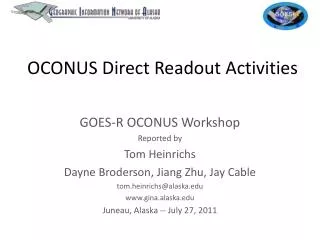
Collaborations with UAF/GINA • Virtual Machines for SPoRT • Processing locally at GINA via Direct Broadcast data accessed onsite • SPoRT Code transferred to GINA VMs • Products made via VMs • VIIRS RGBs (MODIS coming new h/w) • GEO/LEO Hybrids w/ MODIS&VIIRS • Value of VMs • Reduced latency and file “traffic” • Processing issue resolution via SPoRT partnership • Terra de-stripping coefficients (right) • Plan to Integrate with CSPP
Pacific Region QPE 15 min rain rate (in/hr) QPE 3 day accumulation (in) • Pacific Region is most recent collaboration • Coordinated with region headquarters on visiting scientist proposal • Accepted and first trip occurred 5-9 May 2014 • Discussed collaborations with headquarters and met with forecasters at the co-located WFO Honolulu and Central Pacific Hurricane Center • Initial focus • GOES-R Quantitative Precipitation Estimate (QPE) • Sea Surface Temperature Composite • Passive microwave discussed
Initial Visit GOES IR Image courtesy of Robert Ballard – SOO WFO Honolulu 1 hr QPE (in) Radar Reflectivity QPE example in AWIPS demonstrating modified color curve to better match radar estimates. • Corrected AWIPS display • SSTs very popular • Used by Central Pacific Hurricane Center on Tropical Storm Wali to forecast intensity • QPE is newest activity • Support satellite analysis product • Insight on storm dynamics? • Modify wave forecasts
Continued Collaborations Himawari Field of View Guam Hawaii • Assess QPE during wet season • Training module • Assess QPE with current GOES to • Assess operational uses • Determine updates • Create baseline for comparison to new missions • Pacific Region will benefit from Japan’s Himawari • Nearly identical to GOES-R ABI • Test baselined products (like QPE) • WFO Guam likely a key player
SPoRT OCONUS – Future PG Activities Transition of complementary niche products - RGBs, SSTs, Hybrid (including VIIRS), DNB (Reflectance), QPE AWIPS II at 2/3 AK WFOs, AAWU, RFC, PRHQ QPE Transition, Training, Assessment for HFO, Oct/Nov 2014 NESDIS Snowfall Rate Assessment in AK, Oct 2014 (ROSES 2013) Testbed and Assessment of 24hr Microphysics RGB in AK, Winter 14/15