Download
1 / 43
430 likes | 651 Views
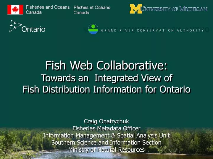
Fish Web Collaborative: Towards an Integrated View of Fish Distribution Information for Ontario. Craig Onafrychuk Fisheries Metadata Officer Information Management & Spatial Analysis Unit Southern Science and Information Section Ministry of Natural Resources. Current Situation.

E N D
Fish Web Collaborative:Towards an Integrated View ofFish Distribution Information for Ontario Craig Onafrychuk Fisheries Metadata Officer Information Management & Spatial Analysis Unit Southern Science and Information Section Ministry of Natural Resources
Current Situation • Many agencies and community-based monitoring groups are collecting fish community and habitat information • Information is collected using various methods • Data are stored on agency networks or individual personal computers • As a result: • Fish distribution data are undiscoverable, uncoordinated and unstandardized • Difficult to access information on fish communities and habitat necessary to make resource management decisions • Difficult to test effects of regulations, habitat improvements or other management techniques • Difficult to make comparisons across spatial and temporal scales Fish Web Collaborative
Purpose of the Fish Web Collaborative • To develop a multi-organizational collaborative model for the management of fish distribution data in Ontario and establish a single standardized source accessible over the Internet • Goals/Results: • Increase communication & data sharing • Reduce costs • Data analysis: increase sample size; compare across time & space Fish Web Collaborative
Goal • Ultimate goal of the project is to provide one repository of fish data maintained by multiple organizations and served via web mapping Source: Fisheries & Oceans Canada Fish Web Collaborative
Phases of the Fish Web Collaborative • Phase 1: Develop thematic data standards for fish distribution information (this project) – completed by Sept 2008 • (Proposed) Phase 2: Publish thematic data on fish distribution in Ontario waterbodies on the internet – Oct 2008 – Oct 2009 • (Proposed) Phase 3: Develop a web-based application to enable the community of practice to continue to contribute fish distribution – October 2009 – March 2010 Fish Web Collaborative
Objectives for Funding • To develop and implement thematic geospatial data organized around a particular theme (i.e., Fish Distribution) • Standards which allow for inter-organizational exchange and interoperability • Project must be collaborative and support an identified end-user community Fish Web Collaborative
Phase I: Technical Committee Members Fish Web Collaborative
Technical Team – Member Roles • Provide technical direction • Empowered to actively participate on behalf of their organization • Communicate progress to & solicit information from home organization (esp. senior management) • Coordinate the cataloguing of fish distribution data with Metadata Coordinator • Support delivery of User Needs Workshops Fish Web Collaborative
Phase 1: Thematic Data Standards Fish Web Collaborative
Phase 1 Goals • Compile a comprehensive list of existing fish data sources • Document the essential descriptive and administrative information to support discovery, access and use of existing fish data sources • Conduct workshops with users to develop a consensus-based data model Fish Web Collaborative
What is Metadata? • High-level descriptions which enables the discovery and analysis of data • At the very least, metadata answers some fundamental questions about data: • Who created the data? Who maintains it? • What is the content of the data? What is its structure? • Where was the data collected? Where is it stored? • When was the data collected? When was it produced? • Why was the data created? What is the purpose? • How was it produced? How can it be accessed? What data quality can you expect? Fish Web Collaborative
Collecting Metadata: A Team Approach • Identify a Metadata Coordinator • User of standards and tools • Establish a production process • Interview method or individual entry • Common templates • Engage appropriate specialists • Data owner (You the practitioner) • GIS Specialist / Metadata Clerk Source: USGS GeoConnections Training Fish Web Collaborative
Information Entropy Time of data development Specific details about problems with individual items or specific dates are lost relatively rapidly General details about data set are lost over time DATA DETAILS DATA DETAILS Retirement or career change makes access to “mental storage” difficult or unlikely Accident or technology change may destroy data and documentation Loss of initial data developer results in loss of remaining records TIME Source: Michener et al 1996; USGS GeoConnections Training Fish Web Collaborative
Metadata Interview Components • General Info • Dataset name, description, purpose, etc. • Constraints, time period, key words, storage • Contact Info • Mapping Info • Coordinate system, datum, accuracy • Geographic Extent • Business Requirements • Location (river, lake); • Protocols (OSAP) • Fish Attribute Info • Naming convention, codes, sampling techniques, photos • Water Temperature Info Source: Christine Brousseau, Fisheries & Oceans Canada Fish Web Collaborative
Metadata Standards and Tools • Ontario Land Information Directory (OLID) Metadata Directory metadata editor • Catalogue tool and repository • Metadata records catalogued according to the Government of Ontario IT Standard (GO-ITS 72) Geospatial Metadata Standard • Based on the North American Profile of ISO 19115:2003 • Compliant with Canadian Geospatial Data Infrastructure (CGDI) endorsed standards • OLID is a registered repository with GeoConnections and is discoverable via GeoConnection’s Discovery Portal Fish Web Collaborative
How is the Fish Web Collaborative Unique? • Metadata collection is being conducted on behalf of agency • Maintenance of record is transferred to agency • Metadata being published prior to data publication • Ontario Land Information Directory (OLID): http://lioapp.lrc.gov.on.ca/edwin/edwin.asp • GeoConnections Discovery Portal: http://geodiscover.cgdi.ca/ • Metadata catalogue host • Conservation Ontario: http://conservation-ontario.on.ca/projects/fishweb.html Fish Web Collaborative
Ontario Land Information Directory Fish Web Collaborative
GeoConnections Discovery Portal Fish Web Collaborative
FWC Catalogue http://conservation-ontario.on.ca/projects/fishweb.html Fish Web Collaborative
Interview Status • Thirteen (14) sites to-date / 18 databases in total: • Ausable Bayfield Conservation Authority • Central Lake Ontario Conservation • Credit Valley Conservation • Grand River Conservation Authority • Grey Sauble Conservation Authority • Lake Simcoe Region Conservation Authority • Otonabee Region Conservation Authority • South Nation Conservation Authority • Toronto and Region Conservation Authority • Upper Thames River Conservation Authority • McMaster, Department of Biology (Coastal Wetland Research Group) • MNR Guelph District Office – Guelph Area • MNR Guelph District Office – Niagara Area • MNR IMA – FishNet 2.0 and 3.0 Fish Web Collaborative
Preliminary results (16 databases) Fish Web Collaborative
Preliminary results Fish Web Collaborative
Phase 2: Publish Fish Distribution Data (Proposed) • Publish thematic data of fish distribution in Ontario waterbodies on the Internet • Users may be able to: • Enter spatial data using existing protocols • Validate site locations where surveys were conducted • Access fisheries species data • Query common attributes & generate statistics • Export selected data for modeling Fish Web Collaborative
Phase 3: Online Data Entry (Proposed) • Online data entry application • A web-based set of tools to enable the community of practice to continue to contribute fish distribution data • Online data entry forms based on the data model from Phase 1 • Potential of a batch upload tool Fish Web Collaborative
External Viewing via WWW External Partner Data via Online Forms or Batch Upload to FWC External Partner Data via Online Forms or Batch Upload to FWC WMS Ontario Stream Information System Municipal Drain DB (DFO) WMS/WFS WMS/WFS WMS/WFS External Partner Data (WMS/WFS Servers) LIO/NRVIS (Ministry of Natural Resources) Potential Framework Fish Web Collaborative Fish Web Collaborative
Review: Fish Websites in North America Fish Web Collaborative
Iowa Rivers Information System Iowa Department of Natural Resources, Iowa State University, and U.S. Geological Survey Fish Web Collaborative
http://maps.gis.iastate.edu/iris/ Fish Web Collaborative
http://maps.gis.iastate.edu/iris/ Fish Web Collaborative
http://maps.gis.iastate.edu/iris/data/aquaticgap.jsp Fish Web Collaborative
http://maps.gis.iastate.edu/iris/data/aquaticgap.jsp Fish Web Collaborative
Wisconsin Dept of Natural Resources & Wisconsin Aquatic Gap Mapping Application “Fish Mapper” Fish Web Collaborative
http://infotrek.er.usgs.gov/wdnrfish/ Fish Web Collaborative
http://infotrek.er.usgs.gov/wdnrfish/ Fish Web Collaborative
http://infotrek.er.usgs.gov/wdnrfish/ Fish Web Collaborative
Trempaleau River Watershed http://infotrek.er.usgs.gov/wdnrfish/ Fish Web Collaborative
http://infotrek.er.usgs.gov/wdnrfish/ Fish Web Collaborative
Northern Pike Abundance http://infotrek.er.usgs.gov/wdnrfish/ Fish Web Collaborative
Minnesota Department of Natural Resources (DNR) Eco Services/Fisheries Fishes of Minnesota MapServer Application (in development) Fish Web Collaborative
Fishes of Minnesota MapServer Application • Project Objective: • Serve fish species distribution data over the Internet • Leverage the Fishes of Minnesota (FOM) database as the source • Enable users to query by multiple criteria and display point locations of fish species occurrences • Create printable species range maps • Provide a basic introduction to fish species distribution across Minnesota, with links to relevant resources Source: Minnesota Department of Natural Resources Fisheries Fish Web Collaborative
Species Scientific name Common name Group name Group common name Habitat guild - Adult Protection status Waterbody Info Waterbody type Waterbody name Lake ID (DOW #) Stream ID (Kittle #) Watersheds (Hydrologic Units) DNR Lake Watersheds (~ HUC16) USGS Hydrologic Units 2-14 (HUC2-Huc14) Geographic Location County DNR Fisheries Administrative boundaries Collection Info Date (start date/end date) Gear Source Voucher Attributes for User Query Source: Minnesota Department of Natural Resources Fisheries, Minnesota DNR Fishes of MN database model Fish Web Collaborative
Scientific name Common name Catch Date Voucher Waterbody name Drainage (HUC4) County Township Township Range # Township Section # UTM X UTM Y Source Gear Nearest town Attributes for Tabular Display Source: Minnesota Department of Natural Resources Fisheries, Minnesota DNR Fishes of MN database model Fish Web Collaborative
Discussion – Questions? Craig Onafrychuk Fisheries Metadata Officer, Southern Science and Information, MNR Tel: 705 755-3288 craig.onafrychuk@ontario.ca Fish Web Collaborative