Download
1 / 14
140 likes | 379 Views
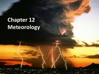
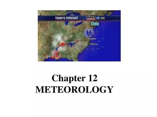
Ch. 12 - Meteorology. Weather – current state of the atmosphere. Climate – long-term variations in weather for a particular area. Meteorology – the study of the atmosphere Meteor is Greek for “high in the air”. Hydormeteors – cloud droplets and forms of precipitation with water.

E N D
Ch. 12 - Meteorology Weather – current state of the atmosphere. Climate – long-term variations in weather for a particular area. Meteorology – the study of the atmosphere Meteor is Greek for “high in the air”. Hydormeteors – cloud droplets and forms of precipitation with water. Lithometeors – condensation nuclei – dust, smoke, haze, etc. Electrometeors – thunder and lightning. Usually of 30 years or more.
The Sun’s radiation does not heat the whole surface for it’s round; it relies on the green house effect. • The radiation hits the Earth at angles ranging from 0 to 90 degrees. • The continual motion of air and water reallocates heat energy among Earth’s surface, oceans, and atmosphere and brings it into balance. • At what angle does it heat the Earth the most? • 90 degrees (direct) illustrate • Some areas around the equator receive close to direct radiation at noon all year long.
During what part of the day is it coolest? • Just before sunrise • During what part of the day is it hottest? • 3:00 to 4:00 Why? • Cloudy skies trap the heat & clear skies allow it to release rapidly • Which would cause a higher risk of sunburn? • When is it the warmest time of the year in the Northern Hemisphere? • June 21 • Southern Hemisphere? • Dec. 21 • What is the coolest time in the N.H.? • What is the coolest time in the S.H.? • Illustrate – tilt of the Earth
Air Masses - these are huge sections of the lower troposphere that have the same kind of weather throughout it. • They usually maintain the same position for days or even weeks. • The weather in an air mass is determined by the region it originated in. Cold vs. Warm. • Warm and dry from continental tropic (cT), warm and humid from maritime tropic (mT), cold and dry continental polar (cP), cold and humid maritime polar (mP), and artic (A). • Fig. 12.3 (pg. 303) & Table 12-1 (pg. 304) • Video – air masses
Weather Systems • Coriolis effect – the air coming from the poles moves to the right in the northern hemisphere and to the left in the southern hemisphere. This is due to the rotation of the Earth. • Trade winds • Occurs at 30° North & South latitude. • The air sink, warms and moves toward the equator in a westerly direction. • Causes high pressure • Prevailing westerlies • Between 30° & 60° north and south latitude in circulation pattern opposite that of the trade winds. • Blowing from the west to the east • Responsible for movement of weather across the U.S. • Video – Coriolis effect
Polar easterlies • Between 60° & the poles. • Similar to the trade winds • Jet Streams – narrow bands of fast, high-altitude, westerly winds. • They strongly influence the temperature and pressure on either side of the jet stream. • This causes wind. • Polar jets stream & Subtropical jet stream fig. 12-6. • The deeper it dips or the steeper it rises the more influence it has on temperature changes.
Fronts • Front is a boundary of different air masses. • They have different densities due to different temperatures, pressure, and humidity. • They can bring big changes in weather. • 1. Cold Fronts – cold, dense air displaces warm air up. As the warm air rises it cools and condenses – clouds, showers, and sometimes thunderstorms. • 2. Warm Front – warm air displaces cold air. The warm air develops a gradual frontal slope unlike a cold front – extensive cloudiness and precipitation. • 3. Stationary Front – neither air mass advances the other. The boundary stalls – seldom have extensive cloud and heavy precipitation. • 4. Occluded Front – cold air mass moves so rapidly that it overtakes a warm front. The cold air wedges the warm air upward. Precipitation is common on both sides of the front. • Video - fronts
Pressure System • Rising air is associated with low pressure and sinking air is associated with high pressure. • High Pressure air sinks and spreads away from the center. The deflection of the air to the right caused by the Coriolis effect makes the overall circulation around a high pressure center move clockwise in the northern hemisphere and counter-clockwise in the southern hemisphere. • Cold air masses are associated with high pressure. • Low Pressure air rises and must be replaced by air from outside the system so it flows inward. The air in a low pressure system turns counter-clockwise in the northern hemisphere.
It is hard for clouds to form when air sinks. Thus, high-pressure systems are usually associated with fair weather, while low-pressure systems are associated with clouds and precipitation. • A wave cyclone usually begins along a stationary front. Some imbalance in temperature, pressure, or density causes part of the front to move south as the cold front and another part of the front to move north as a warm front. This causes a counterclockwise rotation. • Video – weather influences
Gathering Weather Data • A thermometer is the most common weather instrument used by meteorologist. • What measures air pressure? • Barometer • At sea level the air pressure is 760 mm or 30 in. • As air pressure goes up the Hg is forced up in its measuring column (mercury barometer) • An aneroid barometer contains a vacuum inside a metal chamber in which the chamber contracts or expands with changes in air pressure.
Anemometers are used to measure wind speeds. • A hygrometer is used to measure relative humidity. • Ceilometers may be used to measure the height of cloud layers and amount of cloud cover. • Data must be gathered at the same time at many different location. Why? • Our Project Globe weather station needs to be taken at International time at solar noon, so all the data collected internationally has consistency.
National weather stations use a radiosonde (weather balloon), which has temperature, air pressure, and humidity sensors that send back readings to the ground station. Tracking the balloon in the upper-level provides accurate snapshots of atmospheric conditions. • Doppler Radar – wave frequencies change speed (energy) as rain & winds caused by a thunderstorm moves towards or away from the radar station. • Accurate wind speeds, precipitation, and storm intensity can be used by meteorologists.
Weather Analysis • To record weather data for a particular site at a particular time a station model is used. • Fig. 12-15 (pg. 317) • Isopleths are used to plot nationwide or global data. The isopleths are lines that connect points of equal or constant values. • Lines of equal pressure = isobars (winds) • Lines of equal temperature = isotherms • Meteorologist use very sophisticated lab equipment, computers, & models. • Meteorologists are very accurate compared to about 15-20 years ago. • Video – Weather Prediction
Digital forecasts are highly dependent on the density of the data available. • An analog forecast is also used to compare current weather patterns to past patterns. • Even high-tech computers cannot predict all factors that affect the weather. • Interpreting a Weather Map (pg. 322). • Video – weather • Video - predictions