Download
1 / 21
210 likes | 335 Views
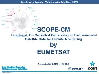
Intro to SCOPE-CM 4 th WCRP Observations and Assimilation Panel (WOAP) Meeting. Barbara J. Ryan Director, WMO Space Programme. 29 March 2010 Hamburg. SCOPE-CM.

E N D
Intro to SCOPE-CM4th WCRP Observations and Assimilation Panel (WOAP) Meeting Barbara J. Ryan Director, WMO Space Programme 29 March 2010 Hamburg
SCOPE-CM • Aim:To address the requirements of GCOS in a cost-effective, coordinated manner, capitalizing on existing expertise and infrastructures • Objective:Continuous and sustained provision of high-quality Essential Climate Variables satellite products (Climate Data Records) on a global scale • Structure:The SCOPE-CM Network is: • Based on activities of existing initiatives (GOS, GCOS and GSICS) • Built upon existing operational infrastructures • Serve users and other organizations (WMO Regional Climate Centres RCCs, National Weather Services NMHSs)
ConsistentCalibrateddata sets Essential Climate products Satellite data Satellites & sensors Users GSICS GOS SCOPE-CM Maximizing Data Quality and Usability • Sustained Co-Ordinated Processing of Environmental satellite data for Climate Monitoring (SCOPE-CM) • Global products • Sustained into the future • Coordinated internationally
SCOPE-CM Participants • Participants of the SCOPE-CM Network • Satellite Operators: • NOAA • JMA • CMA • EUMETSAT • Stakeholders • GEO • GCOS • CEOS • CGMS/GSICS • WCRP
Supporting Climate Applications Satellite observations Simulations In situ observations Climate process studies Operational climate monitoring Climate variability Trend analysis Adaptation and mitigation Decision making Climate Applications
Satellite Support to Climate Applications Satellite observations Climate process studies Operational climate monitoring Climate variability Trend analysis Adaptation and mitigation Decision making Climate Applications
Climate Data Records Satellites and Sensors Long-term data preservation Climate Data Records Satellite operators Satellite data Fundamental Climate Data Records Satellite products Environmental Data Records Thematical Climate Data Records Users and Organisations Model Reanalysis Climate Information Records Climate process studies Operational climate monitoring Climate variability Trend analysis Adaptation and mitigation (decision making) Applications
Conversion to Geophysical Parameters Satellites and Sensors Long-term data preservation Climate Data Records Re-calibration Inter-calibration reprocessing Satellite operators Satellite data Fundamental Climate Data Records Conversion to geophysical paramters (ECVs) Satellite products Environmental Data Records Thematical Climate Data Records Reanalysis using NWP models Users and Organisations Model Reanalysis Climate Information Records Climate process studies Operational climate monitoring Climate variability Trend analysis Adaptation and mitigation (decision making) Applications
Where SCOPE-CM Fits In Satellites and Sensors Long-term data preservation Climate Data Records Scope of SCOPE-CM Satellite operators Satellite data Fundamental Climate Data Records Satellite products Environmental Data Records Thematical Climate Data Records Users and Organisations Climate Information Records Model Reanalysis Climate process studies Operational climate monitoring Climate variability Trend analysis Adaptation and mitigation (decision making) Applications
GCOS Essential Climate Variables (ECVs) • Oceans • O.1 Sea Ice • O.2 Sea Level • O.3 Sea Surface Temperature • O.4 Ocean Colour • O.5 Sea State • O.6 Ocean Reanalysis • O.7 Ocean Salinity • Atmosphere A.1 Surface Wind Speed and Direction A.2 Upper-air Temperature A.3 Water A Vapour A.4 Cloud properties A.5 Precipitation A.6 Earth Radiation Budget A.7 Ozone A.8 Atmospheric reanalysis (multiple ECVs) A.9 Aerosols A.10 Carbon Dioxide, Methane and other Greenhouse Gases A.11 Upper-air Wind • Terrestrial • T.1 Lakes • T.2 Glaciers and Ice Caps, and Ice Sheets • T.3 Snow Cover • T.4 Albedo • T.5 Land Cover • T.6 fAPAR • T.7 LAI • T.8 Biomass • T.9 Fire Disturbance • T.10 Soil Moisture
Long-term Observations - Combining Research and Operational Satellite Data Needed for Further Climate Information and Services From NOAA 11
SCOPE-CM Phases Phase I Phase II Phase III 2008 2009 2010 2011 2012 2013 2014 • full deployment of the sustained system of product generation • product review and quality control • continuous product improvement • establish structures for sustainable generation of FCDRs and TCDRs • generate first SCOPE-CM products • increase coverage of products in terms of ECVs, time and spatial dimension • foster extension of the network establish initial network and structure agree on principles and standards pilot projects on selected subjects Assess current capabilities establish feedback mechanisms
Pilot Project 1 • 30 years of AVHRR data after re-calibration • Processing and validation started for selected regions • AVHRR cloud effective droplet radius
Pilot Project 2 SSM/I – Water Vapor, Clouds, Precip • SSM/I 20 years data set water vapour over ocean: MPI-Meteorology University Hamburg Research To Operations
Pilot Project 4 15-year Clear Sky Radiance data set from 1995 to 2009 2009 CSR from GMS-5 22 Jan 1999 CSR from MTSAT-1R 22 Jan 2009 Clear Sky Radiances from JMA Geostationary satellites currently processing
Maturity Matrix Identifies Milestones and Research-to-Operations Transition Points
CDR Evolution Requires Research & Operational Agency Collaboration At Every Step Need to capture essential elements of CDR generation experience from last 20 years Physical Understanding of Measurement Process Measurement of Key Instrument Characteristics Public Accessibility of Data Processing Rigorous Validation Long-term Preservation
National and International Progress on Climate Services Requires Improved Collaboration and Framework for Research/Operations Transitions Differing community views of data maturity and science data stewardship need to reflect wide diversity Vocabulary Experience Background Need understandable approach Try adopting ‘maturity model’ from software engineering Science Data ShowingDataEffectiveness Society
Different Perspectives! An International Organization! An Operational Agency! A Research Agency!
The Way Forward • Need more involvement from research agencies and/or those working on ECVs • Broaden testing of maturity model/matrix • Test concepts with oceanic and terrestrial ECVs • Continue to advance dialogue between operational and research communities