Download
1 / 24
240 likes | 451 Views
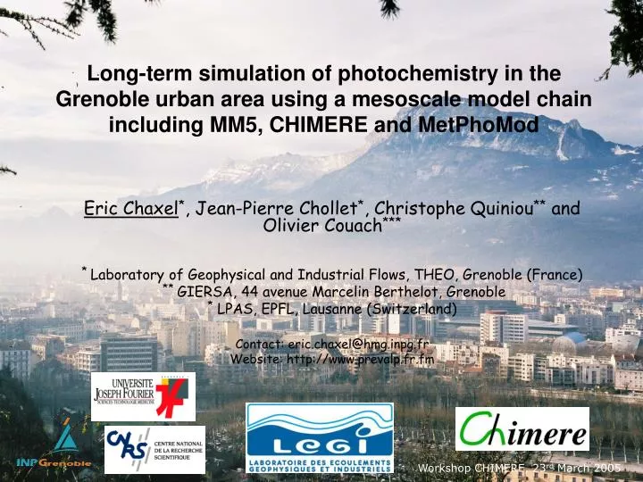
Long-term simulation of photochemistry in the Grenoble urban area using a mesoscale model chain including MM5, CHIMERE and MetPhoMod. Eric Chaxel * , Jean-Pierre Chollet * , Christophe Quiniou ** and Olivier Couach *** * Laboratory of Geophysical and Industrial Flows, THEO, Grenoble (France)

E N D
Long-term simulation of photochemistry in the Grenoble urban area using a mesoscale model chain including MM5, CHIMERE and MetPhoMod Eric Chaxel*, Jean-Pierre Chollet*, Christophe Quiniou** and Olivier Couach*** * Laboratory of Geophysical and Industrial Flows, THEO, Grenoble (France) ** GIERSA, 44 avenue Marcelin Berthelot, Grenoble * LPAS, EPFL, Lausanne (Switzerland) Contact: eric.chaxel@hmg.inpg.fr Website: http://www.prevalp.fr.fm Workshop CHIMERE, 23rd March 2005
Outline • Framework of the study • Description of the modelling chain • Two highlights: • Evaluation of nested CHIMERE simulation for the summer 2003 (June-August) in Rhône-Alpes region • Impact of long range transport shown by CHIMERE in July 1999 on Grenoble photochemistry • Discussion
Framework • In assistance to local air quality agency ASCOPARG: • to assess emission reduction scenario • To develop a modelling chain able to correctly predict ozone events • In a scientific context: project PARAMET (Photochemistry and Aerosols in Alpine Region: Mixing and Transport • Model the processes responsible for high ozone events in narrow valleys: slope winds, inversion layers, recirculation • Evaluate the impact of regional transport in the valleys of Grenoble, Maurienne and Chamonix
Our use of CHIMERE • CHIMERE is used at boundaries of an other model: MetPhoMod (LPAS, EPFL, Lausanne) • Since CHIMERE has never been validated in very complex terrain our use of the model is limited to 2 regional scales: • Continental for calculate background concentration in the Alps • Regional to account for main cities (Lyon, Geneva, Marseille, Torino) contributing to regional ozone • A “beta test” simulation at a 2-km resolution has been recently evaluated
GIS GIERSA Technical schematic of the chain Gridded hourly emissions RACM or MELCHIOR speciation NetCDF files Annual inventory NOx, COV, CO, SO2 ASCII files Annual inventory NOx, COV, CO, SO2 ASCII files CADASTRE prepCadastre prepemis_cdf prepemis CHIMERE Gridded hourly emissions RACM species NetCDF files chimere2racm MM5 MetPhoMod TONETCDF + TOMETPH ECMWF Legend Temporary files 3d models Interfaces
Results for the summer 2003 • CHIMERE runs on 6 15-day periods: • 1 to 15 June • 16 to 30 June • 1 to 15 July • 16 to 31 July • 1 to 15 August (Heat wave period) • 16 to 31 August
Summer 2003: an high ozone summer Heat wave 2003 Background level of ozone measured at le Casset (alt. 1800 m) in summer 2000, 2001 and 2003 A net increasing trend is observed over the summer 2003 General trend over the summer Heat wave Many exceedance days of the treshold 180 μg/m3 (seuil information) Background O3 level at le Casset (alt. 1800 m) Daily ozone maximum (μg/m3) measured by ASCOPARG from 1st June to 31st August 2003.
Meteorological ground station Ground station with O3/NOx meas. Stations used for validation CHIMERE regional domain 40*40 cells dx = 8 km 8 vertical levels Lyon 45 AQ stations:O3, NO, NO2 35 meteo stations:U, V, RH, T, Ray Grenoble MetPhoMod domain 36*58 cells dx = 2 km 24 vertical levels
Results of CHIMERE at 6 km resolutionfor hourly ozone CHIMERE dx = 6 km Hourly measurement Hourly measurements are compared with model results at all stations 1 2 3 4 5 6 7 8 9 10 11 12 13 14 August 2003
Some results of MM5 at 6 km resolution 1. MM5 at a 6-km resolution underestimates the daily maximum for 2-m temperature at the sites located in valleys 2. This effect is observed at all sites during the heat wave (1st to 15th August 2003)
Results of CHIMERE at 6 km resolutionfor daily ozone maximum Mean error over the summer 2003 at 45 sites: 12.7 μg/m3 Mean bias over the summer 2003 at 45 sites : - 6.0 μg/m3 (model - obs)
Use of CHIMERE to constraint a other model: MetPhoMod ? Why ? To provide realistic forcing compulsory for long term simulations (several months)
Use of CHIMERE to constraint a fine scale model: MetPhoMod • Problems and questions: • How evaluate the quality of forcing by MM5 and CHIMERE ? • Model have different horizontal meshesLambert, dx = 6 km/ Lambert 2 Etendu, dx = 2 km • Model have different vertical descriptions 8 hybrid sigma levels/ 24 cartesian levels • Models have different chemical mechanisms MELCHIOR/ RACM • Solutions: • Perform comparison with 3D and ground data • Perform horizontal interpolation • Perform vertical interpolation • Using only common species to both mechanisms
Correspondance between MELCHIOR and RACM 20 species from CHIMERE are related to RACM species Table : correspondance between MELCHIOR and RACM species
Validation of CHIMERE forcing using 3D data from 25-27 July 1999 The CHIMERE model is used at boundaries of MetPhoMod Validation of this forcing using data from POI 1 of GRENOPHOT 99 UHF radar and Lidar are located in Vif (south of Grenoble) CHIMERE domain MetPhoMod domain windprofiler Grenoble UHF radar Vif
Night valley wind in Grenoble by northerly synoptic wind Synoptic wind Valley wind Dévoluy range La Mure Chartreuse range Grenoble 27 July 1999 00UT N Typical stratified atmosphere: #1: 0 - 400 m agl: ground-influenced layer #2: 400 - 2000 m agl : Thermic layer #3: 2000 m agl - ~: Synoptic regime S
Validation of the MM5 forcing using UHF radar Altitude amsl ? 3 Both synoptic and valley winds are correctly described by MetPhoMod forced with MM5 2 Wind shears = transition zones with low speeds Strong synoptic southerly wind blows on 27th July 1999 1 Altitude amsl Altitude amsl Low speeds = max. ozone production
Validation of the chemical forcing using LIDAR data Altitude amsl Altitude amsl Long range transport associated with southerly wind Long range transport as described by CHIMERE • CHIMERE provides a good description of the synoptic situation (above 2500 m amsl) • The long range transport is well detected by CHIMERE but slightly underestimated (140 μg/m3 modelled versus 160 μg/m3 measured) • MM5 forcing provides southerly wind reaching too early the MetPhoMod domain • The valley bottom is more affected by sourtherly winds in the simulation than on radar profiles Transition zone with max. ozone production
Long range transport of ozone on July 27th 1999 • Backward trajectories reaching Grenoble on July 27th at 12UT shows that: • the switch from northeasterly to southerly wind occured during the evening on July 26th • air mass travelled over Marseille on July 26th • air mass travelled over the Pô valley on July 25th Grenoble(July 27th, 12UT) Turin (H-36) Marseille (H-12) Very particular circulation leading to long range transport of ozone
A try at a 2-km resolution MM5 (dx = 2 km) correctly describes the local wind system on the period 25-27 July 1999 MM5 but.. CHIMERE underestimates ozone production compare with measurements windprofiler Grenoble
Discussion (1/2) • For our applications CHIMERE at a 6-km resolution provides good synoptic/regional forcing (mean error of 10 μg/m3 on daily maximum) • For a use at small scale several points should be/are in development in MM5: • Better impact of the topography on flows in MM5 such as impact on slopes on incoming solar radiation (improvements in version 3.7) • Description of the PBL in MM5: actual parameterisations are not adapted to complex terrain (problems on slopes) • Vertical mesh should be refined near the PBL top to well detect the thermic layer (#2)
Discussion (2/2) • For a use at small scale several points should be/are in development in CHIMERE: • Use a domain top higher than 500 hPa in CHIMERE • The number of layers should be increased in our simulations (> 8) • Vertical mesh has to be refined near the ground to well account for transport by valley winds (layer #1 is 400 m agl at night and 2000 m agl during the day) • The thickness of the layers near the transition zones (wind shears) are of major importance • In Grenoble case the reservoir layer is formed at 1800 m agl
Thanks for your attention! Further information available at: http://www.legi.hmg.inpg.fr/~Alpes/Internet