Download

1 / 103
1.03k likes | 1.23k Views
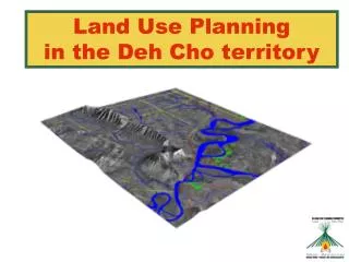
Land Use Planning in the Deh Cho territory. Agenda. INTRODUCTION TO THE COMMITTEE WHAT IS LAND USE PLANNING? LAND USE PLANNING AND THE DEH CHO PROCESS UPDATE ON DCLUPC ACTIVITIES & PROGRESS INPUT DATA FOR LAND USE OPTIONS LAND USE OPTIONS + ECONOMIC MODEL CUMULATIVE EFFECTS RESEARCH

E N D
Agenda • INTRODUCTION TO THE COMMITTEE • WHAT IS LAND USE PLANNING? • LAND USE PLANNING AND THE DEH CHO PROCESS • UPDATE ON DCLUPC ACTIVITIES & PROGRESS • INPUT DATA FOR LAND USE OPTIONS • LAND USE OPTIONS + ECONOMIC MODEL • CUMULATIVE EFFECTS RESEARCH • QUESTIONS AND DISCUSSION
Committee & Staff • Committee Members • 2 DCFN reps (Tim Lennie and Petr Cizek) • 1 GNWT rep (Bea Lepine) • 1 Federal Government rep (Adrian Boyd) • Chairman selected by the 4 members (Herb Norwegian) • 5 Staff Members • Executive Director (Heidi Wiebe) • Office Manager (Sophie Bonnetrouge) • GIS Analyst (Monika Templin) • Land Use Planner (Paul Wilson) • Land Use Planner Trainee (Priscilla Canadien)
What is Land Use Planning? Potential Land Uses Decisions (Planning Partners) (Staff & Committee) ? ? ? ? • DevelopmentConservation • Forestry - Green TLUO – Red • Tourism – Orange Wildlife – Blue • Oil and Gas – Purple Archaeology - Black • Minerals – Brown • Agriculture – Yellow Zones (Planning & Management)
Land Use Planning in the Deh Cho • Land Use Planning means determining what types of land use activities should occur and where they should take place • “The purpose of the plan is to promote the social, cultural and economic well-being of residents and communities in the Deh Cho territory, having regard to the interests of all Canadians.” • Our planning area extends to the whole Deh Cho territory, excluding municipal areas and Nahanni National Park Reserve
Deh Cho Process • The Deh Cho Process is the process of negotiations on lands and resource management and self-governance between the Deh Cho First Nations, Government of Canada and the Government of the Northwest Territories • Began in 1993 and is on-going • May 2001- Signed a Framework Agreement and Interim Measures Agreement • April 2003 – Signed Interim Land Withdrawals and Interim Resource Development Agreement • Currently working towards an Agreement in Principle (AIP) • Aiming for a Final Agreement by 2008
Interim Land Withdrawals Approval Land Use Planning • Land Withdrawals identified critical areas for interim protection • Land Use Plan will revise Land Withdrawals 5 years in parallel Interim Land Withdrawals
Deh Cho Process • Will address ownership/sovereignty over land • Not following the typical land selection model • Negotiating Shared Stewardship over entire 210,000 km2 • For more information go to: • http://www.ainc-inac.gc.ca/dehcho/or • http://www.dehchofirstnations.com/
Land Use Planning and the Deh Cho Process • Land Use Planning is only one part of the larger Deh Cho Process • Land Use Plan must be completed before the Deh Cho Process to be used by the three parties to negotiate in the Deh Cho Process • Draft Land Use Plan (2005) • Final Land Use Plan (March 2006) • Complete Deh Cho Process (~ 2008) • Land Use Plan will be revised to be consistent with the final agreement and every 5 years after
Planning Partners + + 2nd Priority Businesses, Associations, non- governmental organizations 1st Priority Residents Approve Plan
Planning vs. Management • Our mandate is to plan for future resource development – map potential, identify issues, write final plan to show “what” and “where” • We are not involved in past or current resource applications – current government structures do that (DCFN, GNWT and Gov of Canada) • May change with Deh Cho Process – Future Deh Cho Resource Management Authority
Update on DCLUPC Activities & Progress • Staff Recruitment • Round 1 Consultation Feedback • Q & A Report • Further Research: • Wildlife Workshop, • Dene Nahodhe Workshop • Economic Development Model Completed • Reviewing Various Land Use Options
Land Use Options • Draft Land Use Options represent different visions for the final land use map • Represent 5 different levels of development • Based on information (mostly scientific) gathered to date – little community or planning partner input yet • Will be revised based on feedback and presented at the next round of meetings
Wildlife • Traditional Knowledge & Expert Research • Regional Wildlife Workshop - Held: November 2003 • 308 species in the Deh Cho territory (3 amphibians, 36 fish, 213 birds and 56 mammals) • Key species include: • Caribou, Moose, Bison, Fish and Waterfowl for consumption • Trumpeter Swan, Whooping Crane, Peregrine Falcon (Endangered) • Black Bear, Grizzly Bear, Furbearers, Dall’s Sheep, and Mountain Goat (Trapping & Hunting species) • Critical wildlife areas include: • Nahanni National Park Reserve • Mackenzie Bison Sanctuary (denning, staging and calving, etc.) • Edehzhie • Central area between Fort Liard & Wrigley • Important consideration for Cumulative Effects Management
Traditional Use Density • Important to Traditional Dene Lifestyles • Information gathered and maintained by DCFN • Consulted 386 harvesters and mapped information • Harvest areas, kill sites, sacred sites, berry patches • DCFN approved publication and use at Kakisa Assembly 2004 • Planning Committee only gets generalized density of use, not raw data
Archeology, Cabins, Historic Sites & Rare features • Evidence of past human use • Important small sites i.e. fire rings, cabins, trails • Buffer required for protection • Development must avoid these areas • Rare Features: • i.e. Hot Springs and Karst Formations Conservation Value is determined by distance from these important sites
Minerals • Knowledge-driven mineral potential mapping approach based on geological favourability and known mineral occurrences • Assessed 9 mineral types thought to have the most potential in the region • Sedimentary Exhalative Sulphides (SEDEX) • Sedimentary-hosted Stratiform Copper • Mississippi Valley-type Lead-Zinc • Vein Copper • Skarn Lead-Zinc-Silver • Skarn Gold • Skarn Tungsten • Granitic Pegmatite • Primary Diamonds
Information Sources • Geological Base: 1:1,000,000 digital map by Journey and Williams (1995) • Mineral Occurrences: NORMIN Database • Mineral Deposit Type Information: Geology of Canadian Mineral Deposit Types by Eckstrand (1996)
Minerals • Produced a final cumulative mineral potential map showing geological favourability and ranking of Resource Assessment Domains (RADS) • The highest potential is in the western tip of the territory • There is significant potential for: • Sedimentary exhalitive sulphides (SEDEX) zinc-lead, • Sediment-hosted stratiform copper, • Mississippi Valley-type lead-zinc, • Vein copper, • Skarn deposits (emerald, gold, tungsten, copper, and lead-zinc).
Mineral Priority Areas • Combines geological information with synoptic level economic factors to identify priority areas for development • Geographical factors (remoteness, infrastructure) • Size of potential deposit • Inclusion of precious metal in a base metal deposit increases development potential • Reduced emphasis on Stratiform Fe, Sedimentary Cu and Vein Cu and increased emphasis on SEDEX, MVT Pb-Zc and Skarn deposits. • World markets • Ease/Costs of mineral extraction • Presence of existing deposits
Oil and Gas Potential • Canadian Gas Potential Committee estimates 69,177x106m3 natural gas has been discovered in the Deh Cho plus 31,075x106m3 in undiscovered nominal marketable gas • 419 hydrocarbon wells drilled, most are wildcat wells (exploratory) but 127 have found hydrocarbons • Hydrocarbon Potential was assessed by defining hydrocarbon plays and identifying the number of confirmed and conceptual plays existing in a given region • 20 hydrocarbon plays in the Deh Cho • 9 confirmed • 11 unconfirmed • Current producing regions are Fort Liard (natural gas) and Cameron Hills (gas with oil); other significant discoveries found but not yet developed • Greatest potential is in the Liard Plateau and the Great Slave Plain (northern extension of the western sedimentary basin)
Tourism • The greatest potential is along the Mackenzie and Liard River valleys and radiates out from communities (the “hub and spoke” effect.) • Exceptionally scenic, offer various types of tourism experiences and have good access • Key tourism destinations include Nahanni National Park Reserve, the Ram Plateau and North Nahanni River, Little Doctor Lake, Cli Lake, Trout Lake and some lodges • Deh Cho tourism is not well developed but has lots of potential - it can still offer tourists pristine wilderness free from commercial interruption
Forestry Potential • Productive timber stands around Fort Liard, Nahanni region, Jean Marie River and the Cameron Hills • Current timber harvest well below sustainable harvest levels (20 years harvest) • Low prices $ and difficult access may impact commercial viability • Potential for community use for log houses and cut lumber in fly-in communities
Agricultural Potential • Agriculture is small scale generally within community boundaries • Potential not developed – minor land use • Limitations include; climate, soil type, difficulties with access and power requirements • South have competitive advantage • Cost of food - opportunities and potential for community use