Download
1 / 14
180 likes | 574 Views
Hurricane Camille. On Sunday evening, August 17, 1969, a small, fierce hurricane skirted the mouth of the Mississippi River and, at 10 PM, thrust inland on the Mississippi Gulf Coast .

E N D
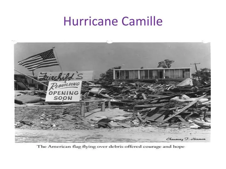
On Sunday evening, August 17, 1969, a small, fierce hurricane skirted the mouth of the Mississippi River and, at 10 PM, thrust inland on the Mississippi Gulf Coast . • Camille, with an unusually compact eye of 5 miles diameter, was the most intense hurricane ever to enter the United States mainland. Winds exceeding 200 miles per hour, and an extremely low central pressure, combined to generate the highest tides ever recorded on the Gulf Coast. A wall of water, up to 30 feet high, surged through the populous Bay St. Louis - Pass Christian Area of Mississippi.
Devastation from Camille • Houses that had withstood many previous storms were reduced to piles of rubble by the ravages of wind and water. • Houses that had withstood many previous storms were reduced to piles of rubble by the ravages of wind and water. In many cases, all that remained of homes and businesses were the concrete foundation slabs
This was the unusual aspect of Hurricane Camille — widespread destruction of homes caused large numbers of refugees to remain homeless for long periods of time. • Of the 284 known deaths, only 5 occurred in Louisiana, 3 of these in Plaquemine's Parish (County). This is the Parish that occupies both banks of the final 80 miles of the Mississippi River, just below New Orleans. Here, early evacuation of nearly all the residents of the southernmost low-lying areas undoubtedly averted hundreds of casualties
During the first month after the storm, refugees, on the West Bank of Plaquemine's Parish, accumulated nearly 30,000 person-days of exposure to the peculiar risks of life in the hurricane shelters.
Deaths and damage from Hurricane Camille • The hurricane flattened nearly everything along the coast of the U.S. state of Mississippi, and caused additional flooding and deaths inland while crossing the Appalachian Mountains of Virginia. • In total, Camille killed 259 people and caused $1.42 billion (1969 USD, $9 billion 2012 USD) in damages. • To this day, a complete understanding of the reasons for the system's power, extremely rapid intensification over open water and strength at landfall has not been achieved.
Inscription. On August 20, 1969, torrential rains, following remnants of Hurricane Camille, devastated this area. A rainfall in excess of 25 inches largely within a 5-hour period, swept away or buried many miles of roads, over 100 bridges, and over 900 buildings. 114 people died and 37 remain missing. The damage totaled more than $100,000,000 and Virginia was declared a disaster area. Erected 2008 by Department of Historic Resources. (Marker Number R 51.) Location. 37° 52.771′ N, 78° 54.49′ W. Marker is in Wintergreen, Virginia, in Nelson County. Marker is on Rockfish Valley Highway (U.S. 151) 0.1 miles south of Horizon Village Road, on the right when traveling east. Click for map. Marker is in this post office area: Nellysford VA 22958, United States of America.