Download
1 / 24
240 likes | 437 Views
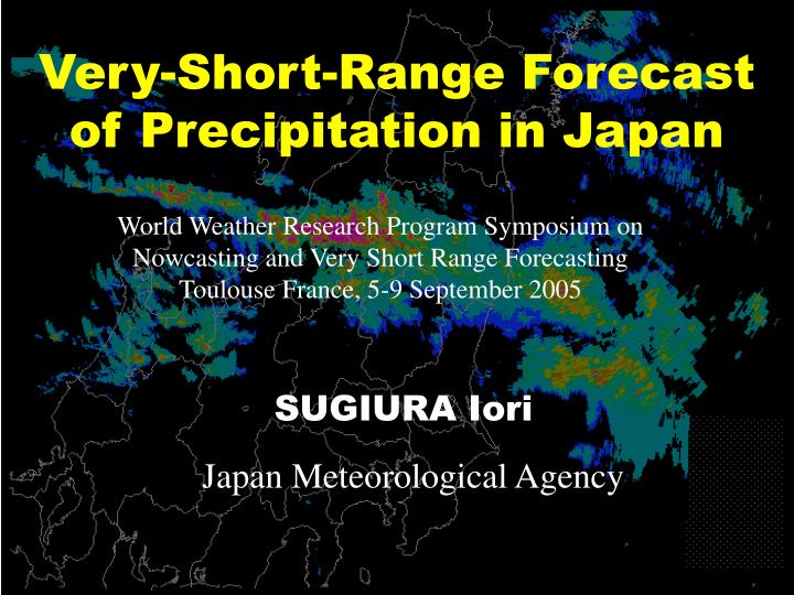
Very-Short-Range Forecast of Precipitation in Japan. World Weather Research Program Symposium on Nowcasting and Very Short Range Forecasting Toulouse France, 5-9 September 2005. SUGIURA Iori. Japan Meteorological Agency. Products of Very-Short-Range Forecast of Precipitation in Japan.

E N D
Very-Short-Range Forecast of Precipitation in Japan World Weather Research Program Symposium on Nowcasting and Very Short Range ForecastingToulouse France, 5-9 September 2005 SUGIURA Iori Japan Meteorological Agency
Products of Very-Short-Range Forecast of Precipitation in Japan Basic Products: 1. Radar-AMeDAS precipitation (R/A) and2. Very Short Range Forecast of Precipitation (KOUTAN) Derivative Products: 3. Soil Water Index (SWI) and4. RunOff Index (ROI)
Basic Products N 1. Radar-AMeDAS Precipitation (R/A) Overview · Estimated 1 hour precipitation based on Radar echo intensity data and rain gauge observation data· Used as basic precipitation analysis data in Japan · Covering whole over Japan with 2.5km grid· Operated at half an hour intervals
Basic Products 1. Radar-AMeDAS Precipitation (R/A) Weather Radar Observation · consists on 20 sites of ordinary weather Radar.· operated at 10 minute intervals· observe echo intensity (1km grid) and echo top height (2.5km grid) with 19 elevation volume scan· Z = 200R1.6 is applied as “Z-R relationship” Radar echo intensity data are spatially detailed for wide area. But in general, they are not suitable for being considered as quantitative precipitation. JMA Radar observation network
Basic Products 1. Radar-AMeDAS Precipitation (R/A) Raingauge observation AMeDAS* raingauges # of stations more than1300 average spacing17km by 17km non-AMeDAS raingauges # of stations more than5000 average spacingvarious AMeDAS raingauge network of JMA Raingauge observation is accurate, but it is only point local data. By using both radar and raingauge data we can analyze accurate and spatially detailed precipitation! AMeDAS*: Automated Meteorological Data Acquisition SystemMLIT*: Ministry of Land, Infrastructure and Transport Raingauges of local governments and MLIT*
Basic Products 1. Radar-AMeDAS Precipitation (R/A) Precipitation Analysis Assumed following relationship among analyzed rain R, hourly-mean echo intensity E and factor F: R(x,y,t) = F(x,y,t)E(x,y,t) If F is calculated, we can get R. 1st step: For each radar, decide Fa and Fx in following equation: F1(x,y)= Fa{1+Fx・H(x,y)2} here H is radar beam height Fa and Fx are decided so that they meets the following 2 principles. (1) precipitation amount for a given area should be consistent between all adjacent Radars(2) calibrated hourly-mean echo intensity agrees with raingauge data on average
Basic Products 1. Radar-AMeDAS Precipitation (R/A) Basic concept of calculating calibration factor
Basic Products 1. Radar-AMeDAS Precipitation (R/A) 2nd step: The factors F1(x,y) are tuned for each grid in order to represent local variability with comparing calibrated hourly-mean echo intensity and raingauge precipitation. 14JST 21 September 1999 hourly mean of radar echo intensity(start) Calibrated precipitation(last)
Basic Products 1. Radar-AMeDAS Precipitation (R/A) N Final step: Composite calibrated hourly-mean echo intensity data of all radars. R/A is obtained. 14JST 21 September 1999
Products of Very-Short-Range Forecast of Precipitation in Japan Basic Products: 1. Radar-AMeDAS precipitation (R/A) and2. Very Short Range Forecast of Precipitation (KOUTAN) Derivative Products: 3. Soil Water Index (SWI) and4. RunOff Index (ROI)
Basic Products 2. VSRF of Precipitation (KOUTAN) Overview · Forecast of 1 hour precipitation up to 6 hours ahead. · Used to issue warnings and advisories related to heavy rain in JMA. · Covering whole over Japan with 5.0km grid· Operated at half an hour intervals· Calculated by merging extrapolation of calibrated radar echo intensity (EX6) and precipitation prediction from Meso-Scale numerical Model (MSM).
Basic Products 2. VSRF of Precipitation (KOUTAN) Basic Concept of extrapolation (EX6) With comparing precipitation distribution of now and before, the movement of precipitation before 1 hour is obtained. After 1 hour, it will be Assuming speed and direction of the movement will bethe same as they werean hour ago, precipitation area is moved up to 6 hours ahead. In this time, precipitation area will beintensified or decayedby orographic effect. movement vector now movement of precipitation before 1 hour
Basic Products 2. VSRF of Precipitation (KOUTAN) Quality of forecast 0 3 6 9 12 15 18 Forecasttime(hour) Merging method Accuracy of EX6 is good for up to 3 forecast hours, but it decreases drastically with forecast time. In other hand, quality of MSM does not change much with forecast time. If EX6 and MSM are merged with appropriate ratio, good accuracy is obtained over the forecasting period. This is the merging method. Extrapolation method Merging method MSM persistence Quality of forecasts (accuracy X resolution) as a function of forecast time (partly from Browning, 1980)
Basic Products 2. VSRF of Precipitation (KOUTAN) EX6 Ft6 0300 MSM Fcst 0300 MRG Fcst 0300 Example of Merged Forecast: MRG(EX6+MSM) 2100UTC 06 - 0300UTC 07 August 2003 R/A 2100 R/A 0300
Products of Very-Short-Range Forecast of Precipitation in Japan Basic Products: 1. Radar-AMeDAS precipitation (R/A) and2. Very Short Range Forecast of Precipitation (KOUTAN) Derivative Products: 3. Soil Water Index (SWI) and4. RunOff Index (ROI)
Derivative Products 3. Soil Water Index (SWI) Overview · Index for predicting occurrence of landslide disasters caused by heavy rain. · calculated for each 5 by 5 km grid every half an hour.· archived for the last 10 years in order to compare with current SWI and judge high potential of landslide.· If current SWI of some area is the highest value in the archive, JMA shall judge that probability of occurrence of landslide is the highest for the last 10 years for the area.
Derivative Products 3. Soil Water Index (SWI) Radar AMeDas precipitation & VSRF precipitation forecasts Calculating SWI Soil water index for every 5 by 5 km area About 16,000meshes in Japan Occurrence of landslides is closely related to soil water index. SWI Archives for 5 by 5 km & damage reportsfor thelast 10 years Soil water index Calculation Water content in soil is estimated by "total Soil water index precipitation" exclusive Rain Firsttank of "volume run off into rivers" and "volume Comparison of current water content in soil with past records permeated into soil Surface runoff downward. Storage The Soil Water Index Second tank equals to the total Storage in storage volume of 3 surface layer serial tanks. Storage permeation runoff Advisories/warnings for heavy rainHow high the potential for landslides is for the last ten years Third tank Underground water runoff Storage calculated by 3 Serial tank model Permeation
Derivative Products 3. Soil Water Index (SWI) Relationship land-slide disasters and the ten years archives ranking in 1991-2000 per local governments 60000 59% 50000 40000 30000 20000 10000 0 1 2 3 4 5 6 7 8 9 10 11 12 13 14 15 16 17 18 19 20 21 the last ten years archives ranking
Products of Very-Short-Range Forecast of Precipitation in Japan Basic Products: 1. Radar-AMeDAS precipitation (R/A) and2. Very Short Range Forecast of Precipitation (KOUTAN) Derivative Products: 3. Soil Water Index (SWI) and4. RunOff Index (ROI)
Derivative Products 4. RunOff Index (ROI) Overview · Index closely related to runoff amount for each grid which contains rivers. · ROI agrees with river water level better than precipitation.· Now under researching relationship between ROI and occurrence of flush flood in detail
Derivative Products 4. RunOff Index (ROI) Precipitation RunOff Index Water Level Time Basic concept of ROI Precipitation in a basin does not agree with the water level of a river. Flow amount is calculated using tank model with the slope of land, type of soil and land use (urbanization) being provided Radar-AMeDAS precipitation. Flow speed is calculated with flow amount, slope and shape of cross section of the river Flow amount is calculated based on runoff and flow amount from upstream RunOff Index agrees with water level better than precipitation. It has more direct relationship with disasters.
Summary · Basic products of very-short-range forecast of precipitation in Japan are precipitation analysis and forecast based on radar and raingauge observations. · JMA has developed derivative products for predicting occurrence of disasters related to heavy rain. These products are more closely related to disasters than precipitation itself.
END Thank you