Download
1 / 31
310 likes | 389 Views
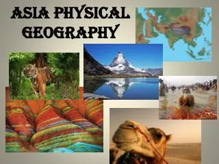
Asia Geography. Standards for Southern and Eastern Asia. SS7G9 The student will locate selected features in Southern and Eastern Asia

E N D
Standards for Southern and Eastern Asia • SS7G9 The student will locate selected features in Southern and Eastern Asia • Locate on a world and regional political-physical map: Ganges River, Huang He (Yellow River), Indus River, Mekong River, Chang Jiang (Yangtze River), Bay of Bengal, Indian Ocean, Sea of Japan, South China Sea, Yellow Sea, Gobi Desert, Taklimakan Desert, Himalayan Mountains, and Korean Peninsula • Locate on a world and regional political-physical map the countries of China, India, Indonesia, Japan, North Korea, South Korea, and Vietnam
Standards cont’d • SS7G10 The student will discuss environmental issues across Southern and Eastern Asia. • Describe the causes and effects of pollution on the Yangtze and Ganges Rivers. • Describe the causes and effects of air pollution and flooding in India and China
Standards cont’d • SS7G11 The student will explain the impact of location, climate, physical characteristics, distribution of natural resources, and population distribution on Southern and Eastern Asia. • Describe the impact climate and location have on population distribution in Southern and Eastern Asia • Describe how the mountain, desert, and water features of Southern and Eastern Asia have affected the population in terms of where people live, the types of work they do, and how they travel
Asia Map Questions Into which large body of water does the Ganges River flow? What is the tallest peak in the Himalayan Mountains? Of the countries you labeled, which two are archipelagoes? Of the countries you labeled, which two have borders on the South China Sea? In what countries is the Gobi Desert? What is the capital of China? Which two major bodies of water surround the Korean Peninsula? Since World War II, what two major wars has the U.S. fought in Asia?
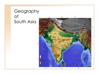
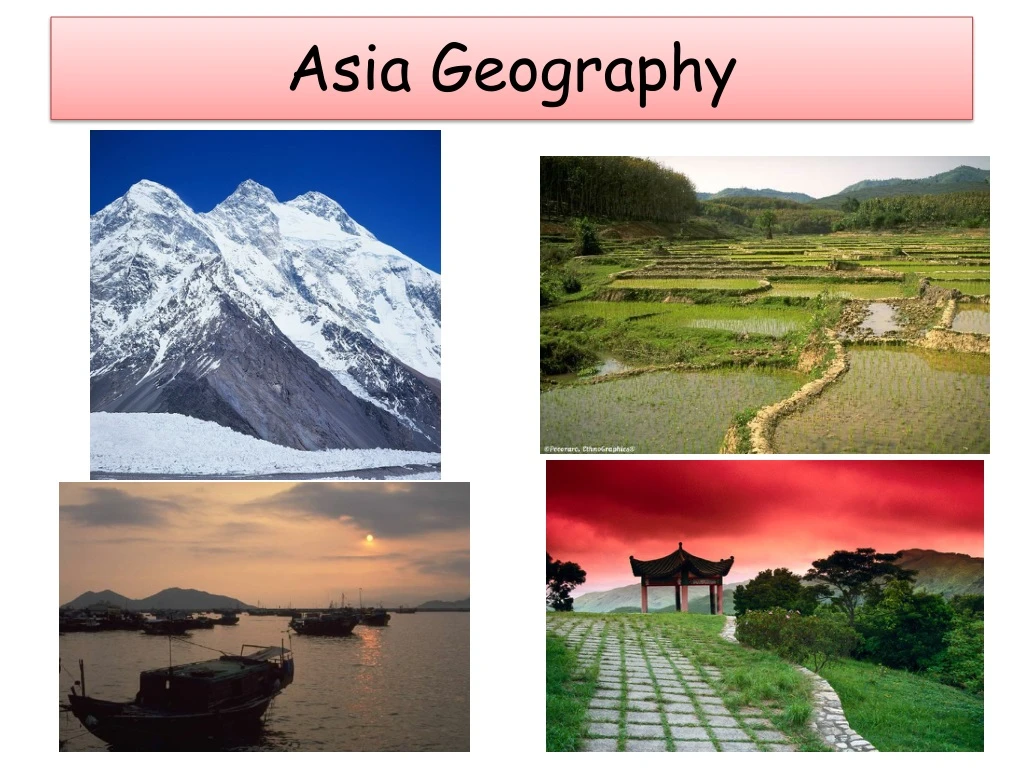
Physical Features – The Land • Mountains • Himalayas • western China, Nepal, and northern India • Tallest mountains in the world • Mt. Everest is the tallest mountain in the world at 29, 028 feet • Hindu Kush and the Karakoram Range • in northern Pakistan • also extremely high • Northern Mountain Rim • Himalayas, Hindu Kush, Karakoram Range • separate Pakistan, India, and Bangladesh from the rest of Asia • The terrain is rough and difficult to farm so fewer people live in this region • These countries form a subcontinent a. a large landmass that is part of a continent but is geographically separated from it
Effects of the Mountains • Difficult terrain causes few people to live there. • Blocks pollution in China from getting out – holds it in • Areas behind Himalayans (China side) get less rain because they block precipitation from Indian Ocean • Areas in front of Himalayas (India side) are fertile (Northern Plains) because they keep precipitation there. • Form a barrier between India and China – affects trade and travel • Many rivers in the region originate from ice in mountains.
(The Land – cont’d) • Deserts • Gobi Desert 1. southern Mongolia and northern China 2. Mongolian word for “waterless place” 3. Summer temps can reach 113 degrees F; winter temps can dip to -40 degrees F B. Taklimakan Desert 1. western China 2. averages less than 1 inch of rain per year a. Rain cannot get over the high mountains b. Result is extremely dry desert 3. one of the world’s largest sandy deserts
The Land – cont’d • Plains • Northern Plains • lie between the Himalayas and southern India • includes the Ganges and Indus River Valleys • fertile farmland because of rich sediment left by the Ganges during flood season • densely populated • North China Plains and Manchurian Plains • eastern and northern China • Most of China’s people live in these fertile areas
The Land – cont’d • Plateaus • The Deccan Plateau • makes up most of southern India • bordered by coastal mountains • fewer people than the Northern Plains • Plateau of Tibet • southwestern China • spreads across ¼ of China’s land • about 15,000 ft above sea level • highest plateau in the world • nicknamed “Roof of the World”
Checking up? • Hindu Kush • Subcontinent • Mt. Everest • Bangladesh • Gobi • Northern Plains • Tibet • Deccan Plateau • High, flat area in India • Includes Ganges and Indus River valleys • Five miles high • Country east of India • Mountains separating Pakistan from China • High, flat area in south west China. • India, Pakistan, Bangladesh • “waterless place”
Warm Up • How are the deserts in China different from the Sahara? • Why is it so difficult to climb Mt. Everest? • How has geography isolated India from China? • What country is northwest of India? (Hint – Muslim) • Where do most people live in India? Where do most people live in China?
The Land – cont’d • Islands • South Asia: Sri Lanka and the Maldives • south and southwest of India • Sri Lanka has lots of rain and is known for its tea production • The Maldives is made up of 1200 atolls (ring-shaped coral islands surrounding a lagoon)
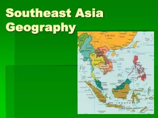
The Land – cont’d • Southeast Asia: Indonesia, the Philippines, and Singapore • Indonesia • 20,000 volcanic islands, more than 6000 of which are inhabited • most people are farmers even though the soil is not fertile • the Philippines • have 800 inhabited islands • half of the people are farmers • Singapore • Located between Malaysia and Indonesia • Only 433 square miles • Only natural resources are fish and deep water ports
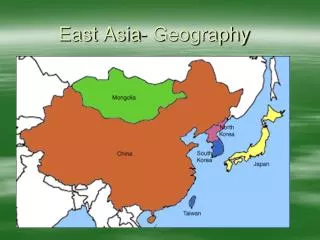
The Land – cont’d • East Asia: Japan and Taiwan • Japan is an archipelago with 4 main islands and about 4000 smaller islands • many active volcanoes and is prone to earthquakes • mountainous, very little flat land • Taiwan has a forested mountain range that bisects the island from north to south • also has foothills, terraced flatlands, and coastal plains
Checking Up on Islands • Where is Sri Lanka? • What is the main industry in the Maldives? • Describe an atoll • What made many of the islands in Indonesia? • What is Sri Lanka known for? • Why is the soil in Indonesia not good for farming? • Why is Indonesia so tropical? • What natural disasters occur frequently in Japan? • Where are many farms created in the Philippines? • Why is Taiwan not part of Communist China?
http://geology.com/articles/night-satellite/satellite-view-of-earth-at-night.jpghttp://geology.com/articles/night-satellite/satellite-view-of-earth-at-night.jpg
Pictorial Summary • You will fold a paper from the teacher into 6 squares. • Label one square for mountains, one for deserts, one for plains, one for plateaus, and one for islands. • In the last square, explain in words the effects of the high mountains, where most people in Asia live and why, and explain why so many cities develop along rivers and how people use them. • Draw a picture or pictures in each square that represents that land feature. It has to show specific features, absolute locations, relative locations, etc. Anything that “summarizes” your notes through pictures will work.
“The Land” – quick quiz • Indonesia • atoll • subcontinent • Taklimakan • Sri Lanka • Deccan • ring-shaped coral islands surrounding a lagoon • small teardrop-shaped island known for its tea • desert in western China • India, Pakistan, and Bangladesh • 6000 inhabited volcanic islands • large area in southern India located between the Western Ghats and the Eastern Ghats
Physical Features – Seas and Rivers Rivers of Southern Asia • Ganges River • located in northern India • carries rich sediment (minerals and debris that settle at the bottom of a river) from the Himalayas to the plains • river valley is a fertile farming area and is densely populated • holy river in Hinduism • pollution causes health problems for the people who bathe in the river
Seas and Rivers – con’t • Indus River • begins north of the Himalayas in Tibet, China • flows southwest through Pakistan to the Arabian Sea Rivers of Eastern Asia • Huang He (Yellow River) • major river system in northern China • called “yellow” because of loess (a fine, yellow-brown soil) that blows in from deserts in western China • rich soil from the river has made the North China Plain a major wheat-growing area • floods regularly killing people and destroying property • nicknamed “China’s Sorrow”
Rivers (continued) • Chang Jiang (Yangtze) • Asia’s longest 3,400 miles long • Flows through canyons and broad plains • Provides water for irrigation of rice paddies • Shanghai is port city • 14 million people • China’s largest port • Chinese are building world’s largest dam. • Three Gorges Dam • 607 feet high • 1.4 miles wide • Will prevent floods and make electric power • Will force 1 million people to move
Mekong River • 2,400 miles long • Forms boundary between Thailand and Laos • Large population along the banks, especially in Vietnam • Fighting along river in Vietnam War. • Water provides irrigation for rice paddies.
Checking Up on Asian Rivers • Ganges River • Mekong River • Indus River • Chang Jiang River • Three Gorges • Huang He River • Shanghai • Loess • U.S. soldiers fought in this delta. • Major dam built in China • China’s sorrow (Yellow) • Asia’s longest river (Yangtze) • Fine yellow soil blown in from desert • India’s holy “Hindu” river • Flows through Pakistan to Arabian Sea • Largest city in China at mouth of Chang Jiang River.
Geography Review • Why is China such an important country in the world? • Why is India called a sub-continent? • What separates India from China? • How many islands make up Indonesia? • What is the largest desert in Asia? (191) • Why is Korea divided into two nations? • Where has the United States fought two wars in Asia since WWII? • Describe an archipelago. (209) • What major river flows through Pakistan? • Name the longest river in China. How long is it? (212) • What is China building on the Chang Jiang? (212) • Where is Mt. Everest? • Name the former U.S. colony east of the South China Sea.