Download
1 / 25
250 likes | 334 Views
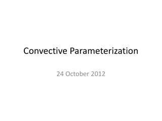
Parameterization Issues. HRU Delineation Hillslope/Drainage Focus Subbasins Cascade HRUs (surface, gw) Water Bodies Parameter Types/Classes Topographic Non-topographic Parameter Complexity Single Factor Multiple Factor Visible/Modifible Estimation Methods Output File Structure.

E N D
HRU Delineation • Hillslope/Drainage Focus • Subbasins • Cascade HRUs (surface, gw) • Water Bodies • Parameter Types/Classes • Topographic • Non-topographic • Parameter Complexity • Single Factor • Multiple Factor • Visible/Modifible Estimation Methods • Output File Structure Parameterization Issues
Distributed Parameter Approach Hydrologic Response Units - HRUs HRU Delineation Based on: - Slope - Aspect - Elevation - Vegetation - Soil - Precip Distribution
Dill Basin, Germany Topography 750 km2 Sub-basins Land Use
PRMS -- HRU Delineation Pixelated Topographic
HRU resolution PRMS SSR resolution GWR resolution
CASCADING FLOW PLANES 1 2 3 1 7 8 Overland Flow Path 10 9 1 Channel Segment 3 Channel Junction 4 3 6 2 Overland Flow Plane 2 4 width Grass/Agriculture Bare Ground/Rock 5 12 11 Trees length Shrubs
MODEL RECIPE FILE PARAMETER ESTIMATION METHOD PARAMETER
Multiple Factor Parameter (available water holding capacity of soil zone) Recharge Zone soil_moist_max Lower Zone • Function of: • Vegetation Type • Vegetation Rooting Depth • Soil Field Capacity • Soil Wilting Point
DIGITAL DATABASES STATSGO Soils (USDA) Vegetation Type (USFS) Satellite SW Radiation (U Md) Vegetation Density (USFS) Land Use-Land Cover (USGS) Monthly PET
GIS WEASEL • Parameterization: • 200+ methods available • Easily add custom methods • Exploit many types of data • Produce maps and ASCII files of parameters • Configure recipes • Apply to feature maps +
Visible/Modifible Estimation Methods (conceptual) Map Window Project Browser HRU 15 Selected Click to display method Equation Box – Edit Method Data Table Filters Parameter Table