Download
1 / 17
170 likes | 246 Views
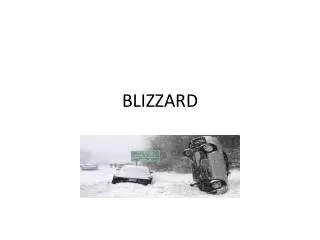
COMPUTER GENERATED GUIDANCE FOR FORECASING THE POTENTIAL FOR BLIZZARD CONDITIONS. William R. Burrows 1,2 and David G. Baggaley 3 1 Cloud Physics and Severe Weather Research Section, Environment Canada, Toronto, Ontario, Canada

E N D
COMPUTER GENERATED GUIDANCE FOR FORECASING THE POTENTIAL FOR BLIZZARD CONDITIONS William R. Burrows1,2 and David G. Baggaley3 1Cloud Physics and Severe Weather Research Section, Environment Canada, Toronto, Ontario, Canada 2Hydrometeorology and Arctic Lab, Environment Canada, Edmonton, Alberta, Canada 3 Prairie and Arctic Storm Prediction Center, Winnipeg, Manitoba
CHARACTERISTICS of BLIZZARD CONDITIONS • 1) temperature < 0ºC 2) strong wind (≥ 30 kmh (16kt) bliz. watch, ≥ 40 kmh (21kt) warning) 3) low ground visibility ( ≤¼ SM in SN &or BLSN for warning) • Can last a few hours to several days north of Arctic treeline • NOTE: ~ ½ Arctic blizzards are “clear sky”!
On the HAL website we show 2 real-time area forecasts of blizzard conditions driven from CMC’s RDPS 15 km resolution output 1) Blizzard Potential - rules-based “conceptual model” … not tuned with obs - “heads-up” area forecast indicates wheredrifting snow, near-blizzard conditions, and blizzard conditions could develop 2) Perfect prog forecasts of the probability of visibility ≤ 1 km in BLSN and concurrent SN + BLSN - models derived from thousands of obs by Dave Baggaley (Baggaley and Hanesiak, WAF, 2005) http://weg-hal-fe01.edm.ab.ec.gc.ca/WxProducts/HAL_Winter/
BLIZZARD POTENTIAL MODEL RULES • Air temperature < 0° C ? • > 1 cm snow on ground (supply of snow to be lifted) ? • Snowing now ? … requires precipitation type forecast • Avgwind speed ≥18 kt in lowest 6 RDPS levels (~ 50 mb) • Low convective stability in the lowest 6 RDPS levels (~ 50 mb) ? -∂(Өw) ∕ ∂p < .02 ºC/hPa at ≥1 level • Apply: (1) ≥ 30% land surface (2) ≥ 80% sea ice-cover • Prediction: SIX Categories
Precipitation Type forecast used in setting blizzard forecast categories(hybrid from Bourgouin tephi-area and Baumgardt top-down methods)
possible DRSN, BLSN likely DRSN, possible BLSN possible near-BLZD in BLSN possible near-BLZD in SN + BLSN likely BLZD in SN + BLSN Last obs CYBK: 1720000Z 33034G44KT 1/8SM –SN +BLSN OVC 030 -14.8/16.9 A2962 BLSN6SC2
Baggaley Models: probability of ≤ 1 km visibility in BLSN depends on1) 10 m windspeed 2) sfc air temperature 3) snowpack age [time since last significant snowfall (.5 cm) ] 95% Probability of ≤ 1 km visibility in BLSN warm temperatures:1) more wind is needed than in cold temperatures 2) an old snowpack needs more wind than a young snowpack cold temperatures: an old snowpack needs less wind than a young snowpack Snow-pack age (Baggaley and Hanesiak, Wea.and Forecasting, 2005)
PROBABILITY OF VSBY ≤ 1 km inBLSN • Regression curve for each category of snow-pack age : 1-2 hr, 3-6 hr, 6-12hr, 12-24 hr, 24-48 hr, > 48 hr • Locate 10 m RDPS wind speed (S) and temperature (T) on curve to get probability S = 10 m wind speed [m/s] S for 95% probability vis ≤ 1 kmS_p95= A2 + B2T + C2T2 S for 5% probability vis ≤ 1 km S_p5 = A1 + B1T + C1T2 S < S_p5 : p = 0 S > S_p95 : p = 100% S_p5 ≤ S ≤ S_p95 : p = linear interpolation
PROBABILITY OF VSBY ≤ 1 km in CONCURRENT SN +BLSN calculateVsby_SNfrom the current snow_rate then see how muchBLSN must contribute to give a visibility of 1km (“BLSN vsby deficit” Vsby_SN = (-1.6/1.35) * ln (snow_rate/2.55) [km] snow_rate[cm/hr] (average, hundreds of “snow alone” obs) *use RDPS “p4” field (stratiform solid precip rate (mm/hr liquid water), convert p4 to snow rate with Dubé algorithm 1 / Vsby_total = 1 / Vsby_BLSN + 1 / Vsby_SN …. For Vsby_total = 1 km, Vsby_BLSN = 1 / (1 – (1 / Vsby_SN) ) km
Need a contribution from BLSN where Vsby_SN > 1 km in order to get 1 km total visibility SN + BLSN Vsby_SN
Vsby_BLSN“deficit” … the extra reduction of vis needed from BLSN to get vis=1 km in SN + BLSN … • use 5% and 95% BLSN windspeedthresholds from: - the 8 km BLSN vis probability curves if the “deficit” is low (i.e. in SN/SN+) - the 1km BLSN vis probability curves if the "deficit” is high (i.e. in SN-/SN--) • setting max Vsby_SN = 8 km, define a visibility ratio: (factor of 0 to 1 that determines where you are in the range of visibility deficit)Vsby_ratio = 1 – (8 – Vsby_BLSN) / 7 (higher number >> less from BLSN) • The final 10m windspeed thresholds are, by linear interpolation: • Prob_95% = Vsby_ratio * ( 8 km Prob_95%) + (1 – Vsby_ratio) * (1km Prob_95%) • Prob_5% = Vsby_ratio * ( 8 km Prob_5%) + (1 – Vsby_ratio) * (1km Prob_5%)
47 hr prog valid 23Z 17 Jan 2012: Compare BLIZ and ProbVsby≤ 1 km forecasts
National Validation: 24 hr forecasts of probability ≤ 1 km visibility issued 00Z, 17 Dec 2011 – 20 Jan 2012 *this is NOT a contingency table WATCH WARNING
National Validation: 24 hr Blizzard Potential forecasts issued 00Z17 Dec 2011 – 20 Jan 2012 *this is NOT a contingency table WATCH WARNING
CONCLUSIONS and FUTURE WORK • both forecasts widely used by forecasters in EC’s Prairie and Arctic SPC’s • the Blizzard Potential Forecast (BPF) is a good “heads-up” area forecast for the likelihood of blizzard and near-blizzard conditions, but has a high false alarm ratio. Category 5 (red) is the most accurate, esp. in the Arctic. • the Baggaley model has fewer false alarms than the BP predictingblizzard conditions; often misses near-blizzard conditions (wasn’t designed to forecast them) … suggest using prob > 50% for “yes” blizzard conditions • both forecasts are being extended to 5 days for northern Canada • the BPF should be tuned statistically with observations and a new model developed … support vector or tree-based regression should work • recently change EC re-defined warning blizzard visibility at ¼ SM … new Baggaley-style probability models are needed