Download
1 / 8
80 likes | 192 Views
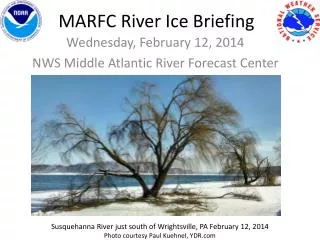
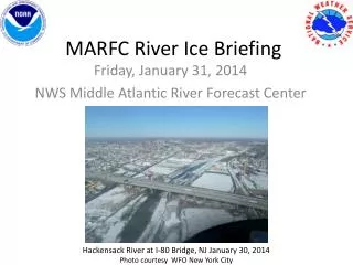
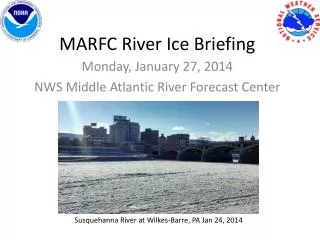
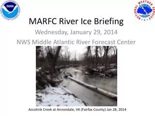
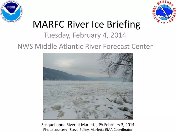
MARFC River Ice Briefing. Tuesday, February 4, 2014 NWS Middle Atlantic River Forecast Center. Susquehanna River at Marietta, PA February 3, 2014 Photo courtesy Steve Bailey, Marietta EMA Coordinator. Our Current Status NY, PA & NJ.

E N D
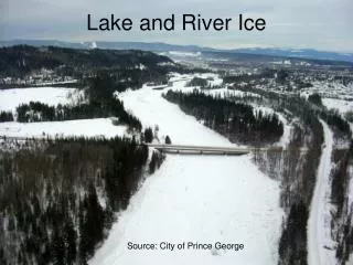
MARFC River Ice Briefing Tuesday, February 4, 2014 NWS Middle Atlantic River Forecast Center Susquehanna River at Marietta, PA February 3, 2014 Photo courtesy Steve Bailey, Marietta EMA Coordinator
Our Current Status NY, PA & NJ • Since the recent precipitation has been in freezing or frozen form over most of Pennsylvania, New Jersey, and New York, little change has been experienced with the river ice. Precipitation tonight and tomorrow should again be mainly freezing or frozen. • Without a significant amount of liquid runoff, there is no force to break up the thick river ice and get it moving. We expect ice to remain in the rivers through the week.
Our Current StatusMD, VA & WV Panhandle • For much of Maryland, the West Virginia panhandle, northern Virginia and the higher elevations of central Virginia , we've noticed ice effects diminishing. The river ice has been eroding for several days now. We expect that trend to continue. Flows are high and that, along with the additional rain and "milder" temperatures should be enough to push ice out. Any ice jams that do happen to form should be isolated.
ImportantMonitor http://water.weather.gov for updates • As always, please stay alert, monitor http://water.weather.gov, and share river ice observations with your local NWS office. River ice is very difficult to predict and conditions can change rapidly. Ice jams can cause quick rises, and even flooding.
Recent River Ice Photos & News • Thank you to everyone who continues to share your photos of the river ice with us. • We are sharing these photos, plus any news we gather, through our Facebook and Twitter accounts, everyday. Following MARFC on Facebook & Twitter is the best way to stay up to date on the river ice because, as you know, conditions can change rapidly. • If you notice anything urgent, such as a jam forming and flooding, please notify your local emergency management and your local National Weather Service office soon as possible.
How to stay updated • Monitor your river forecast at: http://water.weather.gov • Follow MARFC on Facebook https://www.facebook.com/US.NationalWeatherService.MARFC.gov • Follow MARFC on Twitter @NWSMARFC • Follow your local NWS Weather Forecast Offices too. They are also sharing photos and news about river ice.
Additional Resources • NWS Middle Atlantic River Forecast Center Website: http://weather.gov/marfc • NWS Temperature Forecasts: http://preview.weather.gov/graphical/ • NWS Precipitation Forecasts: http://www.hpc.ncep.noaa.gov/qpf/day1-7.shtml • NWS MARFC Water Temperature Observations (raw data - not quality controlled): http://www.erh.noaa.gov/marfc/Maps/water_temps/ • NWS Susquehanna and Delaware River Basins River Ice Website http://www.erh.noaa.gov/er/ctp/hydro/riverice/index.php
As long as conditions remain stable, the next MARFC River Ice Briefing will be Friday, February 7th. If you have any questions or concerns, please email patricia.wnek@noaa.gov