Download
1 / 28
290 likes | 514 Views
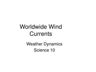
Factors Affecting Climate. LATITUDE, CURRENTS, WIND, ALTITUDE, TOPOGRAPHY. Latitude and Longitude. Skills Day. Typical Graph. Y axis. Each point has two values: The “ X ” value that runs along the horizontal “ X ” axis The “ Y ” value that runs along the vertical “ Y ” axis.

E N D
Factors Affecting Climate LATITUDE, CURRENTS, WIND, ALTITUDE, TOPOGRAPHY
Latitude and Longitude Skills Day
Typical Graph Y axis • Each point has two values: • The “X” value that runs along the horizontal “X” axis • The “Y” value that runs along the vertical “Y” axis X axis
Typical Graph • X value is always stated first • Followed by the Y value • The “origin” is the point where the 2 axes intersect with a value of (0,0) Y (3,8) (9,5) X (0,0)
Typical Graph • A point can also have negative (-) values • Negative X values are to the left of the origin (0,0) • Negative Y values are below the origin Y (-X,+Y) (+X,+Y) (0,0) X (-X,-Y) (+X,-Y)
East West, North South on The Earth • Let the X axis be the Equator. • Let the Y axis be the Prime Meridian that runs through Greenwich outside of London. • Lat/Long are the 2 grid points by which you can locate any point on earth. X Y
East West, North South on the Earth N • Let each of the four quarters then be designated by North or South and East or West. W E S
East West, North South on the Earth • The N tells us we’re north of the Equator. The S tells us we’re south of the Equator. • The E tells us that we’re east of the Prime Meridian. The W tells us that we’re west of the Prime Meridian. (N, W) (N, E) (S, W) (S, E)
East West, North South on the Earth • That means all points in North America will have a North latitude and a West longitude because it is North of the Equator and West of the Prime Meridian. (N, W) Prime Meridian
East West, North South on the Earth • What would be the latitude and longitude directions in Australia? ? Prime Meridian If you said South and East , you’re right!
What is Latitude? • Latitude is the distance from the equator along the Y axis. • All points along the equator have a value of 0 degrees latitude. • North pole = 90°N • South pole = 90°S • Values are expressed in terms of degrees. 90°N Y X 90°S
What is Latitude? • For Example: • 37°, 02’,51’’N • This is close to the latitude where you live. 90°N Y X 90°S
What is Longitude? • Longitude is the distance from the prime meridian along the X axis. • All points along the prime meridian have a value of 0 degrees longitude. • The earth is divided into two parts, or hemispheres, of east and west longitude. Y X 180°W 180°E
What is Longitude? • The earth is divided into 360 equal slices (meridians) • 180 west and 180 east of the prime meridian Y X 180°W 180°E
What is Latitude? • Our latitude and longitude might be: • 37°N • 76° W 90°N Y X 90°S
So Where is (0,0)? • The origin point (0,0) is where the equator intersects the prime meridian. • (0,0) is off the western coast of Africa in the Atlantic Ocean.
See If You Can Tell In Which Quarter These Lon/Lats Are Located • 1. 41°N, 21°E • 2. 37°N, 76°W • 3. 72°S, 141°W • 4. 7°S, 23°W • 5. 15°N, 29°E • 6. 34°S, 151°E B A D C
Let's See How You Did! • 1. B • 2. A • 3. C • 4. C • 5. B • 6. D
Guided Practice Sheet • Work in partners to finish the guided practice sheet—combining latitude and longitude with wind and sun/heating Latitude Longitude Castaway Game • With extra time—in pairs of 4-5 get game set from front—read directions and play game.
10.24 Bell Ringer • Europe and Northern Canada are around the same latitude, so therefore they should have similar climate. Why is it that this is not true and that Canada is much colder than Europe?
Brainpop: Climate Types • What is climate? • Why are tropical climates so hot? • How does the ocean impact climate?
Ocean Temperatures and Climate Patterns • How does ocean temperature affect local atmospheric pressure? • Why do cloud types vary in different regions of the Pacific Ocean? http://cms.gavirtualschool.org/Shared/Middle_Grades_Courses/MiddleGradesScience/6_SummerScience/hydrology_shared/index.html Hydrology/Meteorology Pg. 18
What causes the Gulf Stream? 3. What causes the earth to be unevenly heated? 4. How does this affect the earth's atmosphere? 5. Describe what the Gulf Stream is. • Where is the warmest water found in the Gulf Stream? http://cms.gavirtualschool.org/Shared/Middle_Grades_Courses/MiddleGradesScience/6_SummerScience/hydrology_shared/index.html Hydrology/Meteorology Pg. 18
How currents affect climate? • Currents carry warm water from the equator and cold water from the poles • Currents change the temperature of the air above them, which then affects the temperature of the coast
Look at where the warm-water currents and cold-water currents are located. What is the relationship between the temperature of the water currents and the climate?
5 Factors that Effect Climate • Describe each factor of climate. • ..\Section 3 Factors Affecting Climate\Five_Factors_that_Affect_Climate.asf
Brainpop: Climate Type With your group, decide on the best answer. • 100 points- Right answer • -50 points- Not following directions/Talking
Exit Ticket (answer on back of bell ringer) • The Coriolis effect states that wind and water in the northern hemisphere move ________ and in the southern hemisphere they move _______________. • What causes surface currents? • True or false: Currents located around the equator are cool.