Download
1 / 5
50 likes | 122 Views
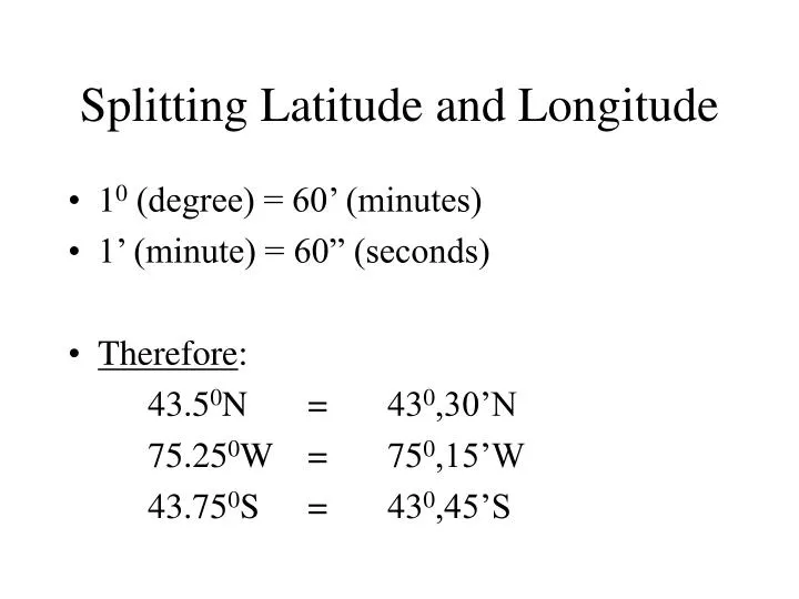
Splitting Latitude and Longitude. 1 0 (degree) = 60’ (minutes) 1’ (minute) = 60” (seconds) Therefore : 43.5 0 N = 43 0 ,30’N 75.25 0 W = 75 0 ,15’W 43.75 0 S = 43 0 ,45’S. Finding your Latitude. The Al titude of Polaris (North Star) is equal to the La titude of the observer!!

E N D
Splitting Latitude and Longitude • 10 (degree) = 60’ (minutes) • 1’ (minute) = 60” (seconds) • Therefore: 43.50N = 430,30’N 75.250W = 750,15’W 43.750S = 430,45’S
Finding your Latitude • The Altitude of Polaris (North Star) is equal to the Latitude of the observer!! • Altitude - Angular distance of an object above the horizon. • Horizon - Where the sky and ground appear to meet (Altitude = 00). • Zenith - highest point in the sky, directly above your head (Altitude = 900).
Shape of the Earth • Oblate Spheroid - (nearly a perfect sphere) Slightly flattened at the poles and buldging at the equator.
Observations for Earth’s shape • Changing altitude of Polaris (North Star) as one traveles north or south. • Stronger gravity measurements at the poles. • Photographs of Earth taken from space. • Ships and planes “sinking” at the horizon.
Globe Measurement Activity **Roundness ratio =Polar circumfrence Equatorial circumfrence **less than 1.0 = Not a perfect sphere!