Download
1 / 15
150 likes | 330 Views
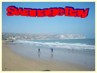
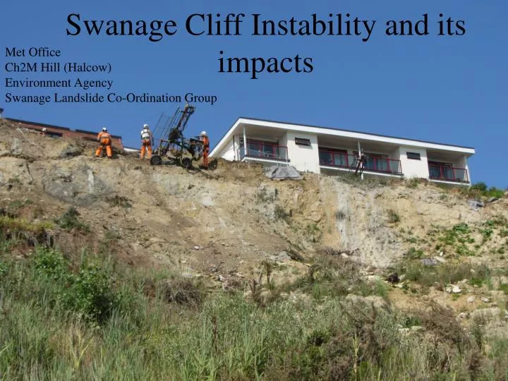
Met Office Ch2M Hill (Halcow) Environment Agency Swanage Landslide Co-Ordination Group. Swanage Cliff Instability and its impacts. Swanage landslides in the news. Landslide caught on camera http:// www.bbc.co.uk/news/uk-england-dorset-20825271

E N D
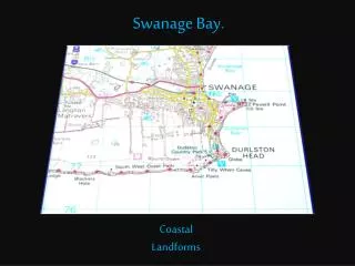
Met Office Ch2M Hill (Halcow) Environment Agency Swanage Landslide Co-Ordination Group Swanage Cliff Instability and its impacts
Swanage landslides in the news • Landslide caught on camerahttp://www.bbc.co.uk/news/uk-england-dorset-20825271 • Up to date photos of landslide rescues http://swanagecoastguard.blogspot.co.uk/ • Guidance for residents in papershttp://www.purbeckgazette.co.uk/news/info.aspx?f=3317 • Reports in local papers http://www.bournemouthecho.co.uk/news/10124339.Landfall_at_Swanage/ http://travel.aol.co.uk/2013/02/17/walker-rescued-from- dangerous-swanage-beach/
The bad weather of 2012/13 In total 1100mm of rain fell in Swanage in 2012 as a whole, compared to the average of 825mm, making it the 3rd wettest year since 1957. The winter of 2012/13 was especially wet with over 160mm of rain in December alone. Above average rainfall was recorded for September, October, November, December and January (2013).
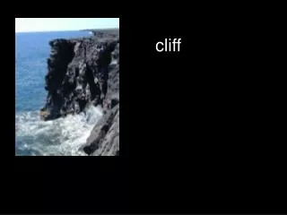
Landslides The effect of this higher than average rainfall on the cliffs was not felt in its intensity, but rather in its cumulative effect seen in the groundwater storage. By December 2012 the cliffs (which are made up of clays, sand and mudstones) were completely saturated, even in May 2013 groundwater could be seen running freely from the cliffs. With groundwater present within the cliffs for such a long period the threshold for subsidence was exceeded leading to landslides mudflows, topples and rock falls.
Consequences As well as the wet winter of 2012/13 long term development on the cliffs coupled with uncontrolled drainage and coastal erosion of the cliff base lead to major disruption and massive subsidence onto the beach below, including the promenade and beach structures, such as beach huts. Several buildings on top of the cliff were also put at risk of collapse with the landslides meaning the cliff retreated. The most notable example was the Pines Hotel, which as well as losing its beer garden, also came within 15m of losing the hotel itself. Fortunately no structural damage was caused.
StabilitySurvey During and following on from the destructive series of landslides the Environmental Agency (EA) granted Purbeck District Council (PDC) emergency funding for a full cliff stability survey to be undertaken. The full document of the report, surveyed by Halcrow, can be found at: www.dorsetforyou.com/coastprotection/purbeck The survey investigated 12 sites along North Beach between Ocean Bay Beach and Sheps Hollow. The survey found that 11 properties were at risk from coastal instability by 2030, with this number increasing to 47 by 2110.
Diagram showing the location of the 12 sites surveyed by Halcrow, as well as specific buildings.
Survey Recommendations • In the areas of smallest landslide activity (sites 1 and 5-6 ) the report recommended that cliff protection measures should be implemented to prevent further events. • Installation of rock catch fences to protect beach users and huts at sites 2-4 and 8. • The site that posed an “intolerable” risk to the public was between sites 8 and 11. Here the scale of the landslides coupled with the potential impact on private development meant that immediate action was needed which involved; the clearance of landslide debris and the installation of structural support. This site includes the area directly beneath the Pines Hotel. An Emergency Government Grant from the EA was given to fund the recommendations for this section. • At all entrances to the beach, signs warning the public of the hazardous environment should be erected.
Problems with Protecting Acquiring funding to help prevent and mitigate the impacts of landslides is complicated. Government funding for cliff erosion not caused by the sea, i.e. cliff base removal, is not currently available. Therefore at Swanage, where cliff instability is driven by weathering, i.e. rainfall, funding cannot be given. However, funding can be given to remove debris from public areas where it may be hazardous to the general public or affecting council owned infrastructure. Areas affected by landslides are the responsibility of the landowner. For large areas owned by one person, clearance and prevention is relatively simple. However, the stretch surveyed in the Halcrow Report is owned by 70 different landowners making it difficult to determine who needs to pay what, as one landslide can affect many landowners. To help minimise cost to landowners and disruption to beach users the PDC would support a co-ordinated approach to the problem. The area above Sheps Hollow includes protected areas, such as SSSIs, and is an AONB meaning that for any cliff stabilisation to occur planning permission and consultation will be required.
Money matters… Local councils and other organisations including the Coastguard, EA, Swanage Coastal Change Forum and LiCCo (Living with a Changing Coast) project are working together to assist the landowners who were affected by landslides at Swanage North beach in the winter of 2012. As part of the nationwide Defra Climate Change Plan an £11 million Coastal Pathfinder Initiative was set up. The Dorset County Council had a successful bid from this initiative for resources to adapt to coastal change, amounting to £376,000. Using this money the Landslide Co-ordination Group made up of members from the organisations above was formed. One of the groups main roles was to advise the general public on how to safely remove landslide debris from their properties. In 2010/11 the Swanage Coastal Change Forum was also formed in another attempt to be rewarded funding for debris clearance. The LiCCo Project was awarded funding for the Poole Harbour area in general. It is helping to co-ordinate the debris clear up and working to develop a strategy for managing cliff stability long term.
Solutions • Short term • Between the Pines Hotel and Sheps Hollow groynes (13-17) have had gaps made in them to provide access for beach users, meaning they do not go near the cliffs and landslides. • In December 2013 material on the promenade and beach huts were removed by a local contractor, funded by Purbeck District Council, so that access along the promenade was then possible. • As soon as tides allow the removal of man made material, woody material and Japanese Knotweed from the settled landslides will occur by funded contractors. • The Grand Hotel (at site 7) are planning on constructing 44 luxury beach huts below the cliffs. Scheduled to be completed by February 2014 these huts will also acts as a barrier to future landslides. Long term • It has been decided that catch fences will be erected in the future below those areas of cliff at significant risk. • Potential for borehole investigation at Pines Hotel and a number of other sites. Tiltometers and groundwater pressure indicators could act as an early warning system for future landslides. Lyme Regis (W. Dorset) already have one in place.
The Pines Hotel The first area to have stabilisation undertaken after the area was surveyed. Had a very high risk factor, scoring 25/25 (certain likelihood (5) and extreme impact(5)). Over 2013, directly below the Pines Hotel, the soil was stabilised using soil nails over 12m long. These were drilled deep into the cliff at an angle giving support to the slopes. A mesh barrier was then layed over the area adding extra support which was then seeded with grass. Lower cliff drainage and stabilisation is scheduled for 2014, but until then large drainage pipes have been left in the cliff to help alleviate the build up of groundwater over the winter which could lead to future landslides. The majority of this engineering work was funded by the owner of the Pines Hotel.