Download
1 / 26
260 likes | 437 Views
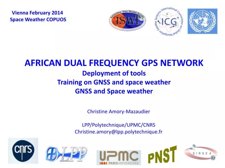
AFRICAN DUAL FREQUENCY GPS NETWORK Deployment of tools Training on GNSS and space weather GNSS and Space weather. Vienna February 2014 Space Weather COPUOS. Christine Amory- Mazaudier LPP/Polytechnique/UPMC/CNRS Christine.amory@lpp.polytechnique.fr. Introduction. UNBSSI [1990-2012]

E N D
AFRICAN DUAL FREQUENCY GPS NETWORKDeployment of toolsTraining on GNSS and spaceweatherGNSS and Spaceweather Vienna February 2014 SpaceWeather COPUOS Christine Amory-Mazaudier LPP/Polytechnique/UPMC/CNRS Christine.amory@lpp.polytechnique.fr
Introduction UNBSSI [1990-2012] United Nations Basic Space Science Initiative • IEEY: International Equatorial ElectrojetYear [1992-1994] • IHY: International heliophysicalYear [2005-2009] http://www.ihy2007.org • ISWI : International SpaceWeather Initiative [2010-2012] http://www.iswi-secretariat.org Since 2013 French National Program PNST http://pnst.obspm.fr/Meteo_espace/ ScientificAssociations : IAGA, SCOSTEP, COSPAR
DELOYEMENT OF GNSS RECEIVERS GLONASS K1 • not only GPS -> GNSS • Research and applications GPS IIR GIOVE-B BEIDOU
Provided by T. Tsugawa (NCIT, JAPAN) N. America ~2,700 receivers JAPAN ~1,200 receivers Region # of GPS Rec. Europe ~1,200 receivers Detrended TEC Map (60-min Window)
January 2010 November 2013 • IGS • http://sopac.ucsd.edu • http://cddis.gsfc.nasa.govhttp://igs.ensg.ign.fr • AMMA stations are now in IGS • NOAA et UNAVCO • http://www.ngs.noaa.gov/CORShttp://www.unvaco.org Main provider : AFREF Free on the web Many networks of GPS Burkina Faso, Algeria, Egypt, Rwanda etc… Necessity to share -> Work of the AGS
The satellite signal is strongly modified by ionosphere and troposphere LAYERS > 600 km EXOSPHERE few collisions, Particles follow balistic orbit 80-600 km THERMOSPHERE Ionization by the solar X-EUV radiation IONOSPHERE 30-80 km MESOSPHERE Absorption of the radiation UV by the ozone layer 11-30 km STRATOSPHERE Turbulence 0-11 km TROPOSPHERE Meteorological phenomena TEC There is a stronginterestto use GPS for meteorology
Equatorial Fountain : map in East Africanow possible Amory-Mazaudier et Fleury, 2013 ISWI : verysuccessfulproject => we have to continue Objective 1 – Map of TEC / Bangalore 2006 Objective 2 – Africanscientific Leaders / Ethiopia 2007 Leaders in : Nigeria, Côte d’Ivoire, Kenya, Egypt, Burkina Faso, Algeria, Morocco etc…
1stPresident : Prof Babatunde RABIU Uses of GPS Water vapor Motions of Earth TEC S4 Motions of ocean Water vapor
Training - Research -> ISWI GIRGEA (26 countries /13 in Africa) Europe -Africa + Asia + America • Capacity Building • 25 PhD -> 1992-2013 • 15 PhD -> 2007-2013 (IHY and ISWI) • 10 countries ( Africa (5) – Europe (2)-Asia (2)) • Actually 30 PhD in progress • GNSS is a tool for research and development
GNSS MASTER -> UN SCHOOLS in MOROCCO and NIGERIA MAGHREB ISWI SCHOOL - each 2 years Schooleachyear Egypt Workshop on SpaceWeather Nigeria eachyear PERENNITY
Need of International cooperation • Need of tools in Africa (GPS, magnetometers, radars etc…) • Schools are very important -> to attractPhDstudents. • Programs of exchange (PhD and post doc) => Need of mentors • African countries in International scientific associations as SCOSTEP, COSPAR URSI • Next AGS meeting at Abuja in June 2014
RESEARCH 2003/10/28 : 11h12 2003/11/04 : 19h48 X28 X17.2 1 2 2003/10/28 : 11h12 2003/11/04 : 19h48 SOHO Extreme ultraviolet Imaging Telescope (EIT) of the fourthlargest (1) and the largestsolarflare (2) STUDIESOF EVENTS : SOLAR FLARES Sun Earth distance : 8 minutes Liu et al, 2006, Solar flare signatures of the ionospheric GPS total electron content, JGR, vol 111, A05308
Signature of TEC storm on 6 november 2001, Maruyama et al., 2004 Units = 1x 10¹⁶ el/m2 JGR, Vol 109, A 10312 EXB Quiet days Large network of GPS stations Real time DTEC = UT + 9h
1 2 3 4
1 : the solarflare 2.: ionization => DTEC FromCurto ‘s PhD 1992
3 : Ionosphericelectric currentdensities 4 : Magnetic signature of the solarflare Solarflare -> black arrows Curto et al., JGR, 1994
Sun CME departure Transport CME arrival Magnetosphere Auroral zone Magnetosphere- Ionosphere-Thermospherecoupling
ARRIVAL NEAR THE EARTH Direct driven process/DDP No shielding Loadeddriven process/RC Shielding Overshielding PPE Penetration of auroral electricfields at equatorduring a substorm, Kikuchi et al., 2000, JGR, Vol 105, N° A10, 23251-23261
CONNECTION HIGH AND LOW LATITUDES : Electric Field DP2 : Nishida, 1968 Richmond/ school in Algeria2013 - TIEGCM model simulation
ASSIMILATION OF DATA Electrodynamiccoupling of high and low latitudes observations on May, 27, 1993 Kobéa et al. 2000, JGR, Vol 105, A10, 22979-22989 PPE Richmond and Kamide, 1988 AMIE JGR vol 83 n°A6, 5741-5759
CONNECTION HIGH AND LOW LATITUDES : Neutralwind Robble 1977
EFFECTS OF ELECTRIC FIELD AND NEUTRAL WIND Richmond/ school in Algeria 2013 – numerical simulation
RESEARCH => SYSTEMIC APPROACH from the ground to the sun a fisrtnecessity TRAINING: Schools on spaceweather and GNSS => global approach ANALYSIS OF EXISTING DATA BASE : manyPhD Assimilation of data in model DATA BASE OF SIMULATION: All the cases analyzedcanbeusedlater AFRICA: To continue the deployment of groundbased instruments over Africa Capacity building in Africa => need of Mentors OPERATIONAL SPACE WEATHER : Researchersproduceknowledge and data