Download
1 / 30
300 likes | 376 Views
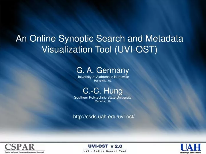
An Online Synoptic Search and Metadata Visualization Tool (UVI-OST). G. A. Germany University of Alabama in Huntsville Huntsville, AL C.-C. Hung Southern Polytechnic State University Marietta, GA. http://csds.uah.edu/uvi-ost/. Abstract.

E N D
An Online Synoptic Search and Metadata Visualization Tool (UVI-OST) G. A. Germany University of Alabama in Huntsville Huntsville, AL C.-C. Hung Southern Polytechnic State University Marietta, GA http://csds.uah.edu/uvi-ost/
Abstract “The primary goal of the proposed work is to provide an online search and visualization tool of auroral and geophysical metadata covering the ascending phase of the current solar cycle.” Project goals have been achieved and important new research targets of opportunity have been pursued.
The Problem • ~8 x 10⁶ images in UVI image collection (and growing) • Before this project… • No method existed for searching instrument info • No method existed for searching image info • Published studies almost exclusively event studies
The Solution • Database of instrument and image info (metadata) is assembled with software ‘miners’ • Online interface allows users to search and visualize metadata • Result of query is list of times meeting search criteria • Link is provided for data download service • Includes image views and diagnostics
Project Impact • Usage statistics show continued access throughout project • Some correlation with meeting and proposal deadlines • Tool used for UVI operational planning and to diagnose instrument anomalies • 8 papers or presentations directly related to OST • Multi-year statistical studies in progress • Thru 3/23/05: • 6738 total queries • 324 unique IP addresses • ~100 different institutions
Unique IP Addresses Australia 2 Austria 4 Belgium 1 Canada 20 Finland 1 France 7 Great Britain 21 Iceland 1 India 2 Ireland 1 Italy 1 Japan 31 Norway 12 Poland 2 Russia 24 South Korea 13 Sweden 6 United States 171 Zambia 1 Centre Universitaire de Velizy Royal Institute of Technology UTA Telekom Uninett North Norway 2C Computing AKnet API DIGITAL COMMUNICATIONS African Network Information Center America Online Ameritech Austrian Academy of Sciences Bellsouth Boston University British Antarctic Survey (NERC) Carnegie Mellon University Centre d'Etude Spatiale des Rayonnements Chungbuk National University Comcast Compuserve Computational Physics Consiglio Nazionale delle Ricerche Dartmouth College EarthLink Network Exchange Point Blocks Finnish University and Research Network George Mason University Institute for Informatics Institute of Nuclear Physics Japan Network Information Center Japan Network Information Center John Hopkins University Applied Physics Laboratory Kola Science Centre of Russian Academy of Science Korea Advanced Institute of Science and Technology Korea Network Information Cente Korea Telecom Kyoto University Kyungpook National University Worldwide Impact Leicester University Level 3 Communications Marshal Space Flight Center Massachusetts Institute of Technology Mission Research Corporation NEC Corporation National Space Science and Technology Center Naval Research Laboratory Nicolaus Copernicus University Norway University OARnet OJSC RTComm Observatory Meteorology Aeronomy Petrozavodsk State University RiNet Dynamic Dialup RoadRunner Rogers Cable Inc Royal Institute of Technology Russian Space Research Institute Rutherford Appleton Laboratory SRI International SaskTel Satyam SouthwestBell Sprint-IPDial St.Petersburg State University Stanford University Starwood Hotels State of Georgia/Board of Regents Swipenet Telia Network Services The University of ElectroCommunications Tohuku University US West Technologies Universite Louis Pasteur Universite Pierre et Marie Curie University of Alabama University of Alaska University of Alberta University of Calgary University of California (3),LA,Berkley,San Diego University of Colorado University of Iowa University of Lancaster University of Lowell University of Michigan University of Minnesota University of New Brunswick University of NewHampshire University of Newcastle University of Oslo University of Southampton University of Texas (2),Austin,Dallas University of Tromso University of Wales University of Washington University of Waterloo University of York Uppsala University Utah State University Videsh Sanchar Nigam Ltd Waterford Institute of Technology
Metadata Definitions * On earth? | % oval seen | Ground station in FOV? NOTE: This is not metadata in the normal sense, i.e. data used to describe elements of a data format, for example. The metadata above are descriptions of the image data and geophysical activity associated with the image data. The key point is that this metadata can be data based and searched on.
Region Mask Image Data Image Mask Segmented Image Polar Cap Auroral Oval FOV edge Metadata Software routines ‘mine’ the UVI data set, extracting boundaries, areas, and total intensities. The location of the oval relative to the edge of the image is stored to help determine how much of the auroral oval we are seeing. Where appropriate, these parameters are calculated as a function of magnetic local time. Additional parameters needed to understand the extracted information, such as the solar zenith angle (SZA), are also cataloged.
Image Metadata • Quality Flags • Low global power or low contrast • FOV flags • what is in field of view? • Oval: 0 (all), 1 (nightside), 2 (some) • Cap: 0, 2 • Scalars (desired) • Fraction of oval or cap seen
Segmentation • A modified K-means algorithm based on the histogram distribution was developed for the UVI image segmentation. • From our experiments, it is unlikely that this segmentation will be trapped into the local optimal solution. • Image segmentation is an essential step towards the higher level information processing such as substorms detection in image analysis approach.
Segmentation (cont.) K-means Clustering Algorithm Step 1: Choose initial cluster centers Step 2: Distribute image pixels among clusters Step 3: Compute new cluster centers Step 4: Repeat steps 2 and 3 until it converges. k=2,3,4,5
Segmentation (cont.) • An adaptive K-means algorithm based on the histogram distribution was recently developed for the UVI image segmentation. • This adaptive version can segment the UVI image more accurately (Fine Segmentation) for further higher level UVI image analysis. (a) (c) (b) (a) An original image, (b) segmented using the static histogram, and (c) segmented using the dynamic histogram, with the same parameters for K-means algorithm.
Original Correction Bias Dayglow Corrected Dayglow Models Mining techniques allowed development of a statistical dayglow model based on multi-year observations. Model is more accurate and more stable than previous techniques.
2. Visualize 1. Search 4. Info Site Overview http://csds.uah.edu/uvi-ost/ 3. Delivery
1. Search User can search on time, instrument ops, FOV constraints, geophysical conditions, and image info.
4. Info User manual gives site instructions and background information necessary to understand the results of the data query
Targets of Opportunity • Not in original proposal • Easy/moderate implementation • Significant impact • Thumbnails • Links to UVI online data • Ground Stations • Solar Wind • Data delivery service • Synoptic science studies
Papers • Germany et al., A simple automated algorithm for substorm identification in space-based auroral images, to be submitted to Geophys. Res. Lett. 2005. • Emery et al., Image Comparisons with the Auroral Electron and Ion Hemispheric Power after Intersatellite Adjustments and Geophysical Variations, Space Weather Week, 2005. • Germany, G.A., J.F. Spann, C. Deverapalli, and C. Hung, The utility of auroral image-based activity metrics, Eos. Trans. AGU, 85(47), Fall Meet. Suppl., Abstract SA51B-0247, 2004. • Germany, G.A., C.-C. Hung, R.A. Doe, D. Lummerzheim, and G.K. Parks, Multi-year analysis of FUV auroral images, Eos Trans. AGU, 84(46), Fall Meet. Suppl., Abstract SM51B-0516, 2003. • Hung, C. C., and G. Germany, K-means and Iterative Selection Algorithms in Image Segmentation, in IEEE Southeast Conference, Session 1: Software Development, Jamaica, West Indies, 2003. • Germany et al., Multi-year analysis of FUV auroral images, SM51B-0516, Fall AGU 2003. • Doe et al., Impact of Global Averaging on UVI-based Bz North Conductance Estimates, SM51B-0517, Fall AGU 2003. • Germany, G. A., C. Hung, D. Chua, Y. Tung, J.F. Spann, and G.K. Parks, Extended Synoptic Analysis Using a Database of Auroral Images, Eos Trans. AGU, 83(47), Fall Meet. Suppl., Abstract SM12A-0486, 2002.
“Polar UVI images are used herein to investigate global conductance morphology for Bz north conditions. These brightness maps indicate a By-dependent variance structure in agreement with modeled and observed morphology of polar cap arcs.” Doe et al., Impact of Global Averaging on UVI-based Bz North Conductance Estimates, SM51B-0517, Fall AGU 2003.
A typical substorm bulge Magnetic Projection Geographic Projection Temporal Mining Substorms characterized by poleward bulge on the nightside and increased intensity. Part of a regular growth and decay cycle with a time constant ~90 minutes. Goal: Identify substorm morphology in single images, then mine forward and backward in time to identify temporal and spatial characteristics of substorm. Goal: Add this information to the searchable database.
Multi-yearAnalysis First complete synoptic view of full mission. Anomalies found near fall equinox.
Daily Mean Daily Median Light Leak Light Leak Rad’n Belts Rad’n Belts Image Contamination
Open Items • Automated quality flags • Temporal evolution, e.g. substorms • Dynamic image segmentation algorithms • Identify and resolve data contamination issues • FOV corrections • Higher temporal resolution • Updated OMNI and indices • Port IDL routines to C • Extend database to IMAGE data
Acknowledgements • Work funded by NASA AISRP Grant NAG5-10743 to the University of Alabama in Huntsville • Subcontract to Southern Polytechnic State University, Marietta GA • Special thanks to our Tiger Team of programmers! • Chakravarthy Deverapalli Lee Adarr • Venkataraman Gopalakrishnan Haining Yao • Sudhakaran Dharmaraj Kiran Pai • Ruchi Tyagi Amirali Jaliaa • Nuo Nuo Xu Vishal Agrawal • Wes Swift