Download
1 / 29
290 likes | 418 Views
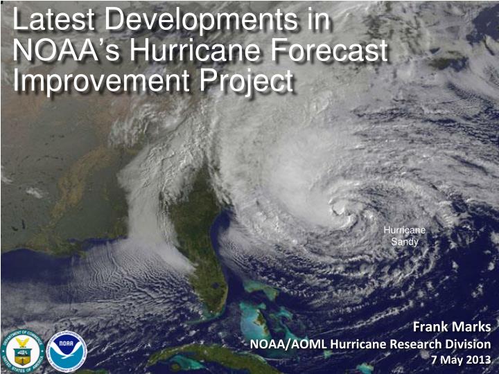
Latest Developments in NOAA’s Hurricane Forecast Improvement Project. Frank Marks NOAA/AOML Hurricane Research Division 7 May 2013. Good – track forecast improvements. Current Capabilities. Not so Good – Modest intensity gains. S ome intensity gains since 2008, especially at >48 h.

E N D
Latest Developments in NOAA’s Hurricane Forecast Improvement Project Frank MarksNOAA/AOML Hurricane Research Division 7 May 2013
Good – track forecast improvements Current Capabilities Not soGood – Modest intensitygains • Some intensity gains since 2008, especially at >48 h • Errors cut in half over past 15 years • 10-year improvement - As accurate at 48 hours as we were at 24 hours in 2000 • 24-48h intensity forecast off by1category • Off by2categories perhaps 5-10% of time http://www.nhc.noaa.gov/verification/verify5.shtml
Current Capabilities Storm Size: Progress is difficult to measure due to inadequate observations • Storm Surge: Accurate within ±20% when track, intensity, and size known • Lead Time: Lead time was extended from 3 to 5 days in 2001 • Precipitation: Modest annual improvements; forecast patterns match observations when track error is low • New/Improved Products: Refined cone graphic, wind speed probabilities, graphical tropical weather outlook, and probabilistic storm surge • Social/Behavioral Science: In its infancy
Improvements still needed! • NOAA’s National Weather Service (NWS) mission is to fulfill this commitment through building a Weather Ready Nation. • NWS must contribute to hazard resiliency by continually assessing and improving its services to Nation. • Hurricane Sandy (2012): • 159 (72 along US East Coast) deaths • ~$50Billion damage • Major infrastructure losses • Power lost to 8.5 million http://www.nhc.noaa.gov/data/tcr/AL182012_Sandy.pdf
Federal Hurricane Team 2012 Snapshot Total: $51,494K HFIP NOAA Total $16,990 http://www.ofcm.gov/ihc13/
Goals • Improve Forecast Accuracy • Hurricane impact areas (track) – 50% in 10 years • Severity (intensity) – 50% in 10 years • Rapid intensity change detection • Extend forecast reliability out to 7 days • Quantify, bound and reduce forecast uncertainty to enable risk management decisions http://www.hfip.org/
HFIP Activities • Traditional Hurricane Research Activities: • Observations, analysis, database, & instrument R&D (IFEX) • Statistical-dynamical model development • Advances in operational models (Stream 1) • New HFIP Research Thrusts: • Experimental global and regional hurricane model development (Stream 2) • Data assimilation techniques and observing system strategy analysis development (Stream 1 & 2) • Model evaluation tool development (Stream 1.5) • Application and tool development for forecasters D1 D2 Partnership: NCEP, AOC, AOML, ESRL, GFDL, DTC, USWRP, NESDIS/STAR http://www.hfip.org/documents/
Global Model Development – GFS/EnKF Sandy (18L) – init00Z 23 October GFS/EnKF T382 20 member ensemble 7-Day forecast – 20 member ensemble Observed http://www.esrl.noaa.gov/psd/forecasts/gfsenkf/ens/ Global Model Team - Tom Hamill & Jeff Whitaker (ESRL)
Global Model Development Track Error 2012 GFS versus ECMWF Global Model Team – Mike Fiorino (ESRL)
Global Model Development – Ensemble – Genesis Global Model Team - Tom Hamill & Jeff Whitaker (ESRL)
Regional Model Development: HWRF http://www.emc.ncep.noaa.gov/gc_wmb/vxt/ • HFIP operational (27/9/3 km) • Advanced nesting algorithm providing resolutions to 3 km • Viable operational pathway & potential transition to operations • Pathway to Improved structure and intensity predictions* • Extension of initialization algorithm down to 3 km resolution • 19 main products; e.g., • Synthetic microwave imagery • SHIPS predictors • Shear and Steering • Time-height cross-sections • Swaths (wind and rainfall) https://storm.aoml.noaa.gov/realtime HWRF Model Team - Gopal, X. Zhang(HRD), V. Tallapragada, S. Trahan (EMC)
Regional Model Development: HWRF 2012 HWRF Experimental HWRF real-time demo simulations (http://storm.aoml.noaa.gov/hwrfxprojects/?projectName=BASIN) HWRF Model Team - Gopal, X. Zhang(HRD), V. Tallapragada, S. Trahan (EMC)
Regional Model Development: HWRF Ensembles • Hurricane Ensemble Prediction System based on Stochastic Convective Trigger (vortex scale) and GEFS initial conditions (large-scale) perturbations • Based on latest FY2013 HWRF configuration (fully coupled system) • Further improvements to track and intensity forecast skill HWRF Model Team – Z. Zhang & V. Tallapragada (EMC)
Regional Model Development: Model evaluation: Wind Structure Data Coverage HWRF 10m winds H*Wind 10m winds HWRF Forecast (108 h) HWIND analysis HWRF Model Team - Gopal, X. Zhang(HRD), V. Tallapragada, S. Trahan (EMC)
Regional Model Development: Model evaluation: Rainfall Stage IV rain accumulation (144 h) HWRF rain accumulation (120 h) HWRF Model Team - Gopal, X. Zhang(HRD), V. Tallapragada, S. Trahan (EMC)
Regional Model Development: What Next? Earl Fiona HWRF Model Team - Gopal, X. Zhang(HRD), V. Tallapragada, S. Trahan (EMC)
Regional Model Development: Storm-storm interactions? Earl Earl Earl Fiona Initialize Earl Vortex 850hPa Streamlines and Isotachs (kts) Earl Earl Fiona Earl Fiona Fiona Initialize Fiona Vortex http://www.emc.ncep.noaa.gov/gc_wmb/vxt
Regional Model Development: HWRF Basin-Scale HWRF Model Team - Gopal, X. Zhang, T. Quirino (HRD), V. Tallapragada (EMC)
Improved Use of Observations:HFIP & Intensity Forecast Experiment (IFEX) • Improve prediction of TC intensity change by: • collectingobservations through the TC life cycle • developing and refining measurement technologies • improving understanding of physical processes important in TC intensity change • In-situ • Wind, press., temp. • Expendables • Dropsondes • AXBT, AXCP, buoy • Remote Sensors • Doppler Radar • SFMR/HIRAD • WSRA • Scatterometer/profiler • UAS - LALE GALE UAS NASA Global Hawk G-IV Tail Doppler Radar AXBT profiles of Loop Current DWL profiles from TCS-08 ONR DWL R. Rogers, S. Murillo, P. Reasor (AOML/HRD)
Future Aircraft ObservationsIFEX & HS3: • IFEX 2012 • NOAA aircraft flew ~282 h (18 P-3 and 12 G-IV missions) • Highlights include Isaac, Leslie, & Sandy • For details see: http://noaahrd.wordpress.com/category/ifex-discussion • IFEX 2013 • 2 NOAA WP-3D, G-IV – 150 flight hours (1 June-30 November) • Crews available 2/day missions starting July based from Tampa, FL • Interact with NASA during their HS3 field campaign • HFIP real-time model demonstration S. Murillo, P. Reasor (AOML/HRD)
Improved Models & Data:IFEX 2012: Sandy 4 P-3 Flights 22 August – 24 August 2011 TDR-Experiment: Doppler data transmitted in real-time for assimilation into HWRF HWRF/GSI 20121026 00UTC • 7 WP-3D TDR missions from 00 UTC 26 – 12 UTC 29 September 2012 at 12 h Doppler sampling (HEDAS/GSI) • 3 G-IV missions (1 G-IV TDR mission) • Sampled Hurricane Sandy from passage N of Cuba to landfall HWRF/GSI 20121026 00UTC Aberson, Aksoy, Gamache, Gopal (AOML/HRD), Tong (EMC)
Improved Models & Data:IFEX 2012: Sandy Real-time P-3 Tail Doppler Composite at 3 km altitude m/s Flight 20121025H1 Flight 20121027H1 Flight 20121028H1 S. Murillo, P. Reasor (AOML/HRD)
Improved Models & Data:Assimilation of data into models Synergy of high resolution forecast and airborne observations P-3 and G-IV QC Doppler observations Data assimilation Improving initial condition in storm core region Improving high resolution regional forecast Wind intensity at 10 m Hurricane Sandy (2012) F. Zhang (PSU), Tong (EMC), Aberson, Aksoy, Gamache(AOML/HRD)
Improved Models & Data:Impact of airborne Doppler radar Intensity Errors Isaac (2013) OPER HWRF OPER HWRF HWRG TDR HWRG TDR Vertical cross section at initial time No Doppler With Doppler S N S N Isaac (2013) HWRF Model Team - V. Tallapragada, M. Tong, S. Trahan (EMC)
Improved Models & Data:HWRF 2013 Implementation 2010-2012 Atlantic Track Verification >20% improvement ~10% improvement Intensity errors Track errors HWRF Model Team - V. Tallapragada, S. Trahan, Y. Kwon (EMC)
HFIP Success to Date • HFIP focused research efforts within NOAA & interagency partners • HFIP defined solution to transition research into operations with Stream 1.5 products available to NHC forecasters in real-time • Transitioned global hybrid DA system and 3-km HWRF into operations this season • HFIP making significant progress – 5-year goals within reach • Global ensembles providing 20% improvement in track guidance • Improved model initialization and higher resolution models, along with inner core data shows significant (20-40%) improvement in intensity • 3-5 day lead-time hurricane genesis product http://www.hfip.org/documents/reports2.php
Keys to Success • Partnership: NOAA Research working closely with NOAA Operations, and Federal & Academic Partners (NASA, NSF, ONR, NRL, NCAR) • More integrated use & support of Testbeds (JHT, DTC, JCSDA) • Blend traditional hurricane and HFIP research activities • Manpower (diversity) to evaluate model performance with hurricane data sets is a critical need IFEX/PREDICT/GRIP CBLAST IFEX/RAINEX DOTSTAR IFEX/TCSP
Outreach • Our blog • http://noaahrd.wordpress.com • HRD Web page • http://www.aoml.noaa.gov/hrd • Facebook • http://www.facebook.com/noaahrd • Twitter • http://twitter.com/#!/HRD_AOML_NOAA Tweets from the eye Tweets from the eye Visiting scientist program Visiting scientist program