Download
1 / 15
150 likes | 257 Views
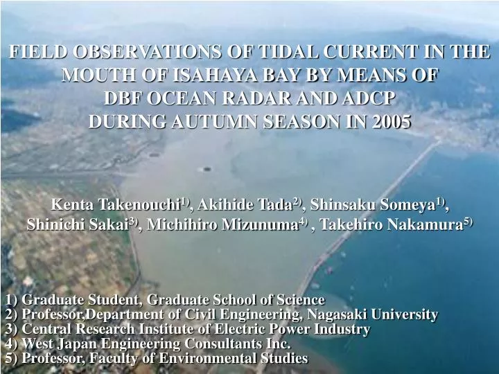
FIELD OBSERVATIONS OF TIDAL CURRENT IN THE MOUTH OF ISAHAYA BAY BY MEANS OF DBF OCEAN RADAR AND ADCP DURING AUTUMN SEASON IN 2005. Kenta Takenouchi 1) , Akihide Tada 2) , Shinsaku Someya 1) , Shinichi Sakai 3) , Michihiro Mizunuma 4) , Takehiro Nakamura 5).

E N D
FIELD OBSERVATIONS OF TIDAL CURRENT IN THE MOUTH OF ISAHAYA BAY BY MEANS OF DBF OCEAN RADAR AND ADCPDURING AUTUMN SEASON IN 2005 Kenta Takenouchi1), Akihide Tada2), Shinsaku Someya1), Shinichi Sakai3), Michihiro Mizunuma4) , Takehiro Nakamura5) 1) Graduate Student, Graduate School of Science2)Professor,Department of Civil Engineering, Nagasaki University3)Central Research Institute of Electric Power Industry4)West Japan Engineering Consultants Inc.5)Professor, Faculty of Environmental Studies
Fukuoka Saga Oita Nagasaki Kumamoto Miyazaki Kagoshima Kyusyu map 50km 1. Location of Isahaya Bay Japanese map
1. Location of Isahaya Bay Takezaki Is. ● N Ariake Sound Isahaya Bay Sea-dyke Isahaya Bay & Ariake Sound map
2. Outline of Big National Project of Isahaya Bay ■ Big National Project of Isahaya Bay • Purpose: Disaster prevention and land reclamation • Start of Constructing : 1989 • Main construction : ① Sea-dyke :about 7 km in length ② Reclamation by drainage:・ Land development・・・about 1,800 ha ・ Regulation pond・・・about 1,700 ha Honmyo River Sea-dyke Regulation pond Isahaya Bay
3. Background of This Study ■ In Isahaya Bay,a big project that consists of the construction of sea-dyke and reclamation by drainage reaches the last lap. ■ These caused severe environmental problems such as a change current, eutrophication, oxygen depression and so on. ■ In this study, therefore, field observations on tidal current in the middle of Ariake Sound including the mouth of Isahaya Bay are carried out by means of both DBF ocean radar and ADCP. during autumn in 2005. The laver has gone down
The current observation using DBF ocean radar • The current observation using ADCP 4. Outline of Field Observation ■ Three kind of observation method • The vertical distributions of various water quality indexes
4. Outline of Field Observation (1)ADVANTAGES OF DBF OCEAN RADAR How ocean radar works as observation instrument ・DBF ocean radar transmits radio waves from land toward the ocean and receives back the radio energy reflected by ocean waves.・By analyzing Bragg scattering, the system provides data on directions, velocities and wave height of surface currents.
4. Outline of Field Observation (1)ADVANTAGES OF DBF OCEAN RADAR ・Conventional ocean surveys have conducted by hanging a current meter from a ship into the sea or mooring it in the sea in order to directly measure current directions and velocities at multiple observation spots. ・With this method, measurements were not possible under adverse weather conditions. Another drawback to it was errors resulting from areal interpolations of point specific data or different measurement times at individual measurement points. ・In contrast, DBF ocean radar allows remote surveysfrom land, that is to say, measurements are possible any time regardless of weather conditions. In addition, it can monitor ocean currents over a wide area simultaneously in a short period of time.
Constitution of DBF ocean radar Transmission antenna eight reception antennas Shelter of DBF Radar System DBF ocean radar
4. Outline of Field Observation (2)Current observation using DBF ocean radar • DBF ocean radar:Digital Beam Forming Marine Rader → Central Research Institute of Electric Power Industry has developed • Two DBF ocean radars were set N Ariake Sound Station-A (Saigo, Unzen City)Station-B (Arao, Arao City) Oura Takezaki Island DBF ocean radar Station B (Arao) 5km • Observational Term Isahaya Bay → September 20 to October 5, 2005 Sea-dyke DBF ocean radar Station A (Saigo) Observation area in Isahaya Bay
4. Outline of Field Observation (3)Current observation using ADCP • ADCP: Acoustic Doppler Current Profiler → In order to reveal a dimensional structure of tidal currents during spring tide in Isahaya Bay, the current observation using ADCP. • The E-E’ Line:about 9km in length N Current measurements were collected 9 times during one tidal cycle. Ariake Sound Oura Takezaki Island E’ 5km • Observational Term Isahaya Bay → September 20, 2005 Sea-dyke E Observation line in Isahaya Bay
Ariake Sound Ariake Sound Oura Oura Takezaki Island Takezaki Island 5km 5km DBF radar Station B (Arao) DBF radar Station B (Arao) Isahaya Bay 50cm/s 50cm/s Sea-dike Sea-dike DBF radar Station A (Saigo) DBF radar Station A (Saigo) Isahaya Bay N N 5. Results and Discussion (1) Horizontal distribution on velocity vectors of tidal current in surface layer (DBF ocean radar) At the maximum flood current At the maximum ebb current • It is found that the maximum flood current branches off to both Isahaya Bay and the head of Ariake Sound significantly.
Takezaki Island Takezaki Island Isahaya Bay Isahaya Bay Kojiro Kojiro Sea-dike Sea-dike 5km 5km 5. Results and Discussion (2)Horizontal distribution on velocity vectors of tidal current in surface layer (ADCP) 1m/s At the maximum flood current At the maximum ebb current • It is obvious that the maximum velocity in flood current and ebb current occur near an offshore where is about 2km out from Kojiro, respectively. • These tidal currents are similar to the observation results not only in October 2001 but also in August 2002 (Nakamura et al. 2002, 2003).
2.05 3.05 4.05 5.05 6.05 7.05 8.05 9.05 10.05 11.05 12.05 5. Results and Discussion (3)Vertical structure of tidal currents Water depth (m) N N 0.5m/s 1m/s 9 9 6.75 4.5 2.25 6.75 4.5 2.25 0 0 Kojiro Kojiro Distance (km) Distance (km) Takezaki Is. Takezaki Is. At the maximum flood current At the maximum ebb current • The outflow into Ariake Sound occurred in the northern part of the E-E’ Line. • These tidal currents are similar to the observation results not only in October 2001 but also in August 2002 (Nakamura et al. 2002, 2003).
6. Conclusion in This Study ■ Tidal current along the north coastline of the Shimabara Peninsula is dominant in Isahaya Bay. ■ There is outflow into Ariake Sound from Isahaya Bay near Takezaki Island in the best part of one tidal cycle. ■ DBF ocean radar is one of the powerful remote sensing tools to measure surface currents from lands widely and continuously without being affected by weather conditions.