Download
1 / 30
300 likes | 452 Views
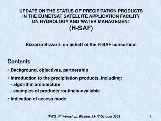
The EUMETSAT Satellite Application Facility on support to Operational Hydrology and Water Management (H-SAF) Bizzarro Bizzarri, on behalf of the H-SAF consortium Contents Background, objectives, partnership The products (precipitation, soil moisture, snow parameters)

E N D
The EUMETSAT Satellite Application Facility on support to • Operational Hydrology and Water Management (H-SAF) • Bizzarro Bizzarri, on behalf of the H-SAF consortium • Contents • Background, objectives, partnership • The products (precipitation, soil moisture, snow parameters) • The Hydrological validation programme • The stepwise development approach • Some focus on the precipitation processing chain IPWG, 3rd Workshop, Melbourne, 23-27 October 2006
Meteosat MetOp-EPS Other satellites (NOAA, TRMM, AQUA, ...) Ozone SAF Climate SAF Land SAF Nowcasting SAF New ! EUMETSAT Central Facility GRAS Meteo SAF Ocean & Ice SAF NWP SAF Hydrology SAF U S E R S SATELLITE APPLICATION FACILITIES (SAF’s): decentralised elements of the EUMETSAT Application Ground Segment IPWG, 3rd Workshop, Melbourne, 23-27 October 2006
BACKGROUND • In recent years, the interest of the hydrological community for using satellite • data has rapidly increased because of: • improved satellite data quality; • improved performance of hydrological models including their capability to assimilate observational data. • Steps towards the establishment of H-SAF: • 2000-2001: consultation among EUMETSAT Member and Cooperating States. • 2001-2002: Working Group on a Potential SAF (established objectives). • 2003-2004: SAF Hydrology Framework Working Group (defined scientific strategy and long term vision). • 2005: Proposal for the H-SAF Development Phase (2005-2010) delivered. • Development Phase approved by Council on 3 July 2005. • Status as of today: • Kick-Off meeting held on 15 September 2005. • Preliminary Design Review (PDR) (12-13 December 2006) being prepared. • The Operational Phase should follow in 2010-2015. IPWG, 3rd Workshop, Melbourne, 23-27 October 2006
Objectives of H-SAF • The objectives of H-SAF are: • to provide new satellite-derived products: • - precipitation (liquid, solid, rate, cumulate) • - soil moisture (at surface, in the roots region) • - snow parameters (cover, melting conditions, water equivalent); • to perform independent validation of the usefulness of the new products for hydrological applications. IPWG, 3rd Workshop, Melbourne, 23-27 October 2006
Composition of the H-SAF Consortium IPWG, 3rd Workshop, Melbourne, 23-27 October 2006
IPWG, 3rd Workshop, Melbourne, 23-27 October 2006
Satellite precipitation products and satellite data sources IPWG, 3rd Workshop, Melbourne, 23-27 October 2006
Coverage each 3 hours by polar satellites operational in 2006 NOAA-17(LST 10:24) (AMSU-A , AMSU-B) MetOp-1(LST 9:30) (AMSU-A , MHS) DMSP-17 (LST 5:30) (SSMIS) DMSP-16 (LST 8:15) (SSMIS) NOAA-18 (LST 14:00) (AMSU-A , MHS) IPWG, 3rd Workshop, Melbourne, 23-27 October 2006
DMSP-16 Data from lightning networks VIS/IR/MW images Meteorological maps Data from raingauge networks DMSP-17 NATO NOAA-17 REAL-TIME PRE- PROCESSING PRODUCT GENERATION SSM/I EUMETSAT SSMIS QUALITY CONTROL NOAA-18 MEMBERS AND AMSU-A AMSU-B COOPERATING MetOp-1 MHS STATES SEVIRI Meteosat-9 Database of precipitating cloud models Tools for product validation and improvement Radar images Feedback from National Civil Protection EOS/Aqua NASA Datasets of AMSR-E + AMSU-A + HSB Datasets of TMI + PR + LIS TRMM Functional concept of the processing chain for precipitation products generation IPWG, 3rd Workshop, Melbourne, 23-27 October 2006
Satellite soil moisture products and satellite data sources IPWG, 3rd Workshop, Melbourne, 23-27 October 2006
ASCAT coverage in 24 h. The close-to-nadir 700-km gap in between the two 500-km lateral swaths is not shown IPWG, 3rd Workshop, Melbourne, 23-27 October 2006
Functional concept of the processing chain for soil moisture IPWG, 3rd Workshop, Melbourne, 23-27 October 2006
MetOp ASCAT Global parameter database European parameter database ASCAT Processing Chain Global product Disaggregated product Additional datasets Quality control SM-OBS-1 – Soil moisture observed by radar scatterometer End-users and H-SAF central archive Surface soil moisture products generation chain IPWG, 3rd Workshop, Melbourne, 23-27 October 2006
SM-OBS-1 Satellite observations Conventional observations Integrated Forecast System Surface Data Assimilation System SM-ASS-1 - Soil moisture from ECMWF assimilation ZAMG product data base Volumetric soil moisture product generation chain IPWG, 3rd Workshop, Melbourne, 23-27 October 2006
Satellite snow products and satellite data sources IPWG, 3rd Workshop, Melbourne, 23-27 October 2006
AVHRR coverage in 6 h by NOAA-17, NOAA-18 and MetOp-1 MODIS coverage in 9 h by EOS-Terra and EOS-Aqua Coverage from AVHRR (in 6 hours) and MODIS (in 9 hours) during the Development Phase IPWG, 3rd Workshop, Melbourne, 23-27 October 2006
Data from in-field snow stations VIS/IR/MW images REAL-TIME PRE- PROCESSING AVHRR PRODUCT GENERATION EUMETSAT MODIS QUALITY CONTROL SEVIRI MEMBERS AND SSM/I AMSR-E COOPERATING ASCAT STATES DMSP-16 Vegetation, DEM, GIS Tools for product validation and improvement DMSP-17 NATO NOAA-17 NOAA-18 Meteosat-9 MetOp-1 EOS/Aqua EOS/Terra Functional concept of the processing chain for snow products Two similar chains active: in Finland for flat and forested areas in Turkey for mountainous regions. IPWG, 3rd Workshop, Melbourne, 23-27 October 2006
The hydrological validation programme • The hydrological validation programme must provide independent • assessment of the impact of the new data on operational hydrology. • Activities: • requirements analysis; • development of methodology and algorithms for products up-scaling, down-scaling, averaging over catchments etc.; • use of hydrological/hydrodynamic models for impact studies; • determination of the requirements for improvements of product algorithms; • validation of final products with use of hydrological models; • developments of methodology and algorithms for merging satellite products with other data sources; • creation of structure for on-going H-SAF products validation and quality assessment. IPWG, 3rd Workshop, Melbourne, 23-27 October 2006
Concept of the hydrological validation Cluster and its relation to Clusters 1-3 IPWG, 3rd Workshop, Melbourne, 23-27 October 2006
The hydrological validation programme will make use of test sites IPWG, 3rd Workshop, Melbourne, 23-27 October 2006
Measured precipitation Computed precipitation Computed soil moisture Computed snow parameters Measured soil moisture Measured snow parameters Assessment programme to evaluate the benefit of satellite-derived precipitation, soil moisture and snow information in European hydrology and water resource management Routine production of soil moisture data for systematic value assessment Development work for improved precipitation data quality Routine production of precipitation data for systematic value assessment Development work for improved snow data quality Development work for improved data assimilation schemes Development work for improved soil moisture data quality Space-time continuisation for grid data at specified times by assimilation Routine production of snow data for systematic value assessment Logic of the H-SAF Development Phase IPWG, 3rd Workshop, Melbourne, 23-27 October 2006
End-user feedback Augmented databases Advanced algorithms New instruments Initial databases Baseline algorithms Current instruments Cal/val programme Prototyping Version-1 Version-2 Final Version Operational End-users and Hydrological validation programme Logic of the incremental development scheme IPWG, 3rd Workshop, Melbourne, 23-27 October 2006
SCIENTIFIC USERS H-SAF Archive PROCESSING CENTRES INPUT DATA U-MARF Client Institutes in charge of hydrological validation (led by POLAND) U-MARF Coordination ITALY as Host Precipitation products observed and forecast ITALY Other R&D Institutes Satellites by direct read-out Soil moisture at surface layer AUSTRIA Dedicated links Various links Operational hydro services OPERATIONAL END-USERS Satellites via EUMETCast Soil moisture in roots region ECMWF Civil Protection operational units Local databases Meteorological services Products from other SAF’s Snow parameters in flat land, forests FINLAND Ancillary data locally available Snow parameters in mountain areas TURKEY NWP products and climatology Sketch system architecture of H-SAF IPWG, 3rd Workshop, Melbourne, 23-27 October 2006
LEO/MW + GEO/IR processing chain SSM/I – SSMIS processing chain AMSU – MHS processing chain Precipitation products generation chain DMSP F15 DMSP F16 NOAA, MetOp NOAA 17 NOAA 18, MetOp Meteosat 8 SSM/I SSMIS AMSU-A AMSU-B MHS SEVIRI Processor Processor Processor Processor Processor Processor PR-OBS-1 – Precipitation rate from LEO/MW PR-OBS-2 – Precipitation rate from blended LEO/MW and GEO/IR Accumulated precipitation processing chain PR-OBS-3 – Accumulated precipitation from LEO/MW and from LEO/MW+GEO/IR Quality control Quality control Quality control End-users and H-SAF central archive IPWG, 3rd Workshop, Melbourne, 23-27 October 2006
OFF-LINE ACTIVITY REAL-TIME ACTIVITY Meteorological events Cloud Resolving Model Actual SSM/I - SSMIS data (pre-processed) Ingestion preparation model Simulated cloud microphysics Radiative Transfer Model Precipitation retrieval model Simulated MW radiances Instrument model Uncertainty estimator model Flow chart of the SSM/I-SSMIS precipitation rate processing chain PRECIPITATION RATE ERROR ESTIMATE Cloud-Radiation Database Error structure database IPWG, 3rd Workshop, Melbourne, 23-27 October 2006
AMSU-A (48 km) AMSU-A (16 km) Cloud microphysics provision (database or in-line NWP model) TBD Geometrical manipulations (reduction to vertical viewing) PRECIPITATION RATE Extraction of high-spatial frequency content Retrieval algorithm (Bayesian or neural network) TBD AMSU-B or MHS (16 km) Flow chart of the AMSU-MHS precipitation rate processing chain IPWG, 3rd Workshop, Melbourne, 23-27 October 2006
SSM/I-SSMIS ~ 3-hourly sequence of MW observations Morphing algorithm AMSU-MHS Lookup tables updating PRECIPITATION RATE Rapid-update algorithm SEVIRI 15-min images Extraction of dynamical info Flow chart of the LEO/MW-GEO/IR-blending precipitation rate processing chain IPWG, 3rd Workshop, Melbourne, 23-27 October 2006
Precipitation rate from MW imagery every 3-4 hours (PR-OBS-1) Library of error structure of PR-OBS-1 PR-OBS-1 products archive PR-OBS-2 products archive PR-OBS-3 products generation Precipitation rate from MW+IR imagery every 15 minutes (PR-OBS-2) Library of error structure of PR-OBS-2 Accumulated precipitation over 24 h from MW only Accumulated precipitation over 24 h from MW + IR Accumulated precipitation over 12 h from MW + IR On-line meteorological information (surface wind and temperature, …) Accumulated precipitation over 6 h from MW + IR Accumulated precipitation over 3 h from MW + IR Flow chart of the accumulated precipitation processing chain IPWG, 3rd Workshop, Melbourne, 23-27 October 2006
DMSP F15 DMSP F16 NOAA, MetOp NOAA 17 NOAA 18, MetOp SSM/I SSMIS AMSU-A AMSU-B MHS Processor Processor Processor Processor Processor High resolution model synthetic radiances SSM/I – SSMIS processing chain AMSU – MHS processing chain 1D VAR Analysis Analysed precipitation rate (PR-ASS-1) Analysed hydrometeor profiles High resolution model Integration Snow water equivalent (experim.) Soil moisture (exp.) Forecast precipitation rate Accumulated precipitation PR-ASS-2 End-users and H-SAF central archive Precipitation and derived products by a meso-scale NWP model IPWG, 3rd Workshop, Melbourne, 23-27 October 2006
CONCLUSIONS • H-SAF could strongly expand the use of satellites in Hydrology. • The Development Phase (2005-2010) will: • make available new products (precipitation, soil moisture, snow parameters) in a pre-operational fashion; • progressively improve products quality through a continuous development programme parallel to the pre-operational activity; • independently assess the benefit of the new products through a hydrological validation programme. • Consequent to: • demonstrated feasibility and affordability of generating the new products; • demonstrated cost-effectiveness for application to Hydrology; • a possible Operational Phase (2010-2015) could follow. • Cooperation with IPWG is essential for H-SAF: • H-SAF is not for science: it is for implementing an operational application; • all algorithms being used or considered for use stem from IPWG activity; • for products cal/val it is envisaged to heavily rely on IPWG settlements. IPWG, 3rd Workshop, Melbourne, 23-27 October 2006