Download
1 / 31
310 likes | 395 Views
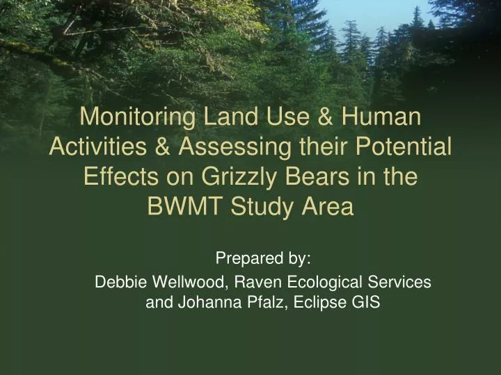
Monitoring Land Use & Human Activities & Assessing their Potential Effects on Grizzly Bears in the BWMT Study Area. Prepared by: Debbie Wellwood, Raven Ecological Services and Johanna Pfalz, Eclipse GIS. Phase 1.

E N D
Monitoring Land Use & Human Activities & Assessing their Potential Effects on Grizzly Bears in the BWMT Study Area Prepared by: Debbie Wellwood, Raven Ecological Services and Johanna Pfalz, Eclipse GIS
Phase 1 Preliminary Analysis of Road Development and Access and Proposed Framework for Monitoring
Land Use Planning Considered • Babine River Land Resource Use Plan (Babine LRUP, MOF and MELP 1994). • Kispiox LRMP (KLRMPT 1996, amended 2001), • Bulkley Land and Resource Management Plan (BVCRB 1998), • Babine Landscape Unit Plan (MOF 1999a), • Nilkitkwa Landscape Unit Plan (MOF 1999b), • Babine River Corridor Park Management Direction Statement (BC Parks 2000),
Land Use Planning Considered • Bulkley LRMP Higher Level Plan Order (Government of BC 2000), • West Babine Sustainable Resource Management Plan (MSRM 2004), and • Bulkley LRMP Objectives set by Government (ILMB 2006).
Framework • Monitor the implementation of selected land use plan strategies for identified indicators and targets specific to the prevention or mitigation of road-related impacts to grizzly bears. • Assess the risk to grizzly bears associated with road-related land use and human activities.
Objectives • Monitor implementation of land use planning strategies specific to grizzly bears. • Assess risk to grizzly bears. • Build on existing scientific knowledge • Provide a foundation that future studies and monitoring can build on.
Phase 1 • Preliminary GIS analysis of road (type, status, density). • Gather background information for framework development. • Explore road-related variables as potential indicators of risk. • Developed theoretical framework.
Phase 1 Deliverables • Part I – preliminary GIS analysis • Part II – proposed framework • Part III – proposed work plan and proposal (review draft versions) • Part IV – this presentation
Part I - GIS Results • 1,259.8 km road • Area = 4,024 km2 • Road density = 0.32 km/km2
Road Density Threshold • Road density 0.6 km/km2 estimated as moderate risk threshold value for roads through or adjacent to moderate/low value habitats for risk of grizzly bear mortality (Babine Watershed Monitoring Framework, Appendix 2 - Knowledge Base: Information used for Estimating Risk, Uncertainty and Probability of Success, Price and Daust 2004)
Shedin and Hanawald • Targets specify road density of less than 0.6 km/km2 for at least 80% of each watershed for timber harvesting activity occurring at any one time. Deactivated roads (i.e., not accessible by four-wheel drive vehicle) were not considered in this road density target/measure.
Preliminary Analysis • Preliminary analysis indicated that 95.8% of Hanawald Watershed (0.08 km/km2)and 94.8% of the Shedin Watershed (0.11 km/km2)sub-units had a total and active road density of less than 0.6 km/km2.
Other Watershed Sub-Units • Total road density and active road density were approaching or higher than threshold (>0.5 km/km2) in the Babine (Bulkley TSA), Nichyeskwa (Kispiox TSA) and Gail-Thomlinson (Kispiox TSA) watershed sub-units. • Red Flags
Preliminary Analysis • Risk to grizzly bears in these watershed sub-units and possibly other sub-units may be high. • Uncertainty associated with these results is also high, as the implementation and effectiveness of strategies to reduce or mitigate risk to grizzly bears associated with roads have not yet been explored.
Other Analysis Units • Total density of roads for Babine River Corridor Provincial Park, the Babine Special Management Zone, and the 300 m buffer surrounding the park • = Red Flags • Indicating further investigations are warranted including interviews and field studies to verify existing data and collect additional data.
Part II – Conceptualized Framework & Preliminary Study Design • Original proposal only looks at a few of the many factors that may negatively effect grizzly bears. • Study area specific empirical data very limited or none. • Need to rely on expert inputs. • Therefore, chose to broaden our field of view and look at the “Big Picture”
Narrowing the Scope • We then narrowed our focus to the area of interested to propose a study design • Specific to mortality risk to grizzly bears associated with road access
Framework • Assessment of implementation. • Assessment of risk of road-related grizzly bar mortality. With respect to risk assessment: • Proposed framework will provide a more defensible and credible product. • Given the lack of REAL data. This is important.
Implementation • Assessment can be done the same time as risk assessment. • Finalized methods will depend on decisions made about how to proceed with risk assessment in Phase 2
Risk Assessment • Open motorized road density, total motorized road density, and security core habitat based on methods used by Summerfield et al. (2004). • This component of the analysis can be used to document and follow trends in road development and access management over time.
Risk Assessment • Determine Mortality Risk Index for Bear Management Units within the framework developed for Cumulative Effects Model developed by the USDA Forest Service (1990) and adapted by MacHutchon (1998). • Information gathered can be used to support implementation monitoring and increase understanding re: risk factors in study area.
Acquisition of Expert Input: Delphi Survey Process • To support development of various aspects of study design and models. • Poll several experts who are asked a series of questions; • Experts respond, providing rationale for their response; and • Expert reviews aggregate responses and revises original response based on the responses and rational from other experts.
Benefits • Provides a process for soliciting expert knowledge and opinions. • Perhaps most importantly, can be used to define levels of agreement. • Provides much greater credibility.
Recommendations for Phase 2 • We recommend the trust review the results of Phase 1….Workshop? • Decide extent and direction for Phase 2. • Determine funding and in-kind resources that will be pursued through proposal and/or request to various stakeholder/agencies.
This could include: • Update road data for the Bulkley Forest District. First Priority • Complete interviews and field investigations to verify and update road data sets and collect addition data. • Based on the results from points 1 and 2, assess the implementation of access-related strategies.
This could include: • Complete an analysis of open & total motorized density & security core habitat. • Complete mortality risk sub-model with mortality risk index. Recommend focusing on road-related aspects of this model to start. • Based on the results from points 1 to 5, evaluate effectiveness & uncertainties.