Download
1 / 61
620 likes | 764 Views
Digital Watersheds. David R. Maidment Center for Research in Water Resources University of Texas at Austin. Waters Network Meeting Baltimore, Oct 23, 2007. Collaborators. San Diego Supercomputer Center Ilya Zaslavsky , David Valentine, Tom Whitenack Utah State University

E N D
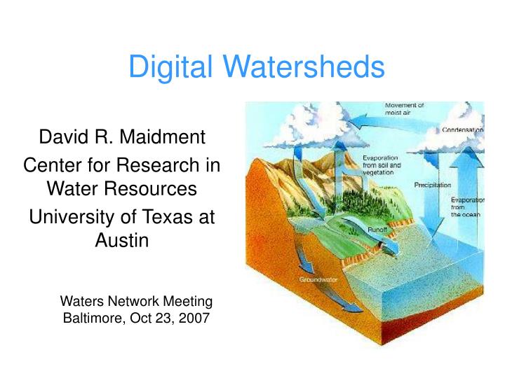
Digital Watersheds David R. Maidment Center for Research in Water Resources University of Texas at Austin Waters Network Meeting Baltimore, Oct 23, 2007
Collaborators • San Diego Supercomputer Center • Ilya Zaslavsky, David Valentine, Tom Whitenack • Utah State University • David Tarboton, Jeff Horsburgh, Kim Schreuders • Drexel University • Michael Piasecki, Bora Beran, Yoori Choi • University of South Carolina • Jon Goodall
Additional Collaborators • Environmental Systems Research Institute • Dean Djokic, Zhumei Qian, Zichuan Ye, Christine Dartiguenave, Clint Brown, Steve Kopp • National Center for Atmospheric Research • David Gochis, Larry Winter • Unidata, Boulder, CO • Jon Caron, Ben Domenico • University of Texas at Austin • Tim Whiteaker, Cedric David, Ernest To, Nishesh Mehta
Formal Publication of Data • Collin Bode: “Right now we don’t have a mechanism for someone to publish a dataset: how do you give credit for a well groomed dataset?” • Johnnie Moore: “Where is the archiving process? Where is the common data held and how will it be accessed? HIS is not pulling their data into one place – do we need a centralized location/server for all data?” Need a peer review process for data Academic science is project based. What happens when the project ends?
Digital Watershed How can hydrologists integrate observed and modeled data from various sources into a single description of the environment?
Digital Watersheds • Requirements • Principles • Arc Hydro • NHDPlus • Modeling
Digital Watersheds • Requirements • Principles • Arc Hydro • NHDPlus • Modeling
Requirements • Hydrologic synthesis: (Günther Blöschl, WRR 2006) is needed across • Processes: interacting dynamic systems including feedbacks between components • Places: plethora of case studies around the world in past decades • Scales: general characteristics of processes as a function of space and time scales for the same site or an ensemble of sites
Digital Watershed Framework • Must be independent of process, place and scale so that • It can be implemented for any process at any place at any scale; • It can be used to link processes, compare places, and integrate across scales • Hydrology of a dynamic earth • Human impact on landscape • Need to think of evolution of critical zone in geologic time
Ilya Zaslavsky
Robust DW representation: formal requirements • Standard platform- and software-independent template • both computer and human-readable • Can materialize DW into common open or vendor-specific documents or services (e.g. geodatabases, map services, SOAP services) from both local and remote data and models • Expresses how DW integrates different types of data objects from lower levels (data layers, services, real time streams, etc., processes and models, regulatory framework): various spatio-temporal or attribute join models (integration models) • Support DW analsys for completeness (data gaps), consistency (projections, formats, temporal reference), availability of integration models • ease of integration with other emerging digital representations (digital estuary, etc.) • compatibility with CI: ontology support, SOA-reliance, XML representation of sources. • evolving and flexible: ease of update as new knowledge or data sources become available
GetSites GetSiteInfo GetVariables GetVariableInfo GetValues Hydrologic Information Server WaterOneFlow services DASH – data access system for hydrology ArcGISServer Geospatial Data Observations Data Microsoft SQLServer Relational Database
Synthesis models in DW • Co-location in space: boundaries of most data layers are defined by watershed boundaries • Other types: based on functional relationships between watershed parameters (atmospheric, groundwater flows, underlying geology, as well as demographic and economic variables and processes that don’t necessarily coincide with natural boundaries). • For example: pointing to conditions upstream and downstream • DW representation must explicitly include the types of joins between different watershed elements, to make automatic instantiation and update of digital watersheds possible. DW as a system of integrated views.
Digital Environments • Digital watershed is one of several constructs that describe particular water environments • Others are digital atmosphere, digital lake, digital river, digital reach, digital snowpack, digital soil, digital aquifer, digital estuary, digital bay We need a set of principles for design of digital environments and ways to trace the movement of water among them
Digital Watersheds • Requirements • Principles • Arc Hydro • NHDPlus • Modeling
What Have We Learned? Network : Site -- Sites have meaning within an observation network and are indexed with Site Codes. Site Value (Time) Variable Vocabulary : Variable -- Variables have meaning within a vocabulary and are indexed with Variable Codes.
Site Value (Time) Variable Generalize the observations information model Site Code Variable Code An environment is described by a set of spatial features Indexed by Hydro Code Location Value (Time) A process is described by a set of variables Indexed by Variable Code Variable
Feature Observations Data Model Waterbody Watershed HydroPoint HydroID HydroID HydroID HydroCode HydroCode HydroCode * FType DrainID FType Name AreaSqKm Name AreaSqKm JunctionID JunctionID JunctionID NextDownID * * ComplexEdgeFeature SimpleJunctionFeature HydroEdge HydroJunction HydroJunction HydroJunction 1 HydroID 1 HydroID HydroID HydroID HydroCode HydroCode HydroCode HydroCode ReachCode NextDownID NextDownID NextDownID Name LengthDown LengthDown LengthDown LengthKm HydroNetwork DrainArea DrainArea DrainArea LengthDown FType FType FType FlowDir Enabled Enabled Enabled FType AncillaryRole AncillaryRole AncillaryRole EdgeType Enabled EdgeType Flowline Shoreline Definition: A Digital Watershed is the electronic representation of the watershed representing the synthesis of both the data and the spatial representation of the data Digital Watershed Geography Model ODM 1 Sites 1 SiteID SiteCode SiteName OR Latitude Longitude … CouplingTable 1 SiteID HydroID 1
Digital Watersheds • Requirements • Principles • Arc Hydro • NHDPlus • Modeling
Drainage System Hydro Network Flow Time Time Series Hydrography Channel System Arc Hydro Components HydroID HydroID
Arc Hydro: GIS for Water Resources Published by ESRI Press The Arc Hydro data model and application tools are in the public domain
Data Integration Based on Behavior “Follow a drop of water from where it falls on the land, to the stream, and all the way to the ocean.” R.M. Hirsch, USGS
Integrating Data Inventory using a Behavioral Model Relationships between objects linked by tracing path of water movement
Arc Hydro II – one water model Groundwater features Surface water features Time Series
Linking surface water and groundwater data Hydrovolumes and Geovolumes Hydro network Aquifers In the future go to 3D...
Digital Watersheds • Requirements • Principles • Arc Hydro • NHDPlus • Modeling
Scales of Representation of Drainage Systems Basins: Administratively chosen drainage areas Watersheds: A tesselation of a basin for a particular purpose Catchments: A tesselation of a basin using physical rules NHDPlus Digital Elevation Model: a representation of the land surface as a spatial continuum
3-D detail of the Tongue river at the WY/Mont border from LIDAR. Roberto Gutierrez University of Texas at Austin
NHDPlus Reach Catchments ~ 3km2 Average reach length = 2km 2.6 million reaches for continental US About 1000 reach catchments in each 8-digit HUC
Slope Elevation Mean annual flow Corresponding velocity Drainage area % of upstream drainage area in different land uses Stream order Reach Attributes
Mean Annual Flow on NHDPlus Mean Annual Flow and Velocity for each reach is estimated Percentile distributions of flow are given for stream gage locations
BaseFlow Index on NHDPlus BaseFlow Index estimates the proportion of the mean annual flow that comes from groundwater
NLCD is a classification of land cover by USGS into 21 classes NHDPlus Catchments have attributes of the % of each land cover class in their local area NHDPlus Flowlines are attributed with their % land cover class from their total upstream watershed NHDPlus and National Land Cover Dataset (NLCD)
NLCD Land Change 1992 Land Cover 2001 Land Cover USGS is putting out in December 2007 a new Land Change product which consistently classifies 30m Landsat imagery from 1992 and 2001 and produces a pixel by pixel accounting of land cover change in 7 land cover categories
NHDPlus has elevation attributes on streams Longitudonal Stream Bed Profile
Arc Hydro connects geospatial and temporal water resources data Streamflow Arc Hydro NHDPlus Weather
Digital Watersheds • Requirements • Principles • Arc Hydro • NHDPlus • Modeling
Hydrologic Simulation • How do we enable a “community” approach to models? A framework, concept with open source tools? • The NCAR approach – very large computing resources operating over a complex modeling framework (CCMP) • The OpenMI approach – making existing models interoperable and creating model services
Hydrologic Simulation • How do we enable a “community” approach to models? A framework, concept with open source tools? • The NCAR approach – very large computing resources operating over a complex modeling framework (CCMP) • The OpenMI approach – making existing models interoperable and creating model services
Climate Model – Hydrology Linkage Cedric David, David Gochis (NCAR) Atmospheric Data (NARR+NEXRAD) Land Surface - Atmosphere Model (NOAH) Stream and River Flow Model
NOAH Land Surface ModelLand – atmosphere processes 900 m resolution in our study Noah is fully coupled with WRF (North American Model) First version in 1999
NOAH-Distributed adds Land Surface Routing processes • Overland flow routing: fully unsteady, explicit, finite difference, 2-dimensional diffusive wave flowing over the land surface • Subsurface runoff: 'Shallow' groundwater flow (down to 2m depth) explicitly modeled using a quasi-steady state saturated flow model 30 m resolution in our study
Sphere-spheroid conversion Atmospheric sciences Hydrology Latitude is different Earth is a Sphere Earth is a Spheroid
Running NOAH-D over NHDPlus at NCAR • NHDPlus • Elevation • NARR • Downward radiations • Temperature • Wind • Pressure • Humidity • Soil moisture • Runoff • Upward radiations • Evapotranspiration • etc. • Ideal precipitation Conclusion is that there is greater granularity in the landscape than in the atmosphere and land – atmosphere model needs to be adapted to NHDPlus not the reverse 30 m land surface routing 900 m land/atmosphere interaction
Hydrologic Simulation • How do we enable a “community” approach to models? A framework, concept with open source tools? • The NCAR approach – very large computing resources operating over a complex modeling framework (CCMP) • The OpenMI approach – making existing models interoperable and creating model services
Project sponsored by the European Commission to promote integration of water models within the Water Framework Directive • Software standards for model linking • Uses model core as an “engine” • http://www.openMI.org
Time, T D Space, L Variables, V OpenMI Conceptual Framework All values are referenced in a what-where-when framework, allowing different data resources or models to communicate data VALUES An application of the data cube to integrate simulation models Jon Goodall, University of South Carolina