Download
1 / 20
200 likes | 295 Views
Conflation of aquatic habitat data for linking stream and landscape features. Mindi Sheer, NOAA fisheries – Northwest Fisheries Science Center, Seattle Bernard Catalinotto – DES, Maryland. Conflation. SOURCE -GOOD ATTRIBUTES. TARGET GOOD LINEWORK. RESULT BEST ATTRIBUTES & LINEWORK.

E N D
Conflation of aquatic habitat data for linking stream and landscape features Mindi Sheer, NOAA fisheries – Northwest Fisheries Science Center, Seattle Bernard Catalinotto – DES, Maryland
Conflation SOURCE -GOOD ATTRIBUTES TARGET GOOD LINEWORK RESULT BEST ATTRIBUTES & LINEWORK What is “GIS Data Conflation?” Combining attributes and arcs, polygons, or points of two GIS files to create a third, best-case data set. • The first dataset is the “source” • The second dataset is the “target” • The combination of source + target is the “result”
Conflation software requires three major steps: SOURCE TARGET • Automatically match corresponding arc nodes • Automatically match corresponding arcs within user-defined distance • Check and fix errors
Objectives • GIS data conflation • How conflation is applied to hydrographic datasets • Watershed case study • Use of conflation • Habitat study results • Benefits and “caveats” of conflating • Recommendations
GIS Data Conflation - Example • US Census Bureau: • Realigning 50 million TIGER file road & hydro arcs, 3200 counties Target – 1:6,000 & 1:2,000 (photogrammetry) Source – 1:100,000 DIME (1970)
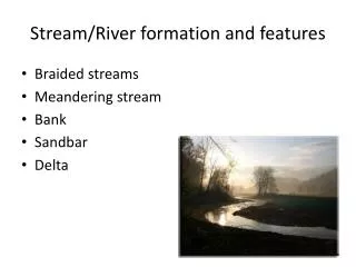
Why conflate streams? • Highly variable spatial representation of stream features • Limitations in positional accuracy, density, and sinuousity of 100k streams, can result in inaccurate results Multiple methods & sources of stream hydrography
Stream Length 100k streams Stream density Stream sinuousity
Project Background The challenge: 1. Stream hydrography & land cover to correlate landscape & fine-scale stream morphology 2. Validation of DEM-based modeled stream Sources: Oregon Dept. of Fish and Wildlife Surveys (1:100,000) DEM hydro (1:24,000)
TARGET: DEM-derived 24k reach-segmented streams • SOURCE: Oregon Department of Fish and Wildlife (ODFW) segmented field data
Conflation Results • All source (survey data) successfully transferred • Target DEM reaches were subdivided to reflect relative arc length of the habitat unit • Small amount of stretching of arcs at the unit scale
Also… • 10% of the data had “0” arc lengths (dyn segmentation) • “0” length channels were secondary channels to the main stream (important as salmon rearing habitat)
0-5 m Count (# arcs) -5-0 m Difference in conflated length (m) Habitat Results • Length differences (+ 9%): • 1639 km (New) • 1507 km (Survey) • 85% of conflated stream units +/- 10 m • New lengths matched calibration info
Model Validation - Gradient Molalla Field slope Model slope North Santiam
Conclusions • Benefits • Provides substantial benefits to ecological studies • Allows automated and manual processing • Data was validated effectively • Results had higher confidence than if conflation had not been used • Costs • Conflation was performed at low cost for major project (80,000 features) • Recommendations • Recommend researchers consider using conflation on their multi-scale projects
Feel free to contact Us…. • Mindi Sheer • NOAA • Mindi.Sheer@noaa.gov • 206-860-3428 • Bernard Catalinotto • Data Enhancement Services, LLC • bcatalinotto@gisdes.com • 301-717-1077