Download
1 / 1
10 likes | 87 Views
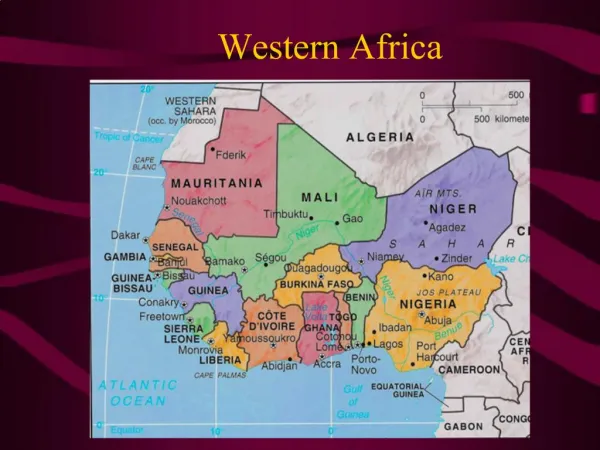
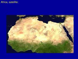
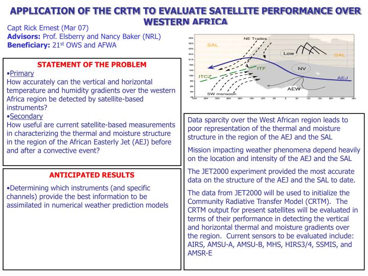
APPLICATION OF THE CRTM TO EVALUATE SATELLITE PERFORMANCE OVER WESTERN AFRICA. Capt Rick Ernest (Mar 07) Advisors: Prof. Elsberry and Nancy Baker (NRL) Beneficiary: 21 st OWS and AFWA. STATEMENT OF THE PROBLEM Primary

E N D
APPLICATION OF THE CRTM TO EVALUATE SATELLITE PERFORMANCE OVER WESTERN AFRICA Capt Rick Ernest (Mar 07) Advisors: Prof. Elsberry and Nancy Baker (NRL) Beneficiary: 21st OWS and AFWA • STATEMENT OF THE PROBLEM • Primary • How accurately can the vertical and horizontal temperature and humidity gradients over the western Africa region be detected by satellite-based instruments? • Secondary • How useful are current satellite-based measurements in characterizing the thermal and moisture structure in the region of the African Easterly Jet (AEJ) before and after a convective event? • Data sparcity over the West African region leads to poor representation of the thermal and moisture structure in the region of the AEJ and the SAL • Mission impacting weather phenomena depend heavily on the location and intensity of the AEJ and the SAL • The JET2000 experiment provided the most accurate data on the structure of the AEJ and the SAL to date. • The data from JET2000 will be used to initialize the Community Radiative Transfer Model (CRTM). The CRTM output for present satellites will be evaluated in terms of their performance in detecting the vertical and horizontal thermal and moisture gradients over the region. Current sensors to be evaluated include: AIRS, AMSU-A, AMSU-B, MHS, HIRS3/4, SSMIS, and AMSR-E • ANTICIPATED RESULTS • Determining which instruments (and specific channels) provide the best information to be assimilated in numerical weather prediction models