Download
1 / 11
110 likes | 203 Views
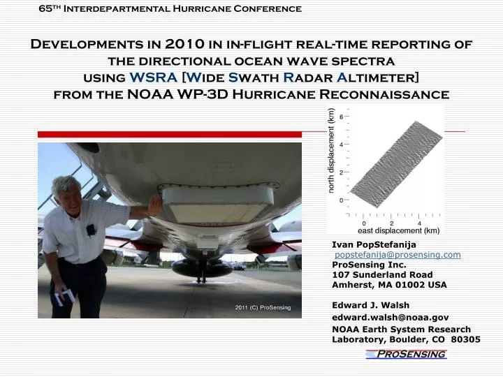
65 th Interdepartmental Hurricane Conference. Developments in 2010 in in-flight real-time reporting of the directional ocean wave spectra using WSRA [ W ide S wath R adar A ltimeter] from the NOAA WP-3D Hurricane Reconnaissance. Ivan PopStefanija popstefanija@prosensing.com

E N D
65thInterdepartmental Hurricane Conference Developments in 2010 in in-flight real-time reporting of the directional ocean wave spectra using WSRA [Wide Swath Radar Altimeter] from the NOAA WP-3D Hurricane Reconnaissance Ivan PopStefanija popstefanija@prosensing.com ProSensing Inc. 107 Sunderland Road Amherst, MA 01002 USA Edward J. Walsh edward.walsh@noaa.gov NOAA Earth System Research Laboratory, Boulder, CO 80305
Operational WSRA • Why? • Mapping ocean wave height (surface topography) • Measurement of ocean directional wave spectra • Real-time reporting of 12-foot seas radius • Improved forecasting of hurricane development • Verification of various ocean wave models • Operational, targeted measurements of storm surge for land falling hurricanes 65th Interdepartmental Hurricane Conference
Technology Description: • Digital beam-forming antenna • Microstrip planar antenna array • Comprised of 62 sequentially-sampled subarrays • Size: 30 in x 30 in x 2 in • Transmitter • 20 W solid-state transmitter • Pulse compression processing • Compression ratio of 1000:1 (at a flight altitude of 500 m) to over 6000:1 (at a flight altitude of 3 km) • 10-60 kW effective peak power • Digital Receiver • WSRA DAQ Hardware: Echotek ECDR-2-12210-PMC 210 digitizer embedded in a single board dual core Pentium processor 65th Interdepartmental Hurricane Conference
WSRA highlightsthe 2010 Hurricane Season • Test flight on March 3rd 2010 [Partial success!] • Testing WSRA data quality against the varying aircraft parameters: flight altitude, pitch, roll, and cross-track movement of the aircraft (caused by flight level winds) using specified flight patterns. • Nuisance – Repair of WSRA transmitter hardware • Delayed installation WSRA on WP-3D until end of August. • WSRA missed the flights into Earl • Flight on 9/16/2010 into CAT-1 Hurricane Karl • All the parts of the WSRA software were successfully tested, including the transmission of data to AOC • Performance during flight of both software and hardware have shown the feasibility of fully-automated unattended operational WSRA 65th Interdepartmental Hurricane Conference
WSRA software developments • Implementation of the processing algorithm for unattended in-flight execution • Multi-threaded C application executed on a multi-core PC processor • WSRA algorithm improvements: • Antenna beam-pointing angle adjustment factor calculated based on the estimation of the antenna width distortion caused by the lateral movement of the aircraft during the data integration time • Incremental (looped) estimation of the range-to-surface weighed by the range estimates in the neighbouring beams • Automatic adjustment of WSRA radar parameters as the auxiliary-reported aircrafts altitude changes • Streamlining and automating the backend processing, which estimates the ocean wave directional spectra from the surface elevations • Development of the software for transmission of data products from the NOAA P-3 to NHC via satellite internet link. 65th Interdepartmental Hurricane Conference
Flight into KarlLessons learned • All the parts of the WSRA software were successfully tested, including the transmitting of the data to AOC • WSRA hardware can sustain data processing in real-time • Several adjustments to various processing parameters to improve the robustness of the unattended operation of the WSRA system • Hardware issues that occurred during the flight led us to the re-design of the WSRA electronics (RF section), which was completed in the post-season • Necessity to receive additional auxiliary information from the aircraft’s data system. Updated information on the eye fixes and/or VORTEX messages • Frequency of reporting wave spectra to NHC should be variable depending on the aircraft distance from the eye of the hurricane • Wave spectra products updated should vary between 5 minutes at the edge of the hurricane to 30 minutes while flying through eye of the hurricane 65th Interdepartmental Hurricane Conference
Flight into KarlMost important lesson learned • Operating from 12,000 feet provides WSRA data with marginal quality. For good quality WSRA data the aircraft’s altitude should not exceed 10,000 feet. • Good quality data critical for unattended operation – no human editing available • Rain attenuation more detrimental • Cleaner topography and better wave spectra at 8,000’ altitude as opposed to 12,000’ • Note to the NOAA flight director: We recommend / request flying at 8,000 feet when operating WSRA. Hurricane Karl 16 SEP 2010 3.8 km altitude Hurricane Ike 11 SEP 2008 2.4 km altitude 65th Interdepartmental Hurricane Conference
WSRA Transfer & Display data products at NHC • From onboard FTP site WSRA spectra automatically transmitted to FTP site at AOC • WSRA data transmission from aircraft while on ground was successful • WSRA data transmission from aircraft in-flight tested, but data received at AOC were scrambled. Need additional testing to identify the problems • For the next hurricane season, AOC will incorporate the WSRA data into their standard aircraft data package • WSRA application running at NHC on the JHT server (Muskie) download spectra as they become available on the AOC FTP site. • Not tested with live data; successfully tested in simulation • WSRA data displayed on NMAP2 within NAWIPS • Not tested with live data; successfully tested in simulation Transfer scripts and display developed and tested under JHT Funding FY08 to Dr. Walsh 65rd Interdepartmental Hurricane Conference
Poster IComparison wave spectra from Hurricane Ike from model Wave Watch III with WSRA data • The poster will show segments of WSRA wave topography throughout Hurricane Ike and detailed comparisons of the resulting directional wave spectra with the WW3 model predictions. • For most parts of Hurricane Ike, the WSRA and WW3 SWH values were nearly the same. WW3 SWH averaged 1.2% lower with a standard deviation of 4%. • Recently modified WSRA algorithm used to estimate range-to-surface in all beams-produced wave spectra with lower wave heights estimates, thus making the difference even smaller then 1%. 65th Interdepartmental Hurricane Conference
Poster II Storm Surge Measurement Potential of the Wide Swath Radar Altimeter • Capability of providing operational, targeted measurements of storm surge for landfalling hurricanes • Measurement of storm surge consist of subtracting the absolute altitude of the aircraft determined using the Global Positioning System (GPS) from the WSRA-measured distance to the sea surface • Absolute range calibration of the WSRA can be determined and maintained during the flights using tide gauges within Tampa Bay when returning from each operation as well as flying by tide gauges in the vicinity of the landfall ERES =RWSRA - hGPS - C Left panel shows contours of geodic height relative to the ellipsoid in the Tampa Bay area. Right panel shows the GPS measured aircraft height above the ellipsoid along the straight 5-km flight segment yellow-highlighted in the left panel. Curves show the aircraft pitch (blue) and roll (red) variation for the highlighted flight segment over Tampa Bay and dots represent the residual error ERES as defined in equation above . 65th Interdepartmental Hurricane Conference
WSRA Development Funded by JHT ProgramTitle: In-Flight Data Processing for the Wide Swath Radar Altimeter (WSRA) for Real Time Reporting of Directional Ocean Wave Spectra from the NOAA WP-3D Hurricane Reconnaissance Aircraft • Continued analysis of data collected during the 2008 season (storms Fay, Gustav and Ike) to aid development of the optimized WSRA processing code. • Development of the WSRA algorithm to extract range-to-surface during significant roll maneuvers of the aircraft of the roll correction • Acquisition of the in-flight processing computer • Spring 2011 verification test flight (repeat of the test flight on March 2010 ) • Testing WSRA data quality against the varying aircraft parameters • Testing transmission of data products from the NOAA P-3 to NHC via satellite internet link. • Support of the WSRA operation during the 2011 hurricane season • Conduct absolute range calibration of the WSRA on flight approaches to the McDill AFB • Completion of a turnkey WSRA system development • Operation of the turnkey antonymous WSRA during the 2011 hurricane season Unattended processing on the Fly is The End 65rd Interdepartmental Hurricane Conference