Download
1 / 77
780 likes | 889 Views
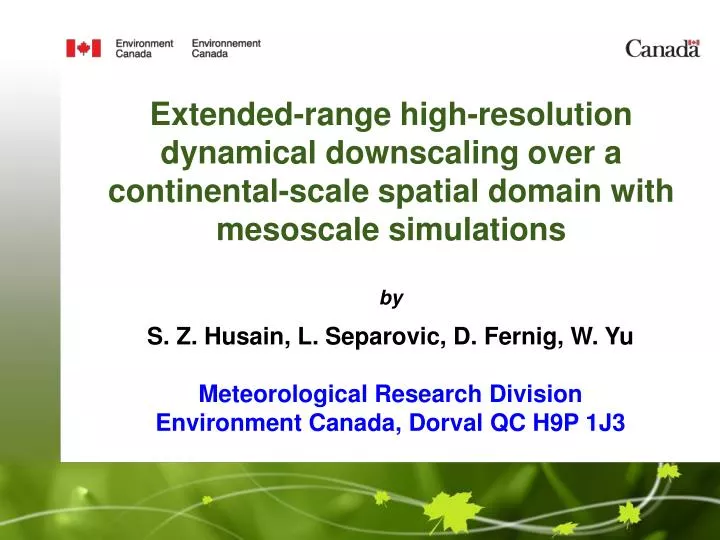
Extended-range high-resolution dynamical downscaling over a continental-scale spatial domain with mesoscale simulations. by S. Z. Husain, L. Separovic, D. Fernig, W. Yu Meteorological Research Division Environment Canada, Dorval QC H9P 1J3. Motivations.

E N D
Extended-range high-resolution dynamical downscaling over a continental-scale spatial domain with mesoscale simulations by S. Z. Husain, L. Separovic, D. Fernig, W. Yu Meteorological Research Division Environment Canada, Dorval QC H9P 1J3
Motivations • High-resolution multi-year time series of surface-layer meteorological fields are of tremendous interest to weather-dependent energy industries. • Canadian Wind Energy Association (CanWEA) targets to generate 20% of Canada's electricity from wind by 2025. • CanWEA has commissioned Pan Canadian Wind Integration Study (PCWIS) to - analyse multi-year wind speed time series - devise plan for large scale wind energy integration • EC is responsible for generating the time series data for PCWIS.
Basic Dynamical Downscaling Strategy CMC Regional Analysis (6hrs interval) 15-km resolution Geophysical fields 15 km GEM-LAM simulations Forcing files are generated every 20 min 2 km GEM-LAM simulations 2-km resolution Geophysical fields Final outputs
15-km and 2-km ResolutionSimulations Domains Orography (m) 15-km GEM-LAM simulation domain 480x300 grid cells 2-km GEM-LAM simulation domain 3000x1800 grid cells
Issues to be addressed • Controlling large-scale deviation of the atmosphere (with LAM-15 simulations). • Addressing deviations of evolving surface fields (with LAM-15 simulations). • Extending findings of LAM-15 test simulations to LAM-2 simulations. • Propose optimal configurations for dynamical downscaling.
Atmospheric large-scale deviations:The biggest challenge • Atmospheric large-scales can deviate during dynamical downscaling primarily due to - Large spatial domain - Extended length of temporal integration • The problem may be separated into multiple periods of sufficiently small time-frames (e.g. NREL did in the US). - May lead to abrupt changes in time-series after temporal blending. - Would require additional computational time for spin-up of clouds not present in CMC regional analysis.
Atmospheric large-scale deviations:The biggest challenge • The problem may be separated into multiple simulations over smaller domains for extended periods (e.g. NREL did in the US). - May lead to discontinuities in the meteorological fields along the lateral boundaries of the small domains due to spatial blending. - The domains cannot be arbitrarily small for proper development small scales and to avoid small-scale variance deficiency. • Overall, continuous temporal integration over the entire spatial domain appears to be the most feasible approach, provided a mechanism is put in place to control large-scale deviations.
Similarity of scales • Similarity for a meteorological field Ψ between the model outputs and the driving fields for a simulation time t and scale of interest L, is computed as where <> is spatial average (Storch et al. 2000). • The length scale L is separated using Discrete Cosine Transform based spectral filter. • For large scales higher degree of similarity is desirable, i.e., P(t,L) should be close to 1. • Small scales between the driving and the driven fields should ideally be different.
Large-scale similarities between LAM-15 CONTROL and CMC regional analysis For scales larger than 450 km (Feb 1 – Mar 2, 2010) (Jun 10 – Jul 9, 2010)
Large-scale similarities between LAM-15 CONTROL and CMC regional analysis For scales larger than 450 km (Feb 1 – Mar 2, 2010) (Jun 10 – Jul 9, 2010) Significant drop Significant drop
Small-scale similarities between LAM-15 CONTROL and CMC regional analysis For scales smaller than 450 km (Feb 1 – Mar 2, 2010) (Jun 10 – Jul 9, 2010)
Estimating the impact on screen-level scores • Total number of stations is 898. • Only Canadian stations are included for evaluation. • 100 m elevation difference permitted between model and observation. • Statistical analyses using USTAT (Marcel Vallée).
Screen-level scores REG FORECAST LAM-15 CONTROL Winter (Feb 1 – Mar 2, 2010) Dew point temp Dew point temp Temperature Temperature Wind speed Wind speed
Screen-level scores REG FORECAST LAM-15 CONTROL Summer (Jun 10 – Jul 9, 2010) Dew point temp Dew point temp Temperature Temperature Wind speed Wind speed
Controlling large-scale deviations:Some basic assumptions • Smaller scales are preconditioned by the large-scales. • Large-scale features of the driving field (CMC analysis for LAM-15, and LAM-15 outputs for LAM-2) are assumed to be more reliable. • Influence of smaller scales on the large scales are insignificant.
Selection of nudging parameters:Nudging length scale • Selection of nudging length scales λLand λS requires - Comparison of variance spectra of analysis and model fields - A soft/gradual cut-off of scales between λLand λS • Filter applied on the 2D DCT to obtain the DCT of the filtered field • It’s followed by inverse DCT. 2D DCT 2D filter fF λS λL
Controlling large-scale deviations:Nudging of simulation outputs • A meteorological field Ψ at a given vertical level is nudged using the following relation Vertical profile of nudging Nudging term Spatial scale of interest Mesoscale simulation output Driving field Relaxation time
Controlling large-scale deviations:Nudging of simulation outputs • A meteorological field Ψ at a given vertical level is nudged using the following relation Vertical profile of nudging Nudging term Spatial scale of interest defined by λL and λS . Mesoscale simulation output Driving field Relaxation time • Nudging term is expanded in the spectral space to have better control over scale selection for retaining. • Spectral decomposition is based on 2D DCT.
Variance SpectraAveraged over two days (Feb 1-2, 2010) CMC Regional Analysis LAM-15 CONTROL LAM-2 CONTROL
Variance SpectraAveraged over two days (Feb 1-2, 2010) CMC Regional Analysis LAM-15 CONTROL LAM-2 CONTROL
Sensitivity of different nudging parameters • Sensitivity tests are conducted to identify an optimal nudging strategy by investigating - Different nudging vertical profiles β(ζ) - Different temporal relaxations τ(t) - Different nudging length scales, λSand λL • Only temperature and horizontal wind are nudged. • Different test configurations are denoted as follows N# T# S# Nudging scale Temporal relaxation Nudging vertical profile
Different nudging vertical profiles • General profile shape is given by where
Different temporal relaxations Relaxation time scale • General form: Temporal weighting function where with m=0,2,4,6,… Time interval between two consecutive driving fields • T1: Constant weak relaxation tR=tD and m=0, i.e., ω(t)=1 • T2: Variable strong relaxation tR=Δt and m=2 1/τ • T3: Variable weak relaxation tR=tD and m=2 tD
Different nudging length scales • S1: λS=100 km and λL=300 km • S2: λS=225 km and λL=450 km • S3: λS=350 km and λL=700 km
Sensitivity: Nudging vertical profileVariance ratio (LAM-15/Analysis) Winter Feb 1 – Mar 2, 2010 LAM-15 N1T1S1 LAM-15 N2T1S1 LAM-15 N3T1S1
Sensitivity: Nudging vertical profileSimilarity LAM-15 N1T1S1 LAM-15 N2T1S1 LAM-15 N3T1S1 Winter (Feb 1 – Mar 2, 2010) Large scales (at 500 hPa) Small scales (at 850 hPa)
Sensitivity: Nudging vertical profileScreen-level scores Winter (Feb 1 – Mar 2, 2010) REG FORECAST LAM-15 CONTROL LAM-15 N1T1S1 LAM-15 N2T1S1 LAM-15 N3T1S1 Dew point temp Dew point temp Temperature Temperature Wind speed Wind speed • Overall N3 is selected as optimal for the next tests.
Sensitivity: Temporal relaxationVariance ratio (LAM-15/Analysis) Winter Feb 1 – Mar 2, 2010 LAM-15 N3T1S1 LAM-15 N3T2S1 LAM-15 N3T3S1
Sensitivity: Temporal relaxationVariance ratio (LAM-15/Analysis) Winter Feb 1 – Mar 2, 2010 LAM-15 N3T1S1 LAM-15 N3T2S1 LAM-15 N3T3S1
Addressing variance deficiency • Strong nudging only at times when driving fields are available - May lead to abrupt changes in time series. - Increasing m will have similar impact. • Computing hourly analysis estimates from RDPS outputs or by running LAM-15 simulations. - More effective but computationally expensive.
Addressing variance deficiencyEstimating hourly equivalent of analysis (ΨA)06 (ΨA)00 Input Six hourly simulation output (ΨM)00-00 (ΨM)00-01 (ΨM)00-02 (ΨM)00-03 (ΨM)00-04 (ΨM)00-05 (ΨM)00-06 Error, ε00-06 = (ΨM)00-06 - (ΨA)06 For linear growth of error, ε00-0N = (N/6) ε00-06 Therefore, hourly analysis estimate, (ΨA)0N = (ΨM) 00-0N - ε00-0N
Addressing variance deficiencyComparison of different approaches LAM-15 N3T2S1 LAM-15 N3T2S2_M6 [with m=6] LAM-15 N3T2S3_HA [with hourly analysis estimates] Averaged over five days (Feb 1 -5, 2010)
Sensitivity: Temporal relaxationSimilarity LAM-15 N3T1S1 LAM-15 N3T2S1 LAM-15 N3T3S1 Winter (Feb 1 – Mar 2, 2010) Large scales (at 500 hPa) Large scales (at 500 hPa) Small scales (at 850 hPa) Small scales (at 850 hPa)
Sensitivity: Temporal relaxationScreen-level scores Winter (Feb 1 – Mar 2, 2010) REG FORECAST LAM-15 N3T1S1 LAM-15 N3T2S1 LAM-15 N3T3S1 Dew point temp Dew point temp Temperature Temperature Wind speed Wind speed • Overall N3T2 is selected for further tests
Sensitivity: Nudging length scaleVariance ratio (LAM-15/Analysis) Summer Jun 10 – Jul 9, 2010 LAM-15 N3T2S1 LAM-15 N3T2S2 LAM-15 N3T2S3 S1: λS=100 km,λL=300 km S2: λS=225 km,λL=450 km S3: λS=350 km,λL=700 km
Sensitivity: Nudging length scaleSimilarity LAM-15 N3T2S1 LAM-15 N3T2S2 LAM-15 N3T2S3 Summer (Jun 10 – Jul 9, 2010) S1: λS=100 km, λL=300 km S2: λS=225 km, λL=450 km S3: λS=350 km, λL=700 km Large scales (at 500 hPa) Large scales (at 500 hPa) Small scales (at 850 hPa) Small scales (at 850 hPa)
Sensitivity: Nudging length scaleScreen-level scores Summer (Jun 10 – Jul 9, 2010) REG FORECAST LAM-15 N3T2S1 LAM-15 N3T2S2 LAM-15 N3T2S3 Dew point temp Temperature Wind speed Dew point temp Temperature Wind speed
LAM-15 simulationsOverall comparison • Overall N3T2S1, i.e., uniform nudging vertical profile and with variable strong relaxation and nudging length scales defined by λS=100 km and λL=300 km, is found to be optimal for LAM-15 simulation. S1: λS=100 km,λL=300 km S2: λS=225 km,λL=450 km S3: λS=350 km,λL=700 km
Deviations in the evolving surface fields:Another challenge Summer (Jun 10 – Jul 9, 2010) REG FORECAST LAM-15 N3T2S1 LAM-15 N3T2S1_EXT N3T2S1_EXT was initialized 4 months earlier Dew point temp Temperature Wind speed Dew point temp Temperature Wind speed
Deviations in the evolving surface fields:Another challenge • Prognostically evolving surface fields (e.g. soil moisture, surface temperature, snow-conditions) may deviate from their expected values due to accumulation of error. • This may lead to erroneous surface induced fluxes and inaccurate prediction of surface-layer meteorology.
Deviations in the evolving surface fields:Another challenge • Any evolving surface field, Φ,at a given time step can be readjusted using the following relation • Prognostically evolving surface fields (e.g. soil moisture, surface temperature, snow-conditions) may deviate from their expected values due to accumulation of error. • This may lead to erroneous surface induced fluxes and inaccurate prediction of surface-layer meteorology. Readjustment Model simulated field Reference field Relaxation factor
Impact of surface nudgingScreen-level score Surface fields for nudging: Surface temperature, soil moisture, and snow-conditions (snow depth and density) a) Winter Dew point temp Temperature Wind speed Dew point temp Temperature Wind speed REG FORECAST LAM-15 N3T2S1 LAM-15 N3T2S1_SPS (with γF=0.01) LAM-15 N3T2S1_SPSV3 (with γF=0.25) b) Summer REG FORECAST LAM-15 N3T2S1 LAM-15 N3T2S1_SPS (with γF=0.01) LAM-15 N3T2S1_SPSV3 (with γF=0.25)
Extension to LAM-2 simulationsExperiment configurations • Period: Winter (Feb 5 -18, 2010) • Vertical profiles: - N3 (uniform) - N4 (steep gradient in surface-layer) • Temporal relaxation: • - T2 • - T4 (tR=Δt, m=0, i.e. τ=1) 1/τ tD
Extension to LAM-2 simulationsVariance ratio (LAM-2/LAM-15) For winter (Feb 5 – 18, 2010) LAM-2 N4T2S1 LAM-2 N4T2S1_SPSV3 LAM-2 N3T4S1_SPSV3
Extension to LAM-2 simulationsScreen-level scores Temperature (Feb 5 – 18, 2010) REG FORECAST LAM-15 N3T2S1_SPSV3 LAM-2 N4T2S1 LAM-2 N4T2S1_SPSV3 LAM-2 N3T4S1_SPSV3
Extension to LAM-2 simulationsScreen-level scores Dew point temperature (Feb 5 – 18, 2010) REG FORECAST LAM-15 N3T2S1_SPSV3 LAM-2 N4T2S1 LAM-2 N4T2S1_SPSV3 LAM-2 N3T4S1_SPSV3
Extension to LAM-2 simulationsScreen-level scores Wind speed (Feb 5 – 18, 2010) REG FORECAST LAM-15 N3T2S1_SPSV3 LAM-2 N4T2S1 LAM-2 N4T2S1_SPSV3 LAM-2 N3T4S1_SPSV3