Download
1 / 1
10 likes | 65 Views
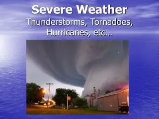
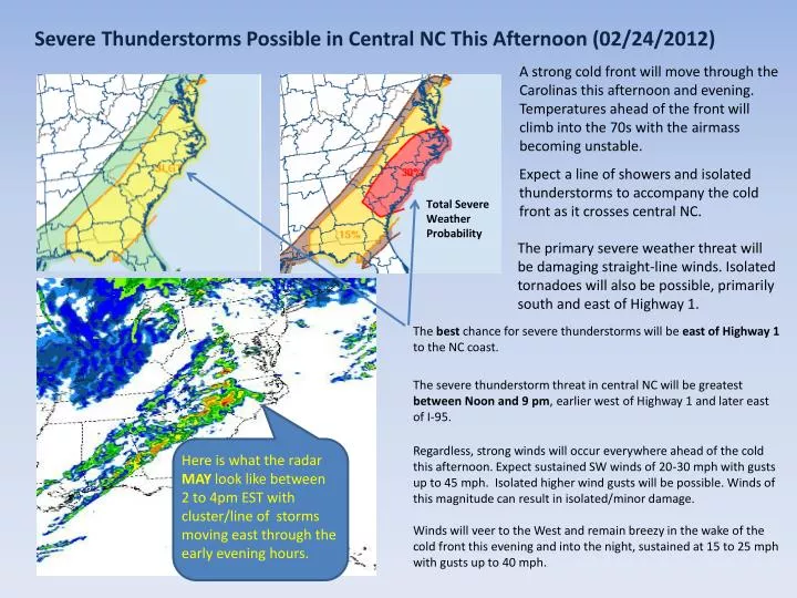
Severe Thunderstorms Possible in Central NC This Afternoon (02/24/2012). A strong cold front will move through the Carolinas this afternoon and evening. Temperatures ahead of the front will climb into the 70s with the airmass becoming unstable. .

E N D
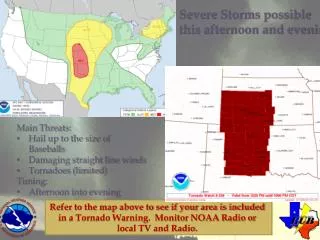
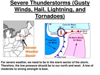
Severe Thunderstorms Possible in Central NC This Afternoon (02/24/2012) A strong cold front will move through the Carolinas this afternoon and evening. Temperatures ahead of the front will climb into the 70s with the airmass becoming unstable. Expect a line of showers and isolated thunderstorms to accompany the cold front as it crosses central NC. Total Severe Weather Probability The primary severe weather threat will be damaging straight-line winds. Isolated tornadoes will also be possible, primarily south and east of Highway 1. The best chance for severe thunderstorms will be east of Highway 1 to the NC coast. The severe thunderstorm threat in central NC will be greatest between Noon and 9 pm, earlier west of Highway 1 and later east of I-95. Regardless, strong winds will occur everywhere ahead of the cold this afternoon. Expect sustained SW winds of 20-30 mph with gusts up to 45 mph. Isolated higher wind gusts will be possible. Winds of this magnitude can result in isolated/minor damage. Winds will veer to the West and remain breezy in the wake of the cold front this evening and into the night, sustained at 15 to 25 mph with gusts up to 40 mph. Here is what the radar MAY look like between 2 to 4pm EST with cluster/line of storms moving east through the early evening hours.