Download
1 / 16
160 likes | 319 Views
The Geological Pacific Northwest. Thursday February 10, 2011 Pacific Northwest History Mr. Rice. Free Response #2. Please do not simply list the items for this response, tell me what you know about each item. Minimum of 3-5 Sentences

E N D
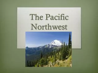
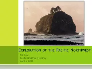
The Geological Pacific Northwest Thursday February 10, 2011 Pacific Northwest History Mr. Rice
Free Response #2 • Please do not simply list the items for this response, tell me what you know about each item. • Minimum of 3-5 Sentences • Except for the harbor that we live on, what are some other land forms and features that are different across the state of Washington? • 5 minutes to finish.
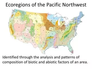
What is Geography? • Geography is the study of landforms and natural features that make up the earth. • Geography can also be described as the study of how people live in/with these features • The study of geography and also history (time and place) allows us to understand aspects of peoples lives in history. It allows us to understand the formidable struggles that early pioneers and settlers faced when settling our land.
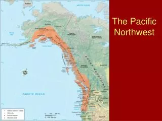
Washington Basic Information • Located between the 46th and 49th parallels north latitude and in between 117 degrees and 125 degrees west longitude. • Boundaries – Canada to the North, Oregon to the South, Idaho to the East and the Pacific Ocean to the West. • Washington is considered a Hinterland. • Because of it’s “far corner” location. • Because of it’s late settlement. • Because of it’s location from other heavily populated areas. • Also a hinterland usually exports raw materials and imported manufactured goods.
The Mighty Ocean • The ocean is very important to the economic and social vitality of Washington state. However, we will spend a full class period, at least, talking about why the Pacific Ocean is so important.
Vocabulary • Mountains – High rugged land • Plateaus – High, wide, flat land many miles across • Mouthof River – where a river opens into a larger body of water • Valley or Basin – lower land between mountains and plateaus. • Strait – A narrow passage way of water. • Bay – A body of water that curves into a coastline • Harbor – A sheltered part of a body of water deep enough for anchoring ships • Peninsula – A piece of land that is surrounded on three sides by water.
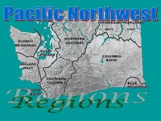
The Five Regions of WA The Coastal Range Region The Puget Sound Lowlands The Cascade Range Region The Columbia Plateau Region The Rocky Mountain Region
Coastal Range Region • Made up by the Olympic Peninsula • Has some of the greatest diversity and greatest weight of living matter found anywhere in the world. • It is considered a Rainforest • This is the region that is bordered by the ocean in the west and the Olympic Mountains and the Puget sound in the east. • Heavy industries include: Logging and Commercial fishing. • Also, there are five Indian reservations on the coast and one along the strait.
Puget Sound Lowlands • This region is made up of the area between the eastern base of the Olympic Mountains and the Cascade Range. • Because of the deep sound and the large amount of commerce found in this region, there are many large metropolitan cities found here. • Has some of the worst traffic in the entire nation. • While there are large cities there are also bustling farming communities, especially those found in the Skagit River Valley.
The Cascade Range Region • This range consists of the Cascade Mountains, which run from the northern border of Canada all the way to the Northern portion of Oregon. • They serve as a rugged division between Eastern and Western Washington. • “The Cascade Curtain” • Five famous mountains – Mt. St. Helens, Mt. Rainier, Mt. Adams, Mt. Baker and Glacier Peak. • I-90 and Snoqualmie Pass serve as the major arterial to move over this region.
The Columbia Plateau • Sits directly in the rain shadow created by the Cascade Region. • Fertile soil makes this region a strong agricultural area • Includes the wheat growing fields of the Palouse and the huge Columbia Basin Irrigation Project. • Spokane is the major Metropolis of the region • Why do you think that the areas of the Puget Sound Lowlands attract more people than the Columbia Plateau?
The Rocky Mountain Region • Sometimes called the Okanogan Highlands • The steep hills are the foothills of the Rocky Mountains. • There are three Indian reservations found here • Most of the communities are very small and are supported by logging, mining and ranching and farming.