Download
1 / 52
520 likes | 527 Views
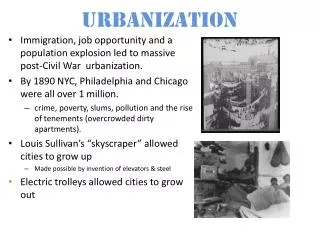
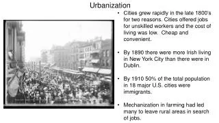
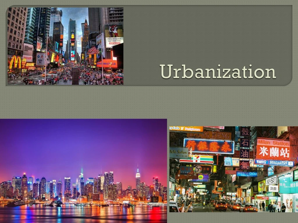
Urbanization. Urbanization – Intro. Urbanization is a measure of development (abundant Agricultural technology, people leave rural areas for cities for work and services) MDCs – about 75% is urban LDCs – about 40% is urban BUT LDCs contain most of world’s largest cities.

E N D
Urbanization – Intro • Urbanization is a measure of development (abundant Agricultural technology, people leave rural areas for cities for work and services) • MDCs – about 75% is urban • LDCs – about 40% is urban • BUT LDCs contain most of world’s largest cities
Urbanization – Intro LDCs = mega cities: rapid population growth and migration to cities has caused explosion of urban growth in LDCs. What are the potential problems of this rapid population growth?
LDCs cannot support booming growth. Mega cities plagued by chaotic, unplanned growth…no jobs, poor infrastructure, inadequate housing, urban squalor, horrible pollution, poverty, squatter settlements
Urbanization – Intro • MDCs = world cities – worldwide centers of economic, political, cultural activity and influence. • Top tier = economic and cultural powerhouses…New York, London, Tokyo • Second tier…. • Government Seats – DC, Moscow, Paris • Pop Culture – Los Angeles, Mumbai • Industrial Centers – Mexico City, Sao Paulo
Defining Urban Settlements Cities have • Lots of people, most of whom are anonymous • High pop density • Job specialization • Social heterogeneity (diverse)
Physical Distinction Between Urban and Rural City Center: legal boundary (i.e. DC proper). Independent and self governing unit (city officials, taxes, providing services, etc.) Urbanized Area: central city + surrounding suburbs (i.e. Arlington, Herndon = urbanized area of DC)
Physical Distinction Between Urban and Rural Metropolitan Statistical Area (MSA): the functional area/region of a city – i.e.. its zone of influence Megalopolis: When MSAs overlap and create one continuous highly urbanized complex. Ex: from Boston to DC = Boswash Corridor
Concentric Zone Model • Developed in 1923 by E.W. Burgess • Based on Chicago • Concentric rings of development coming outward from the core (CBD) • Each ring = different types of development and economic activities • Land value decreases as you move out • Model based on process of invasion and succession – newest immigrants move into old housing near city center and push earlier groups outward
Sector Model Developed in 1933 by Homer Hoyt Also based on Chicago Says city development in sectors not rings. Sectors radiate out from CBD like spokes on a wheel Activities expand in wedges Seems to work better for Latin American cities (Mexico City fits sector model)
Multiple Nuclei Model 1945 – Harris and Ullman City doesn’t have just one central core but many nodes of business and cultural activity Los Angeles = classic example – no real downtown but instead many independent nodes of high land value and business activity – Santa Monica, Pasadena, Hollywood, etc.
Multiple Nuclei Model This is a better model for cities built mostly after WW II and post auto-dependent. Older cites built before automobiles are more compact with real downtown (CBD). Newer cities have more sprawl and multiple nuclei. Why would newer cities be more likely to fall into a Multiple Nuclei Model? *** NO city matches any one model perfectly
Criticisms of Models 1.) Models too simplistic and fail to consider all of the varied and complicated reasons that cause people to select a certain location 2.) all 3 models created in U.S. between world wars – are they relevant to other countries and are they still relevant today?
Inner City Problems In U.S. cities greatest contrast is between suburbs and inner city Ghettoization: process of inner city decay Problems……..
Inner City Problems • Old, poor quality housing • Filtering – subdividing big old homes into several apartments and use for low income rent • Redlining: banks draw lines on map and refuse to loan $$ within • Public housing projects (subsidized – pay 30% of income in rent) –run by government…poorly maintained, drugs, crime, violence, gangs, high density, culture of poverty, etc.
Inner City Problems • 2.) Social Problems • Permanent underclass – trapped in perpetual cycle (unemployment, teen pregnancy, drugs, gangs, single parents, welfare, high school dropout, etc. Can you get out? (There Are No Children Here) • Racial and ethnic segregation – disproportionate minority representation • Did you know that a 2011 study found that in D.C., only 59% of high school freshman who began the 2006-2007 school year graduated in 4 years.
Inner City Problems – cont’d • 3.) Economic Problems • Often lacks adequate public services and lacks tax base to pay for them (i.e. schools, roads, etc.) • Annexation – legally adding land area to a city’s boundaries. Most suburbs do not want to be annexed in and rarely happens anymore
Inner Cities – Urban Renewal Revitalization – new attempts to fix up downtown…buy poor houses, build new, shopping, cultural attractions…try to bring in young, single professionals Gentrification: process where inner city neighborhoods turn into expensive/fashionable urban districts (squeezes out low income residents)
Problems of Suburbs Rapid growth of Suburbs in 2nd half of 20th C (i.e. automobiles, GI Bill, mass production of housing) 1950: 20% in suburbs 40% in central city 40% small towns/rural areas 2000: 50% in suburbs 30% in central city 20% small towns/rural areas
Suburbs – cont’d • Counter urbanization – net migration from urban to rural areas (happening in some parts of N. American and W. Europe for first time). More people moving to rural areas than are leaving. • Exurbanite: people who leave city to move to suburbs or rural area
Suburbs – cont’d • Cons of Suburbs…. • Land hungry process – vanishing green, encroaching on good Agricultural land • Lose unique sense of place – all are cookie cutter alike (strip malls, chain stores) • Auto dependent and fuel consumption (pollution) • Rush hour commute
Suburbs – cont’d • Suburban growth comes at expense of inner city • Erosion of tax base • Segregation – poor, elderly, singles, minorities in cities. • Young families, white, educated wealthier move to suburbs. • Spatial Segregation – rarely go to other’s place • Zoning also fuels segregation
Suburbs – cont’d • Edge Cities: urban sprawl sometimes takes the form of edge cities • Located on outskirts of larger cities and come to serve many of same functions as large city • Often located off a beltway surrounding main city • Classic ex: Tyson’s Corner
Central Place Theory • Theory developed by Walter Christaller in 1930s in Germany. Looks at relationship between cities and surrounding communities based on people’s demands for goods and services • Central Place: place (big city) people travel to make purchases • Market Area: areas people travel from for purchases (i.e. the functional region of the central place)….where do you go to buy groceries, a car, medical treatment, etc.?
Central Place Theory Large cities are the economic hubs for their region because they provide a great variety of goods and services not available in smaller communities Hinterlands: smaller towns in periphery of big city/central place. People from hinterland often travel to central place for big city amenities (i.e. sports teams, cultural events, restaurants, etc.). Small towns in hinterland contain fewer goods and services than central place.
Central Place Theory Size of Market Area….assume you wanted to open a new store, how do you determine 1.) if it will be profitable and 2.) where the best location is within the market? The answer to these questions varies for all services based on range and threshold.
Central Place Theory • Range: maximum distance people willing to travel for your service • Often expressed in time not distance • Short distances for groceries, long for bball game. Short distance for gas, long distance for medical treatment • Must be modified if competing locations provide same service
Central Place Theory • Threshold: minimum number of people needed to support a service • How many customers do you need to make a profit? • Potential customers in a given areas depend on the product (i.e. not a high demand for a roller skate rink in a retirement community)
Central Place Theory • Low order central place functions: have small range and threshold. • Services obtained on regular basis • Requires only a small market to be profitable • People unwilling to travel far to obtain it • Ex: gas, groceries, movies, etc.
Central Place Theory • High order central place function: large range and large threshold • Is required less frequently • Requires a large market area (lots of customers) to be profitable • People willing to travel further to obtain it • Ex: pro ball team, special medical services, museums, concerts, etc.
Central Place Theory • The Gravity Model can predict optimal location for service • Directly related to # of people in the area • Inversely related to distance people must travel to access it
Central Place Theory • Therefore…… • Small settlements are limited to low order functions (with small ranges and thresholds and market areas) because too few people live here • Higher order functions are more likely to be in big cities (central places) with enough people to support the larger range, threshold, and market area
Rank Size Rule • Ranking settlements from largest to smallest in a country often produces a pattern • Rank Size Rule: • The country’s nth largest city is 1/n the size of the population of the largest • i.e. the 3rd largest city is 1/3 the size of the largest
Rank Size Rule • When plotted rank size distribution is a fairly straight line (true for U.S.) • Works better for MDC’s (LDC’s not enough wealth in society to pay for full variety of services in other cities) • If graph is not fairly straight line it does not fit rank size rule