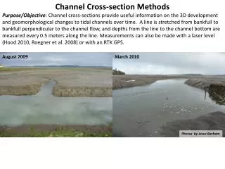
Download
1 / 5
50 likes | 128 Views
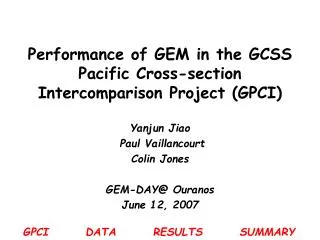
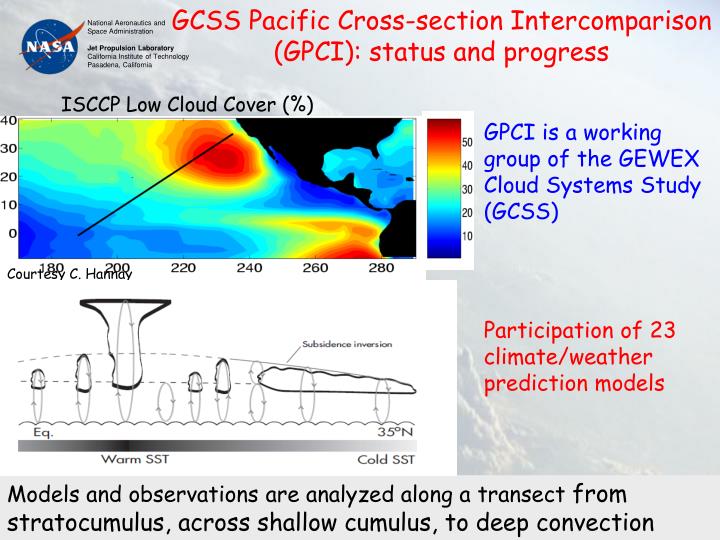
GCSS Pacific Cross-section Intercomparison (GPCI): status and progress. ISCCP Low Cloud Cover (%). GPCI is a working group of the GEWEX Cloud Systems Study (GCSS) Participation of 23 climate/weather prediction models. Courtesy C. Hannay.

E N D
GCSS Pacific Cross-section Intercomparison (GPCI): status and progress ISCCP Low Cloud Cover (%) GPCI is a working group of the GEWEX Cloud Systems Study (GCSS) Participation of 23 climate/weather prediction models Courtesy C. Hannay Models and observations are analyzed along a transect from stratocumulus, across shallow cumulus, to deep convection
Satellite observations of cloud regime transitions along GPCI transect CloudSat cloud occurrence Cloud top height Model ensemble mean tracks MISR observations of cloud-top height ... HOWEVER there is large variability among models
CloudSat liquid water content (LWC) for JJA 2006 along GPCI transect fvMMF ECMWF GEOS5 CloudSat LWC LWC (mg.m-3) LWC LWC LWC from models and CloudSat are similar in magnitude BUT very different in structure: PBL growth is not as clear in CloudSat; Large differences over ITCZ Li et al., 2009
Boundary layer height from GPS RO observations Boundary layer height (2001-2004) ECMWF GPS RO ISCCP Low Cloud Cover (%) Von Engeln et al, GRL, 2005 GPCI is being used for preliminary studies of future GPS RO missions
GPCI practical developments • General GPCI paper is now circulating among co-authors • Model results are assembled and organized at the DIME website at: http://gcss-dime.giss.nasa.gov/gpci/modsim_gpci.html. • LES experiments forced by ECMWF re-analysis are currently being carried out • GPCI framework is being used for: (i) model intercomparison and evaluation (ii) Evaluation of satellite observations (iii) Preliminary studies of future missions Future of GPCI and connections to other initiatives (e.g. CFMIP, EUCLIPSE, YOTC) will be discussed later