Download
1 / 21
210 likes | 355 Views
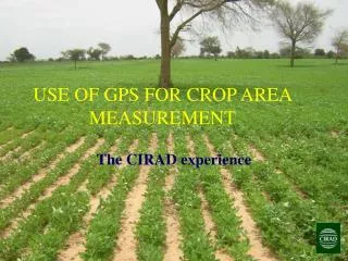
Use of GPS Equipment for Plot Area Measurement. The National Agricultural Surveys of 2002-2008, Mozambique By: Domingos Diogo Ministry of Agriculture, 2008. History.

E N D
Use of GPS Equipment for Plot Area Measurement The National Agricultural Surveys of 2002-2008, Mozambique By: Domingos Diogo Ministry of Agriculture, 2008
History • The Ministry of Agriculture of Mozambique with mandate from National Institute of Statistics (INE) tocollect annual agricultural statistics, started using GPS equipment for the National Agricultural Survey (TIA) in 2002 • GPS equipment was used in conjunction with standard tape and compass, as well as non-standard measurement using paces.
National agricultural surveys: year and samples size of small-and mediumholders • 2002 4,908 • 2003 4,935 • 2005 6,149 • 2006 6,248 • 2007 6,075 • 2008in progress
Methodology followed for plot area measurement • All respondents are asked to declare total plot size, area cultivated to annual crops, area cultivated to permanent crops and fallow area.
Methodology followed for plot area measurement, continued • The percentage of respondents that actually “declare” plot size may be low. In TIA 2003, the source of information is as follows: Declared by respondent in a unit of area: 56 % Estimated using landmarks around interview site as demonstrated by respondent: 34% Estimated using landmarks/comparison to known areas (football fields) as described by enumerator: 10%
Methodology followed for plot area measurement, continued Declared area usually clusters around whole numbers or 0.5 ha increments. Distribution of declared area, TIA 2003 0.5 ha 23.2 % 1.0 ha 27.2 % 1.5 ha 10.3 % Other whole numbers or 0.5ha increments 10.0 %
Methodology followed for plot area measurement 2. 25% of smallholders are randomly chosen for plot area measurement. A smallholder is defined will have total cultivated area not exceeding 10 hectares. About 85% of the sample size are smallholders, representing 99% of the population of farmholdings.
Methodology followed for plot area measurement, continued • Mozambique has about 3.6million small agricultural holdings (from TIA 2007). • The average size of the agricultural holding is 1.4 ha 3.ALL plots of the 25% of smallholders for actual plot measurement are selected for measurement.
Methodology followed for plot area measurement, continued • Plots with “declared” area exceeding 0,3 ha are measured using GPS equipment. Small declared areas are measured using tape and compass. Measurement using paces is generally employed for the area of the homestead, if a sizeable area is also planted to crops.
Methodology followed for plot area measurement, continued • For area measurement with GPS equipment, the enumerators wait to receive the best level of precision. In 2002, our manual allowed the enumerators to wait for a level of precision of 15 meters at least. In practice, the enumerators waited until a level of precision of 5 or 8 meters is achieved. On newer machines (in the field in 2008) we have seen 1-3 meters precision.
Methodology followed for plot area measurement, continued 6.Actual field area measurements using tape and compass or GPS equipment are compared to declared area. Using regression analyses that included district variables and head’s number of years schooling as independent variables, coefficients are derived to adjust the field area measurement of the 75% of households.
GPS equipment used for the National Agricultural Surveys • Garmin Etrex Venture • Garmin Etrex Venture HCx • Garmin Etrex Vista HCx
Advantages of using GPS equipment compared to tape and compass • Less time for area measurement (about 60% of time saved) • Only one person required to do the job • Allows for geo-referencing the plots and households • Allows for plot areas (trajectories) to be stored on machine and transferred to a computer • Can be used for other navigational needs
Disadvantages of using GPS equipment compared to tape and compass • On older machines climatic and environmental conditions do not allow for its use: cloud cover, tree canopy • More expensive • Unless the area measure is saved or shown to supervisor, no other person can confirm area measurement (the tape and compass method requires at least 2 persons, and the area can be recalculated from the distances and angles data collected).
Other considerations • Enumerator preference is for using the GPS equipment instead of tape and compass. If a cutoff is set for using GPS equipment, e.g. below 0.3ha measurement should be made with tape and compass, otherwise use GPS equipment, enumerators may increase declared area to be above this cut-off to avoid using tape and compass.
Recommendations • Select the appropriate GPS equipment for outdoor field use. Currently the basic equipment all come with features necessary for doing the types of surveys we do. • Provide a good training to enumerators and field supervisors
Recommendations, cont’d. • Do one-on-one tests of the enumerators during training to see if they can: 1. show the current level of precision of the satellite readings 2. read and write down the coordinates 3. do an actual area measurement and reading 4. erase the stored data as necessary
Recommendations, cont’d. • Do one-on-one tests of the supervisors during training to see if they can: 1. do all required of the enumerators 2. mark coordinates 3. find points or landmarks based on coordinates 4. do the basic setup of the GPS equipment 5. switch between the different latitude systems: decimal minute, or UTM UPS (the Mozambican government uses this system) 6. locate coordinates on a map
Recommendations, cont’d. • Determine the percentage of households whose plots should be measured. Measuring all plots of all households can be costly. For the TIA we generally select all plots of 25% of smallholders. In 2003 we attempted to do 50% of all households. In some provinces we showed a drop in the mean number of plots, which may partly be attributed to the higher requirement of plots that need to be measured.
Recommendations, cont’d. • Do spot-checks Since 2005, the TIA has included spot-checks on a list of questions that cannot be verified by field-based data entry. This includes number of plots and (declared) plot sizes, among many other questions.
Thank you very much! Muito obrigado!