Download

1 / 14
140 likes | 214 Views
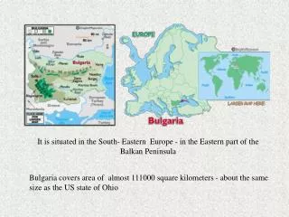
A Study of the Extremity of the October 1998 Rainfall Event in South-Central and Eastern Texas. A Term Project for CE 394K: Surface Water Hydrology Presented by Teresa Hart. Background. Severe Flooding on October 17-18, 1998 18 Counties in South-Central and Eastern Texas affected

E N D
A Study of the Extremity of the October 1998 Rainfall Event in South-Central and Eastern Texas A Term Project for CE 394K: Surface Water Hydrology Presented by Teresa Hart
Background • Severe Flooding on October 17-18, 1998 • 18 Counties inSouth-Central and Eastern Texas affected • Highest streamflow on record at many locations • At least 13 die in flood- related accidents • Severe and costly damage resulted
Objectives • Determine the return-period at various time-durations for the storm event at selected rain gages • Produce a series of contour maps of iso-frequency lines for the various time-durations
Sources of Rainfall Data • National Climatic Data Center • Hourly data from major airports (Austin, San Antonio) • Cooperator network; Canyon Lake gages • Lower Colorado River Authority • Hourly data from Colorado River Basin • 18 gages with at least 5 inches of precipitation • U.S. Geological Survey • Daily precipitation values for 7 gages with at least 7 inches
Intensity-Duration-Frequency (IDF) • Technical Paper 40 (US Weather Bureau, 1964) • Isohyetal maps for durations of 30 minutes to 24 hours and return periods of 2 to 100 years • Based on historical data and Extreme Value Type 1 Distribution
Texas DDF Curves • WRI Report 98-4044 (US Geological Survey, 1998) • Maps of equal parameter lines for durations of 15 minutes to 7 days and any given return period • Based on historical data and Generalized Logistic Distribution
Generalized Logistic Distribution (GLO) where, Xd(F) = precipitation depth for a given frequency F = frequency Three-parameter distribution • Location Parameter, x • Scale Parameter, a • Shape Parameter, k Example: Find 12-hour, 25-yr depth = 3.2 = 0.78 = -0.23
Determination of Return Period GLO Distribution: Solve for F and convert to return period: For San Antonio Airport, Time IntervalDepth, inFrequencyReturn Period, yr 1 hr 2.82 0.9099 11 2 hr 4.89 .9772 44 3 hr 5.63 .9789 47 6 hr 7.95 .9914 116 12 hr 9.40 .9903 104 24 hr 13.42 .9972 353
Things to think about Be Sure to Empty your Rain Gages during Record Storms Storms Don’t Follow IDF Curves New Frequency Curves for Texas--Good stuff GIS just might not be so imposing after all...
Thanks for listening... Any questions?