Download
1 / 21
210 likes | 219 Views
Fluvial Deposits in Margaritifer Basin. Kevin K. Williams and John A. Grant Center for Earth and Planetary Studies, Smithsonian Institution Corey M. Fortezzo Department of Geology, Northern Arizona University. Fluvial Deposits in Margaritifer Basin. Noachian through Amazonian terrains

E N D
Fluvial Deposits in Margaritifer Basin Kevin K. Williams and John A. Grant Center for Earth and Planetary Studies, Smithsonian Institution Corey M. Fortezzo Department of Geology, Northern Arizona University
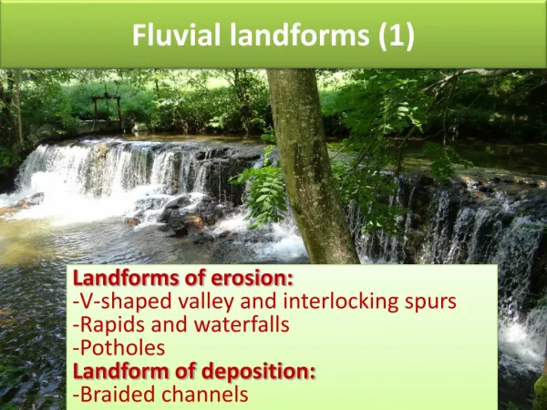
Fluvial Deposits in Margaritifer Basin Noachian through Amazonian terrains complex and interesting fluvial history interesting minerals other water/ice related features nearby volcano-water interactions veins of gold at this point, it looks ‘safe’
LocationMC-19 is eastof Valles Marineris Argye Margaritifer basin
MB2 MB1 MB1: 12º 40.97’ S / 338º 06.34’ E MB2: 11º 41.83’ S / 337º 16.95’ E
Overview of geologic setting Margaritifer basin is located at the confluence plain of the UHLM, Samara, and Parana- Loire valley systems These three valley systems drain a large area of Mars, and it appears that water ponded in Margaritifer basin. -> possibility of sampling material from a broad area of the martian highlands Widespread fluvial activity extended from the Noachian into the mid- to late-Hesperian Latest activity in MB extended into the Amazonian
Large scale geologic map Hch: Hesperian channel Npl1: Noachian plateau sequence Nplh: Noachian hilly plains 1:500,000 geologic map More detailed unit boundaries Younger units in Margaritifer basin Nearby, chaos, collapse, volcanics, Noachian remnants * *
1:500,000 geologic map More detailed unit boundaries Younger units in Margaritifer basin Nearby, chaos, collapse, volcanics, Noachian remnants * *
Layering in plains of Margaritifer basin Edge of channel in MB Amazonian plains MOC image E04-00861 NASA/JPL/MSSS MOC image NASA/JPL/MSSS
Layering in plains of Margaritifer basin High res. imaging in landing circles will likely reveal layering there MOC image E04-00861 NASA/JPL/MSSS MOC image NASA/JPL/MSSS
Within Margaritifer basin, fluvial activity took place from the Noachian through the Amazonian Geomorphic evidence suggests that water ponded in MB and infiltrated into the subsurface, possibly getting re-mobilized during collapse and outwash through Ares Valles The basin plain is mainly smooth with higher remnants and areas where the layers of deposited material are exposed where they have been etched into Nearby activity also includes chaotic terrain, collapse, and a volcanic feature that may have interacted with water/ice Past through recent/present areas of habitable potential Prolonged accumulation of water Access to spatially and temporally diverse material Increase in geologic features and potential for habitability
Elevation Landing ellipses are lower than -2 km MB1: -2120 m MB2: -2535 m
Slopes calculated from MOLA Requirement: <3º over 2-5 km >15º 5º < x < 15º 3º < x < 5º ≤ 3º
Surface roughness Very low within landing ellipses Rock abundance ~10% (need more info)
TES dust coverage Requirement: low TES thermal inertia Requirement: > 100 J m-2 s-0.5 2 1 Essentially 0 at landing sites MB1: 264-428 avg. = 315 MB2: 289-378 avg. = 331
TES hematite (on 0 - 0.2 scale) TES carbonates MB1: low but .025 to NE MB2: ~ 0.02 MB1: 0.07 - 0.08 MB2: 0.06 - 0.08
TES sulfates MB1: 0.03 - 0.05 MB2: 0.04 - 0.08
Engineering summary Elevation: very low. lots of time to slow down Slopes: generally gentle, but more info will be helpful Surface roughness: landing ellipses appear to meet requirements and allow access to nearby rougher ROIs Thermal inertia: High thermal inertia Minerals: Relatively high levels of hematite, carbonates, and sulfates Albedo: < 0.25
Summary • Margaritifer basin has a complex and long-lived fluvial history • that involves ponding of water • This area provides access to materials from diverse areas • of the martian highlands • These materials also span fluvial activity from the Noachian • though the Amazonian • Layers from episodes of activity likely exist in landing area • Nearby chaos, collapse, and volcanics increase scientific • interest and potential for habitability • At this stage, both circles appear safe