Download
1 / 11
110 likes | 268 Views
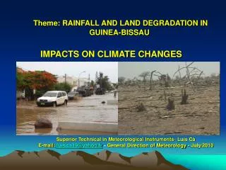
Assessing Land Degradation and Conservation in Somalia. Somalia Water and Land Information Management Project Njeru L., Vargas R., Omuto C. Ecology & Livelihoods. 300 – 500 mm/yr. Pastoralism, Oasis farming, wood collection, charcoal production. Pastoralism and agro-pastoralism.

E N D
Assessing Land Degradation and Conservation in Somalia Somalia Water and Land Information Management Project Njeru L., Vargas R., Omuto C.
Ecology & Livelihoods 300 – 500 mm/yr Pastoralism, Oasis farming, wood collection, charcoal production Pastoralism and agro-pastoralism 100 – 250 mm/yr Pastoralism, Agro-pastoralism, Rainfed and irrigated farming, wood collection 400 – 600 mm/yr
Land degradation challenge Heavy pressure on the land (overgrazing / charcoal / enclosures) Breakdown of traditional land management systems Naturally a marginal environ.
Land degradation concerns Communities want information on > (1) State of the problem - spread and intensity, (2) Causes of the problem, (3) Impacts on People and Environment, (4) What is being done or can be done
Use of LADA-WOCAT to map LD Data preparation - LUS map developed and validated, supporting data compiled Participatory assessments conducted in Somaliland, Puntland and South/Central Results compiled for each Land use unit and land degradation and conservation situation mapped for the whole country
Land use systems Inputs > Bio-physical characteristics and livelihoods (Livestock, farming, others) Verified by field experts
Sample land degradation data Impacts on ecosystem Direct causes of Deg. Indirect causes of deg. Land use unit Main Deg. type Other Deg. types Extend of Deg. Degree of Deg. Rate of Deg.
Land degradation classes Loss of veg, Soil erosion (water, Wind) Loss of veg, Soil nutrient loss, Soil erosion (water) Charcoal production, In-migration -Insecurity Overgrazing, Cultivation in Marginal areas Loss of veg, Loss of biodiversity, Soil erosion (water, Wind), Salinization Overgrazing, Cultivation in marginal areas, poor irrigation mgt
Land management practices Few land management practices across the country However, few success practices available
Conclusions Good tool for mapping degradation & conservation Good preparation needed – good base map and supporting data Adequate time needed for the assessment to reach consensus Land degradation dataset for Somalia now available Dataset will guide land degradation and conservation interventions At community level > LADA Local Assessment / WOCAT DBs and tools